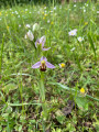
The Dhuys Aqueduct and the Neolithic grinding stone, starting from Crézancy

This is a walk full of discoveries: the Dhuys Aqueduct, the Champagne vineyards, the Neolithic grinding stone at Mézy-Moulins and the banks of the Marne.

Details

n°367529
Creation:
Last update:
Last review:
  • Walking
    Activity: Walking
  • ↔
    Distance: 10.50 mi
  • ◔
    Average duration: 5h 25 
  • ▲
    Difficulty: Moderate

  • ⚐
    Back to start: Yes
  • ↗
    Ascent: + 666 ft
  • ↘
    Descent: - 666 ft

  • ▲
    Highest point: 591 ft
  • ▼
    Lowest point: 197 ft
  • ⚐ Country: France
  • ⚐ City: Crézancy (02650)
  • ⚑
    Start/End: N 49.047551° / E 3.510147°
  • ❏
    IGN map(s): Ref. 2613E
  • Hour-by-hour weather

Photos

Description of the walk

The walk starts in front of the church in Crézancy (Rue de l’Église). Parking is available in front of the church or on the same street, in front of the town hall or the agricultural college.
Crézancy is accessible by on-demand bus from Château-Thierry.

(S/E) Opposite the church, walk a few metres to the right, then at the junction, turn right onto Rue du Calvaire, then left and right onto Rue du Crochet, almost in a straight line. This street leads to an unpaved track that leaves the village. When you reach a small road, continue to the left. Just before the large aerial, you’ll cross the aqueduct.

(1) Turn left. The aqueduct path is overgrown with grass and isn’t always mown in spring. Do not take the private path leading to a house. Walk several kilometres along the aqueduct until you can see a village, on the edge of the woods at Saint-Eugène.

(2) Turn left at the hairpin bend and walk towards the village of Saint-Eugène. When you reach Rue du Mousset, turn right, then left; at the Fork in the road, turn left again, and walk until you reach the D4 main road.

(3) Turn left, cross the Surmelin bridge and cross at the pedestrian crossing. At the war memorial, turn right and cross the railway line. After the bridge over the Surmelin, turn left towards Connigis onto the quiet country lane. Walk past the wash house and along the square lined with lime trees.

(4) After the square, turn right onto the Grande Rue, then left towards Crézancy. Just before the large farmstead ‘Le Château’, turn right onto the path leading towards the vineyards.

(5) Once you reach the vineyards, keep to the left onto the path that runs along the bottom of the vineyard. Continue to the first houses, then turn left and immediately right. Pass through the hamlet of Launay without changing direction. At the sign for Crézancy, carry on straight ahead. In a wide left-hand bend, look out for the path that climbs up to the right after a house covered in Virginia creeper.

(6) The path runs between the houses and joins the vineyards, then follows them. Keep heading in the same direction, due north, until you reach the junction with Rue des Vaches.

(7) Turn right and continue to the end of the street. When you reach a junction between the vineyards and the woods, carry on straight ahead. The path runs alongside a vineyard and enters the woods. It curves slightly to the right, then to the left. Pass close to the stone grinding tool, which lies in a hollow beside a stream on the left-hand side, about twenty metres from the path.

(8) Carry on in the same direction. The path emerges from the woods and joins the vineyards. Turn right and stay on the path which winds around the vineyards until you reach a four-way junction.

(9) Carry on straight ahead until you reach a T-junction. Turn left, then right, and head into the village at the junction of Rue Collinet and Rue de Parroy.

(10) At the crossroads, turn right. Then take the third street on the left and cross the D1003 main road. Continue straight ahead along Rue du Pâtis until you reach the first crossroads.

(11) Turn right onto the path leading through the meadows and copses. Carry on straight ahead until you reach the railway line. Cross it and continue straight ahead. Walk to the River Marne.

(12) At the river’s edge, turn left. Cross the Surmelin bridge and carry on. When you can see Mézy-Moulins church, turn left and walk towards the church.

(13) In front of the church, turn left onto Rue de l’Église and carry on in the same direction. The path crosses fields, passes the railway line and continues alongside another railway line, lined with trees. Walk to a small road.

(14) Turn right onto the road and walk to the next junction.

(15) Turn left onto the unpaved track and walk alongside the small wood. Walk until you reach the first houses in Crézancy. When you reach the main road, the D1003, turn right and walk to the chemist’s.

(16) Turn left onto Rue de l’Église. Walk past the agricultural college and carry on to the church in Crézancy (S/E).

Waypoints

  1. S/E : mi 0 - alt. 276 ft - Crézancy Church
  2. 1 : mi 0.25 - alt. 417 ft
  3. 2 : mi 2.33 - alt. 423 ft - Exit from the Saint-Eugène woods
  4. 3 : mi 2.87 - alt. 249 ft - D4 – Cross the bridge at - Surmelin
  5. 4 : mi 3.54 - alt. 289 ft - Connigis, Place des Tilleuls
  6. 5 : mi 3.91 - alt. 361 ft - Start of the vineyards
  7. 6 : mi 5.08 - alt. 279 ft - Start of the path
  8. 7 : mi 5.63 - alt. 295 ft - Junction with Rue des Vaches
  9. 8 : mi 6.08 - alt. 561 ft - Polissoir néolithique de Mézy Moulins
  10. 9 : mi 6.34 - alt. 554 ft - Crossroads with four paths
  11. 10 : mi 6.72 - alt. 302 ft - Crossroads
  12. 11 : mi 6.91 - alt. 246 ft - Crossroads
  13. 12 : mi 7.36 - alt. 203 ft - Marne (la)
  14. 13 : mi 8.41 - alt. 220 ft - Church of Mézy-Moulins
  15. 14 : mi 9.23 - alt. 213 ft - Route
  16. 15 : mi 9.5 - alt. 210 ft - Crossroads
  17. 16 : mi 10.37 - alt. 269 ft - Crossroads
  18. S/E : mi 10.5 - alt. 276 ft - Crézancy Church

Notes

It is possible to travel by on-demand bus from Château-Thierry, getting off at the Crézancy agricultural college stop. Timetables.

Water is available in the cemeteries of the villages along the route (slightly off the route at Connigis).

The route can be done in two halves: either the aqueduct section or the section along the banks of the Marne, by going directly from (6) to (16).

If you’re not interested in the Neolithic polishing stone (which is hard to find in the woods), you can walk directly from (7) to (10).

Worth a visit

The aqueduct is an underground structure that channels part of the water from the Dhuis (or Dhuys), a small watercourse 21.430 km long that flows into the Marne and the Aisne, and is a tributary of the Surmelin. The total length of the aqueduct is 128.610 km. It has a gentle gradient: starting at an altitude of 128 m, it descends by only 20 m to an altitude of 108 m at its end, giving a gradient of 0.10 m/km – sufficient, however, for the water to flow by the simple action of gravity. Its average flow rate is 22,000 m³/day.

In places, the structure consists of a masonry conduit 2.20 m high and 1.80 m wide, with a right-of-way 10 m wide. Many of the plots within this right-of-way are owned by the City of Paris. The aqueduct is operated by the Eau de Paris authority and the Syndicat des eaux de la Brie. Source: Wikipedia – Dhuis Aqueduct

A very beautiful church on the banks of the Marne in Mézy-Moulins.

The Neolithic grinding stone is on private land; please respect the site.

Reviews and comments

4.7 / 5
Based on 1 review

Reliability of the description
5 / 5
Ease of following the route
5 / 5
Route interest
4 / 5
virgule
virgule

Back to the aqueduct. Haven’t seen a soul all day. It’s still magnificent.

Machine-translated

virgule
virgule

Thank you for this review. I think the high number of visitors is down to the circumstances, as I’ve often gone for walks along the aqueduct and have never come across a single soul there.

Machine-translated

Jean Pierre Richard
Jean Pierre Richard

Overall rating : 4.7 / 5

Date of your route : Nov 29, 2020
Reliability of the description : ★★★★★ Very good
Ease of following the route : ★★★★★ Very good
Route interest : ★★★★☆ Good
Very busy route : Yes

It’s very busy, especially with noisy, polluting motocross bikes, which, as far as I’m aware, are banned on the aqueduct; yet despite this, it’s a magnificent setting, a natural haven surrounded on all sides by vineyards… simply stunning.

Machine-translated

Other walks in the area

For more walks, use our search engine .

The GPS track and description are the property of this route's author. Please do not copy them without permission.