The circular route from Dormans to Sauvigny, following the Marne

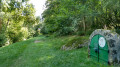
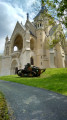
A walk along the GR®15, following the Marne Valley and passing through numerous villages. Dormans is notable for its First World War Memorial, and the route takes you through the Champagne vineyards, past its fountains and wash houses. There are a few picnic tables along the route.

Details

n°111358100
Creation:
Last update:
Last review:
–
  • Walking
    Activity: Walking
  • ↔
    Distance: 8.22 mi
  • ◔
    Average duration: 3h 55 
  • ▲
    Difficulty: Moderate

  • ⚐
    Back to start: Yes
  • ↗
    Ascent: + 118 ft
  • ↘
    Descent: - 115 ft

  • ▲
    Highest point: 292 ft
  • ▼
    Lowest point: 197 ft

Description of the walk

Car park after the green metal bridge on the way out of Sauvigny, heading towards Passy-sur-Marne.

(S/E) Continue down towards the Marne via Rue le Lohan and follow it to the left.

(1) Turn left, then right, running alongside the vineyards, and you’ll come out onto the D320.

(2) Turn right onto this departmental road and enter the village of Courcelles via Rue Pascal. Cross a road, then take Rue Voltaire on the right.

(3) Turn left onto Rue des Coutures and follow the route past the Courcelles water sports centre. Pass through fields and woods until you reach a road.

(4) Follow it to the left and enter Trélou-sur-Marne.

(5) Take Rue Victor Hugo on the right, passing a wash house and the town hall. Turn right to rejoin the Marne.

(6) Follow the GR® 15 Tour de l’Omois to the left, following the Marne for about 2 km, until you reach the D6.

(7) Turn right, cross the bridge and go round the roundabout at Place du Général de Gaulle.

(8) Continue slightly to the left along Rue Gambetta, then turn right into Rue du Château.

(9) Opposite the entrance to the castle grounds, turn right onto Avenue des Victoires until you reach a road. Turn right onto Rue du Chemin du Gault, then immediately left onto Rue de Thelusson, which leads onto the D41.

(10) Turn right onto Rue de Chavenay, then left onto Avenue de Paris. Follow this county road carefully for about 400 metres.

(11) Turn right onto Rue des Vieux Saules, cross the railway line and follow the River Marne on the left (picnic tables nearby and a sewage treatment works). Follow the River Marne for about 500 m.

(12) Leave the Marne by turning left towards the railway line and follow it until you rejoin the Marne.

(13) Turn left, passing the Voucy farm and the lock. Continue straight on until you reach the bridge.

(14) Cross the green metal bridge on the right to return to the car park (S/E).

Waypoints

  1. S/E : mi 0 - alt. 213 ft - Car park after the green metal bridge at Sauvigny - Marne (la)
  2. 1 : mi 0.42 - alt. 207 ft - Junction
  3. 2 : mi 1.15 - alt. 289 ft - Route de Champagne (D320)
  4. 3 : mi 1.36 - alt. 269 ft - Rue des Coutures
  5. 4 : mi 1.99 - alt. 226 ft - Road junction
  6. 5 : mi 2.18 - alt. 220 ft - Rue Victor Hugo - Église Saint-Médard (Trélou-sur-Marne)
  7. 6 : mi 2.56 - alt. 210 ft - Marne (la)
  8. 7 : mi 3.88 - alt. 217 ft - D6
  9. 8 : mi 4.06 - alt. 233 ft - Pond-point, Place du Général de Gaulle
  10. 9 : mi 4.24 - alt. 259 ft - Entrance to the Château
  11. 10 : mi 4.63 - alt. 249 ft - D41, Route de Chavenay
  12. 11 : mi 4.89 - alt. 240 ft - Junction with Rue des Vieux Saules
  13. 12 : mi 5.69 - alt. 207 ft - Junction. Leave the - Marne (la)
  14. 13 : mi 6.61 - alt. 207 ft - Marne (la)
  15. 14 : mi 8.07 - alt. 217 ft - Metal bridge on the right
  16. S/E : mi 8.21 - alt. 213 ft - Car park after the green metal bridge at Sauvigny

Notes

  1. Refreshment point in Dormans.
  2. Water point and toilets at the Dormans stadium.

Worth a visit

  1. Dormans Memorial Garden and Castle.
  2. Fountains and wash houses.
  3. The River Marne.
  4. The vineyards.
  5. Courcelles Water Sports Centre.

Always be cautious and plan ahead when you're outdoors. Visorando and the author of this route cannot be held responsible for any accidents occurring on this route.

The GR® and PR® markings are the intellectual property of the Fédération Française de Randonnée Pédestre.

Other walks in the area

For more walks, use our search engine .

The GPS track and description are the property of this route's author. Please do not copy them without permission.