Country:
 City:
City:


In Saint-Eugène, you can park on Rue du Mousset, after the bridge over the stream, by the tourist information sign (or in the square near the church).
(S/E) From the car park, head back towards the village centre until you reach the traffic lights on the D4. Turn left to cross the road bridge. Then turn right onto the D851 towards Connigis and Monthurel. Cross the railway line, then the Surmelin bridge. Continue right on the D851 towards Monthurel.
(1) At the first junction in the village of Monthurel, take the D85 on the right towards Celles-lès-Condé. In the centre of the village, by the town hall, follow the arrow straight on towards Condé-en-Brie.
(2) After 300 metres and before the last houses, turn right down Rue du Moulin. After the last house, continue down the path to the right until you reach the mill.
(3) After thefirst bridge over the Surmelin, follow the track to the left and cross a second bridge over a tributary of the river. Head towards the railway line.
(4) At the junction, before the railway line, follow the sign and turn left onto the farm track that runs alongside the railway line. Continue straight on, enter the village via Chemin du Bouvier and join the main road, the D4, to Condé-en-Brie.
(5) At the junction, follow the arrow to the right towards Saint-Eugène. At the roundabout by the town hall, turn right, staying on the D4 towards Crézancy.
(6) After the sports hall, at the junction, head left towards the secondary school. After the school, take the path that climbs to the right towards the forest.
(7) After 350 metres, take the Chemin de l’Aqueduc on the right, which is blocked by a metal barrier. Follow the Dhuys Aqueduct for 2 km. At the new barrier, at elevation 128, take the path leading down to the right towards Saint-Eugène and join Rue Joyeuse.
(8) Walk down this street to the right towards the village. Pass a street on your left and continue to the junction; follow the arrow on the left towards Crézancy to reach the car park (S/E).
 Local authority
 Moderate
 Visorando Member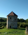
 Difficult