


Refine your search for walks in Ambleville
Ambleville walks


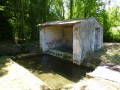
 Route des Petaux
 Local authority
 6.71 mi
 +361 ft
 -384 ft
 3h 25
 Moderate
 Departure from Ambleville (Charente)
The village is crossed by the Collinaud, a tributary of the Né. Primarily focused on wine-growing, Ambleville also has fertile land for growing cereals.
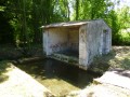
The Petaux Route (short circular route)
 4.13 mi
+207 ft
-200 ft
2h 05
 Easy
Departure from Ambleville (Charente)
The Collinaud, a tributary of the Né, flows through the village. Whilst Ambleville is primarily focused on wine-growing, it also has fertile land suitable for growing cereals.
Circuit de la Motte
 1.24 mi
+102 ft
-105 ft
0h 40
Easy
Departure from Ambleville (Charente)
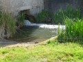
The commune of Ambleville is crossed by the Collinaud, a stream tributary of the River Né, which includes wash-houses typically found in this area of Grande Champagne. During your walk you will have the chance to discover La Motte, a hamlet in this commune. Take the time to admire the rolling countryside and La Motte wash-house.
This walk can be enjoyed with all the family, because children will find it fun to cross the Collinaud by way of the stepping stones.
Ugni Blanc Route
 4.63 mi
+141 ft
-138 ft
2h 15
Easy
Departure from Criteuil-la-Magdeleine (Charente)
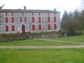
Set slightly apart from the main roads, the village seems to have fallen asleep… And yet, at the start of the last century, it was home to numerous shops and craftsmen who made it famous throughout the surrounding area. Criteuil-la-Magdeleine boasts a wealth of large houses, known as ‘logis’, and around ten mills (no longer in operation today) situated on the River Né. Some of these can be seen from the walking trail.
Criteuil-la-Magdeleine loop
 Visorando Member9.72 mi
+272 ft
-259 ft
4h 40
Moderate
Departure from Criteuil-la-Magdeleine (Charente)
Starting from the car park at the church in Criteuil-la-Magdeleine, the route runs alongside the Né and Collinaud rivers and crosses the vineyards of the Grande Champagne region. Points of interest along the route include: the Church of Saint-Macrin - Saint Jean Baptiste, the Chapel of La Magdeleine, beautiful wine estates, the wash house, the drinking water pumping station, the remains of a watermill and windmill, and various viewpoints.
Route between flax and vineyards (short circular route)
5.55 mi
+256 ft
-246 ft
2h 45
Easy
Departure from Lignières-Sonneville (Charente)
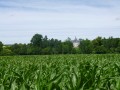
Lignière-Sonneville is a village with the rolling hills typical of the Grande Champagne region, formed by the merger of Lignières and Sonneville in 1845. Nestled in the heart of the Grande Champagne, it has a population of 613.
Route between Lin and Vigne
 12.70 mi
+843 ft
-820 ft
6h 35
 Difficult
Departure from Lignières-Sonneville (Charente)
Lignière-Sonneville is a village with the rolling hills typical of the Grande Champagne region, formed by the merger of Lignières and Sonneville in 1845. Nestled in the heart of the Grande Champagne, it has a population of 613.
Around the Né, through woods and vineyards
 7.16 mi
+249 ft
-276 ft
3h 30
Moderate
Departure from Saint-Palais-du-Né (Charente)
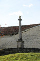
A lovely walk through the woods and vineyards of Petite Champagne around the River Né. Along the route, you’ll see fine examples of farmhouses with Charente-style gates, as well as old mills. The walk crosses the Île de Breuil after fording a stream. There are also fountains dotted along the route or nearby, including the Fontaine de Zade.
Interpretive trail at La Magdeleine
 0.87 mi
+3 ft
-7 ft
0h 25
Easy
Departure from Criteuil-la-Magdeleine (Charente)
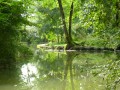
Discover the rich fauna and flora of the Né valley in this Natura 2000 classified area - a nature protected zone with many diverse and protected species and plants, such as the European Mink (a little known species near extinction) and wild orchids, as well as many other species naturally found in a preserved environment.
Pas à Pas in the centre of Verrières
 0.77 mi
+56 ft
-56 ft
0h 25
Easy
Departure from Verrières (Charente) (Charente)
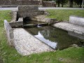
A parish until the Revolution (1789), Verrières became a commune under the Constitution of Year VIII, dated 28 Pluviose. At that time, Verrières fell under the jurisdiction of two neighbouring seigneuries: Juillac-le-Coq and Ambleville, both subject to the chapter of Angoulême Cathedral. Verrières formed part of the canton of Lignières until 16 Brumaire, Year VI, after which it was attached to Segonzac. The commune now has a population of 375 (857 in 1870).
The Bellevue route: between hillsides and valleys
4.17 mi
+138 ft
-141 ft
2h 00
Easy
Departure from Verrières (Charente) (Charente)
The commune is bordered to the south by the Né valley, towards which its land slopes gently. Vineyards, the main crop, cover more than two-thirds of the commune’s area and produce excellent, refined Grande Champagne brandies.
Côt Route
 10.86 mi
+463 ft
-453 ft
5h 25
Difficult
Departure from Juillac-le-Coq (Charente)
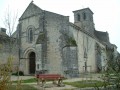
Juillac-Le-Coq is crossed by the Mothe stream, a tributary of the Charente. The village has a population of around 667. Wine-growing is its main industry.
The Côt Route (short circular route)
3.77 mi
+69 ft
-69 ft
1h 45
Easy
Departure from Juillac-le-Coq (Charente)
Juillac-Le-Coq is crossed by the Mothe stream, a tributary of the Charente. The village has a population of around 667. Wine-growing is its main industry.
Circuit of Open-air Wash Houses and Water Sources
 12.11 mi
+840 ft
-843 ft
6h 20
Moderate
Departure from Saint-Preuil (Charente)
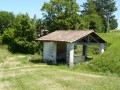
This circuit gives you the chance to discover rural heritage (springs, water sources, open air wash houses); and at each place, a description of its history is displayed. The route also highlights the architectural and historical heritage of the 13th century (Eglise Saint-Prohet, the Place Jacquaire, the protestant stele, the Chateau de Segeville) plus the various hamlets in the locality, flora and fauna.
Route of Fountains and Washhouses – Purple-marked variant
 7.95 mi
+482 ft
-512 ft
4h 05
Moderate
Departure from Saint-Preuil (Charente)
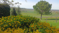
This route allows you to discover the area’s small-scale rural heritage (fountains, wash houses). Each water point features a historical and/or anecdotal description. The route also incorporates architectural and historical heritage (the 13th-century Saint-Projet Church, Place Jacquaire, Ségeville Castle and the scattered hamlets of the commune).
Exploring this route also allows you to appreciate the area’s scenic, floral and wildlife attractions.
Route of Fountains and Washhouses – Orange-marked variant
3.31 mi
+190 ft
-190 ft
1h 40
Easy
Departure from Saint-Preuil (Charente)
This route offers the chance to discover small-scale rural heritage (fountains, wash houses). Exploring this route also allows you to appreciate the area’s scenic, floral and wildlife features.