Country:

 City:


The walk starts from the village square in Aldatz (642 m) near Lekunberri in Navarre.
(S/E) Turn right. The first part of the route presents no particular navigation difficulties, provided you pay close attention to the choice of junctions. After the village of Aldatz, follow the wide path through a beech forest.
(1) Then keep to the right on the GR® Euskal Herriko Ibilaldia.
(2) At the next Fork in the road, turn right, staying on the GR® Euskal Herriko Ibilaldia. The path climbs through the forest heading north-east.
(3) At the junction, carry straight on.
(4) When you reach another T-junction, leave the signposted path (Euskal Herriko Ibilaldia) and take the path on the right.
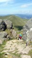
(5) Follow the marked path to the end. From here, use your GPS to navigate off-trail towards Aitzondo. Just a few metres from the summit of Aiztondo, the path emerges from the dense forest and continues the ascent through sparser woodland, from where the summit (1,029 m, the highest point of the hike) eventually comes into view. There’s a beautiful panoramic view from the summit and a view of the Pyrenees if the sky is clear and cloudless.
(6) Descend through the woodland heading north-west to rejoin a path.
(7) Follow it to the left until you rejoin the track you took on the way up.
(3) Continue to the left, in the opposite direction to the way up.
(2) Keep to the left again on the wide path, heading in the opposite direction to the way out.
(1) This is where the second circular loop of the walk begins (stay on the Euskal Herriko Ibilaldia), following the path on the right.
(8) Take the faintly marked path here, which climbs gradually to the summit of Arrizuri, recognisable by its triangulation point (844 m).
(9) Continue along an equally faint track and head down to the left, following your instincts through a beech forest, until you reach a quarry (Mina Alberto, building).
(10) Once past the quarry, take a track to the left, which disappears into the forest. You’ll soon come across a path that gradually realigns itself towards signposts.
(11) These signposts point towards Aldatz on the left; follow this route. The final stretch of the route is straightforward but requires you to remain alert: the GR® markings suggest turning off to the left. After walking a few metres in this direction, you’ll come across the entrance to the Arrizubi cave.
(12) After your visit, retrace your steps back to the fork. Take the path on the left.
(13) At the crossroads, turn left to make your way gently back along the path towards the village of Aldatz (S/E).
 Visorando Member

 Difficult