


Refine your search for walks in Aisne (rivière) - Luxembourg - Affluent de l'Ourthe
Aisne (rivière) - Luxembourg - Affluent de l'Ourthe walks


 From Bomal-sur-Ourthe Castle to the ruins of Logne Castle
 Visorando Member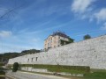
 10.47 mi
 +1,526 ft
 -1,529 ft
 6h 10
6h 10
 Moderate
 Departure from Durbuy (Province de Luxembourg)
At the intersection of the Condroz, Ardennes and Famenne regions, walk through limestone grasslands, forests and country lanes to reach Logne Castle and back.
The bridges over the Aisne (5) and the Lembrée, after the (13), have temporarily disappeared. If you start this hike, please bear in mind that you may have to wade across the river (5) as there is no other alternative.
Between beavers and an old local track in Manhay
 12.02 mi
+1,404 ft
-1,404 ft
6h 45
Moderate
Departure from Manhay (Province de Luxembourg)
12.02 mi
+1,404 ft
-1,404 ft
6h 45
Moderate
Departure from Manhay (Province de Luxembourg)
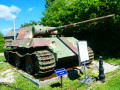
This outing in the northern part of the Plateau des Tailles stretches between the Fagnes de la Goutte and Pouhon (sources of the Aisne) and Grandménil (with its German Panzer and its 1944 museum). Mostly through woodland, the route follows fairly easy paths and tracks. Make sure you wear suitable footwear, especially after a spell of rain, as there are two fords that can sometimes be tricky to cross, one over the Aisne and the other over the stream in the Fagne de la Goutte, which is home to beavers.
Circular loop at the source of the Aisne
 10.00 mi
+715 ft
-715 ft
5h 15
Moderate
Departure from Manhay (Province de Luxembourg)
10.00 mi
+715 ft
-715 ft
5h 15
Moderate
Departure from Manhay (Province de Luxembourg)
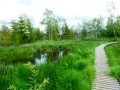
The Tailles plateau rises to an altitude of around 650 metres, where fagnes, fanges, pools and peat bogs are home to the sources of many of the Ourthe’s tributaries. Two of the best-known streams are the Henri Moulin, which flows southwards and joins the Eastern Ourthe just before the Nisramont dam, and the Aisne, which flows northwards and joins the Ourthe at Bomal.This walk explores the northern part of the Plateau des Tailles and the wetlands where the Aisne has its source. The boardwalks installed in recent years at the bottom of the Fagne de Pouhon will save you from the wet feet that were a certainty in previous years! While you’re unlikely to spot any beavers, a bit of careful observation is all it takes to discover their handiwork.
Along the Ourthe between Bohon and Bomal
 11.31 mi
+1,289 ft
-1,266 ft
6h 20
11.31 mi
+1,289 ft
-1,266 ft
6h 20
 Difficult
Departure from Durbuy (Province de Luxembourg)
Difficult
Departure from Durbuy (Province de Luxembourg)
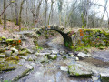
No, the walk doesn’t follow the banks of the Ourthe for 18 km… that would probably be very pretty but too monotonous over such a distance.Starting from the centre of Barvaux, the route begins by climbing the hill on the western side towards Durbuy (which you can visit off the trail) and reaches the Ourthe at the new relief car park.From there, the walk follows the river for just over 3 km before leaving it to reach the plateau between Tohogne and Herbet.After descending to the Ourthe and passing through Bomal, the walk climbs up the other side of the Ourthe and follows the lovely ridge path through the Mont des Pins and Mont Pelé Nature Reserve.
From the TTA station at Forge-à-la-Plez to the Lafosse mill
4.77 mi
+259 ft
-256 ft
2h 25
 Easy
Departure from Erezée (Province de Luxembourg)
Easy
Departure from Erezée (Province de Luxembourg)
This hike (on foot or by mountain bike) takes you to the Lafosse mill from the Forge-à-la-Plez station on the Aisne Tourist Tramway. The hike follows the Aisne river all the way. The return journey is via the same route.
Walks near Aisne (rivière) - Luxembourg - Affluent de l'Ourthe
Sterpigny – Rodt Sankt-Vith
 14.25 mi
+840 ft
-587 ft
7h 15
Difficult
Departure from Gouvy (Province de Luxembourg)
14.25 mi
+840 ft
-587 ft
7h 15
Difficult
Departure from Gouvy (Province de Luxembourg)
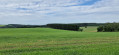
Here we are in the Eastern Cantons. This region isn’t part of Wallonia, but I’ve included it in my ‘Parkin’son tour of Wallonia’ all the same. Through a succession of climbs, some of which are quite steep, as are the descents, we gradually make our way towards the highest altitudes in Belgium. Mainly via paths, tracks and back roads, we link up the various villages and small towns situated between Sterpigny and Rodt, namely Gouvy, Aldringen, Maldingen and Crombach.
Vielsalm - Gouvy
 10.65 mi
+1,572 ft
-1,237 ft
6h 15
Moderate
Departure from Vielsalm (Province de Luxembourg)
10.65 mi
+1,572 ft
-1,237 ft
6h 15
Moderate
Departure from Vielsalm (Province de Luxembourg)
La Salm Valley, known as Le Glain
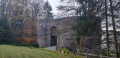
This stage ofthe GRP®571starts in Vielsalm in the Pays des Macralles, crosses the river at Salmchâteau and enters the Deux Ourthes Nature Park, heading towards the Ardennes plateau and Gouvy.
From Vielsalm station to Trois-Ponts station
11.33 mi
+1,440 ft
-1,765 ft
6h 30
Difficult
Departure from Vielsalm (Province de Luxembourg)
This Ardennes walk stretches across the heights of the left bank of the Salm. Set mainly in woodland, it offers magnificent views of the region. Relatively far from road traffic, it is a walk that rejuvenates body and mind through its tranquillity and the fresh air that is ever-present. The charming village of Goronne, the tranquillity of the Domaine de Farnières and the hamlet of Bergeval are much-loved stops along the way.
Trois-Ponts - Vielsalm
 12.67 mi
+1,788 ft
-1,444 ft
7h 25
Difficult
Departure from Trois-Ponts (Province de Liège)
12.67 mi
+1,788 ft
-1,444 ft
7h 25
Difficult
Departure from Trois-Ponts (Province de Liège)
La Salm Valley, whose real name is Le Glain
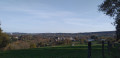
This stage ofthe GRP®571leaves the Amblève Valley and heads up the slopes of the La Salm Valley, known as Le Glain. The route changes banks several times until it reaches Vielsalm in the Pays des Macralles.
From Gouvy station to Vielsalm station
12.32 mi
+1,112 ft
-1,457 ft
6h 40
Moderate
Departure from Gouvy (Province de Luxembourg)
From Gouvy to Vielsalm, skirting Courtil and Provèdroux, the route is quintessentially Ardennes and serene. It alternates between peaceful forest stretches and open countryside, with gently rolling hills. The terrain becomes more undulating as you approach Vielsalm. The walk through the hamlet of La Comté, followed by the climb over the next ridge with its magnificent views, is a real treat. This is followed by the typical descent towards Vielsalm, where you’ll find it all: schist, the Bonalfa forest, blueberry bushes… and the ‘macralles’ (witches)!
Stoumont - Trois-Ponts
 12.22 mi
+2,034 ft
-2,290 ft
7h 25
Difficult
Departure from Stoumont (Province de Liège)
12.22 mi
+2,034 ft
-2,290 ft
7h 25
Difficult
Departure from Stoumont (Province de Liège)
Amblève Valley
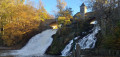
This stage ofthe GRP® 571 starts in Stoumont, passes in front of Froidcourt Castle and crosses the Amblève in Cheneux. The route then descends towards the Coo waterfall, crosses the river again and reaches Trois-Ponts via the Belvédère de Ster.