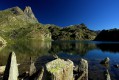
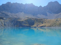
La Bergerie de Chabrières, starting from Maljasset

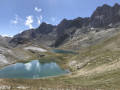
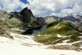
A hike with no major difficulties up to the Casse des Marchands, at which point we had to turn back due to the weather conditions.
A long traverse through the larch forest, following the torrent and passing some beautiful waterfalls.

Details

2577477
Creation:
Last update:
Last review:
  • Walking
    Activity: Walking
  • ↔
    Distance: 8.96 mi
  • ◔
    Average duration: 5h 30 
  • ▲
    Difficulty: Moderate

  • ⚐
    Back to start: Yes
  • ↗
    Ascent: + 1,611 ft
  • ↘
    Descent: - 1,581 ft

  • ▲
    Highest point: 7,621 ft
  • ▼
    Lowest point: 6,230 ft

Description of the walk

Park in the designated car park at the entrance to the hamlet of Maljasset.

(S/E) Walk through the hamlet of Maljasset and stay on the wide track leading to the hamlet of Maurin. You’ll reach a Y-junction where two tracks meet.

(1) Take the track on the right; this is also theGRP® shared by the Tours du Chambeyron and the Bic de Rubren routes. The markings are red and yellow. Descend slightly and cross the Ubaye via the bridge. Continue along the edge of a small stream to reach the junction marked ‘Les Prés du Bas’.

(2) Cross the footbridge and turn left onto the path, which soon runs alongside the Ubaye on its right bank. The path is still marked in red and yellow, but this is now theGRP® route for the Petit Tour du Rubren.
You’ll reach a junction on leaving the hamlet of Plan de Parouart.

(3) Stay on the path on the right to begin the climb through the woods of the Chabrière ravine. Leave the woods and continue the ascent. Before reaching the Casse des Marchands, you’ll come to the Bergerie de Chabrière.

(4) Begin the return journey along the same route back to the previous crossroads.

(3) Turn right, cross the Ubaye via the footbridge and rejoin theGRP® Tour du Bric de Rubren trail. Take it to the left. Wind your way along the right bank of the Ubaye, reaching the Parouart hut.

(5) Continue along theGRP® trail overlooking the Ubaye, passing through the hamlet of Combe Brémond. Stay on the wide track to return to the original crossroads.

(1) Follow the same route as on the way out to return to the car park at Maljasset (S/E).

Waypoints

  1. S/E : mi 0 - alt. 6,230 ft - Parking is compulsory at Maljasset - Refuge de Maljasset
  2. 1 : mi 0.47 - alt. 6,302 ft - Maurin crossroads
  3. 2 : mi 0.94 - alt. 6,401 ft - Les Près du Bas signpost
  4. 3 : mi 2.77 - alt. 6,762 ft - Map of the Parouart
  5. 4 : mi 4.2 - alt. 7,621 ft - Chabrière Hut
  6. 5 : mi 6.65 - alt. 6,804 ft - Parouart Hut
  7. S/E : mi 8.96 - alt. 6,230 ft - Parking is compulsory at Maljasset

Notes

Hiking boots are essential for a high-altitude hike.
Note on this hike: the elevation gain is gentle up to the Casse des Marchands, then becomes significantly steeper as you reach the pass.
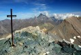
You can then continue on to the Tête de l’Autaret (3,012 m).

Worth a visit

A very beautiful larch forest.
Waterfalls.
Marmots.
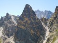
Stunning panoramic views of the peaks.

Reviews and comments

4.5 / 5
Based on 2 reviews

Reliability of the description
4.5 / 5
Ease of following the route
4.5 / 5
Route interest
4.5 / 5
Annie Parant
Annie Parant

Overall rating : 4.3 / 5

Date of your route : Aug 22, 2023
Reliability of the description : ★★★★☆ Good
Ease of following the route : ★★★★☆ Good
Route interest : ★★★★★ Very good
Very busy route : No

There were some beautiful landscapes on the way there, mostly in the shade. The signposting for the path leading to the sheepfolds has disappeared; this would have spared us a rather tedious trek over the large boulders. But it’s impossible to get lost – they’re still clearly visible! The return journey along the track is rather uninteresting, especially in the blazing sun. We regret not having taken the same route back as we did on the way there.

Machine-translated

Troisi
Troisi

Overall rating : 4.7 / 5

Date of your route : Jul 27, 2023
Reliability of the description : ★★★★★ Very good
Ease of following the route : ★★★★★ Very good
Route interest : ★★★★☆ Good
Very busy route : No

The circular route through the forest is very pleasant, but the return journey along the track was rather unpleasant.

Machine-translated

Other walks in the area

For more walks, use our search engine .

The GPS track and description are the property of this route's author. Please do not copy them without permission.