


Refine your search for walks in Bergerie Supérieure du Marinet
Bergerie Supérieure du Marinet walks


 Col de Marinet from Maljasset
 Visorando Member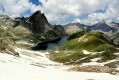
 10.60 mi
 +3,009 ft
 -3,005 ft
 7h 30
7h 30
 Difficult
 Departure from Saint-Paul-sur-Ubaye (Alpes-de-Haute-Provence)
On the agenda: flowers, marmots, mountain lakes (those of Marinet), waterfalls, streams and rivers, snow and two passes (Marinet and Mary). There are some beautiful patches of snow on the trail leading from the last Marinet lake and the nearby bivouac to the Marinet pass (2,800 m) and then to the Mary pass. There are views of Italy from the trail between the two passes. There are quite a few marmots in the Mary valley, which can be seen in the early morning and late afternoon.
Marinet and Roure Lakes Circular Tour
 12.24 mi
+3,596 ft
-3,596 ft
8h 45
Difficult
Departure from Saint-Paul-sur-Ubaye (Alpes-de-Haute-Provence)
12.24 mi
+3,596 ft
-3,596 ft
8h 45
Difficult
Departure from Saint-Paul-sur-Ubaye (Alpes-de-Haute-Provence)
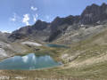
A superb walk offering views of the four Marinet lakes and at least two of the Roure lakes. The hike is long but not difficult; you’ll need a bit of a sense of direction to find the access to the upper Marinet lakes and to walk around the Roure lakes, but it’s child’s play. We regretted not having taken the time to explore the whole area and see all the lakes of Roure.
Trek around Chambeyron Mountain Range (4) Maljasset - Refuge Campo Base
 9.28 mi
+2,408 ft
-3,304 ft
6h 20
Difficult
Departure from Saint-Paul-sur-Ubaye (Alpes-de-Haute-Provence)
9.28 mi
+2,408 ft
-3,304 ft
6h 20
Difficult
Departure from Saint-Paul-sur-Ubaye (Alpes-de-Haute-Provence)
Quite a long stage but a steady route. A climb up to Col de Mary then a long downhill hike all the way to the shelter, in Chiaperra, Italy.
Trek around Chambeyron Mountain Range (3) Refuge du Chambeyron - Maljasset
 10.64 mi
+2,454 ft
-4,764 ft
8 hrs
10.64 mi
+2,454 ft
-4,764 ft
8 hrs
 Very difficult
Departure from Saint-Paul-sur-Ubaye (Alpes-de-Haute-Provence)
Very difficult
Departure from Saint-Paul-sur-Ubaye (Alpes-de-Haute-Provence)
The most demanding stage of the hike during which you'll go through at least 4 passes at over 2700 metres in altitude. Beautiful scenery all along the way! The "Lacs Marinet" offer the opportunity for refreshments before the final descent.
Tête de Cialancioun via the Upper Roure Lake
 12.04 mi
+3,675 ft
-3,671 ft
8h 45
Difficult
Departure from Saint-Paul-sur-Ubaye (Alpes-de-Haute-Provence)
12.04 mi
+3,675 ft
-3,671 ft
8h 45
Difficult
Departure from Saint-Paul-sur-Ubaye (Alpes-de-Haute-Provence)
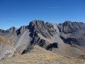
A visit to a lovely lake followed by the ascent of a 3,000-metre peak on the border, offering a stunning panoramic view of Italy, the Ubaye, the Queyras and the Écrins.
Navigation is made easier here by the Visorando app.
From Rubren to Marinet
 12.45 mi
+4,498 ft
-6,201 ft
10 hrs
Very difficult
Departure from Saint-Paul-sur-Ubaye (Alpes-de-Haute-Provence)
12.45 mi
+4,498 ft
-6,201 ft
10 hrs
Very difficult
Departure from Saint-Paul-sur-Ubaye (Alpes-de-Haute-Provence)
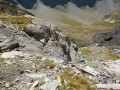
A very long day criss-crossing the border. But what breathtaking scenery! And you won’t be bothered by the neighbours... there’s little chance of coming across other two-legged creatures. But perhaps some ibex, vultures, including (apparently) a pair of bearded vultures.
From Saint-Véran to Larche: Ubaye Transfrontière
 49.21 mi
+20,728 ft
-21,916 ft
5 days
Very difficult
Departure from Saint-Véran (Hautes-Alpes)
49.21 mi
+20,728 ft
-21,916 ft
5 days
Very difficult
Departure from Saint-Véran (Hautes-Alpes)
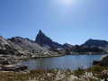
A fantastic Franco-Italian ride between Saint-Véran and Larche! It will take you through strange places, from the solitary, green rocky landscapes of Saint-Véran to the fantastical, almost Dolomite-like terrain of the massif between Chambeyron and Orrenaye.
Trek around Chambeyron Mountain Range
 36.21 mi
+13,120 ft
-13,783 ft
5 days
Difficult
Departure from Saint-Paul-sur-Ubaye (Alpes-de-Haute-Provence)
36.21 mi
+13,120 ft
-13,783 ft
5 days
Difficult
Departure from Saint-Paul-sur-Ubaye (Alpes-de-Haute-Provence)
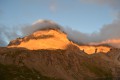
Reaching over 3000 metres in altitude, Aiguilles de Chambeyron and Brec de Chambeyron form an impressive mountain range halfway between Queyras and the Moncantour. This hike offers a trek with no techincal difficulty, with passes over 2700 m in altitude and a summit of over 3000 m. Set in an outstanding landscape and for the most part within a high mountain setting.