Exploring the Guindy Valley

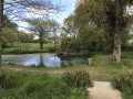
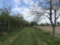
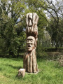
This walk between Cavan and Tonquédec is very easy. It begins and ends with a covered avenue lined with sculptures: this is the Vallée des Arts. Unfortunately, over time, some of the sculptures have disappeared. After exploring the Guindy Valley, you’ll finish with the ‘Apple Tree Avenue’: a wide avenue lined with around a hundred apple trees of various species, where anyone is free to pick apples.

Details

418521
Creation:
Last update:
Last review:
  • Walking
    Activity: Walking
  • ↔
    Distance: 7.37 mi
  • ◔
    Average duration: 3h 30 
  • ▲
    Difficulty: Moderate

  • ⚐
    Back to start: Yes
  • ↗
    Ascent: + 164 ft
  • ↘
    Descent: - 171 ft

  • ▲
    Highest point: 331 ft
  • ▼
    Lowest point: 197 ft
  • ⚐ Country: France
  • ⚐ City: Cavan (22140)
  • ⚑
    Start/End: N 48.673179° / W 3.345937°
  • ❏
    IGN map(s): Ref. 0714OT
  • Hour-by-hour weather

Photos

Description of the walk

The entire route, with the exception of a section indicated below, is signposted in yellow on a green background or with yellow signs for the ‘Petite Randonnée’ routes.

(S/E) The village hall car park, next to the church. Leave the car park heading north-east and head towards Rue Jean Monnet.

(1) Take the path on the left – this is the Allée des Arts (left-hand side). Follow the stream and admire the sculptures lining the Rûz valley. Cross a road and continue straight on until you reach a path on the left. Follow it for 50 metres, then turn right to go round the treatment works’ ponds on two sides. Continue to the left, walking north-west whilst following the Rûz once more. Cross another road and carry on straight ahead to reach another small road.

(2) Take this road on the left. At the end of it, turn left then right towards the roundabout. Take the road that passes under the four-lane carriageway and head for the second roundabout.

(3) Take the path that runs alongside the stream and leads to the Moulin de Cavan. On the road, turn right, then immediately left, and continue to follow the stream. The path becomes a road as you approach Kerstéfan (Kerstéphan on the map).

(4) Before you reach the houses, take the path on the left, passing by the wash house. At the end of the path, follow the road to the right, then, after a bend to the left, take the path on the left marked ‘Vers la Vallée du Guindy’. Continue along this path and then onto the road that follows on from it.

(5) Turn right, then after 40 metres, turn left and then take the first road on the right. The road turns into a track as you continue to the right, eventually leading onto another road.

(6) Turn right and then immediately left. Before you reach the houses, keep to the left and walk south-south-east.

(7) Leave the yellow-markedPR® by turning left. (If you turn right: see the alternative route in ‘Practical Information’). Continue along the road, ignore a road on the left and turn right after the houses.

(8) Join the yellow-markedPR® trail again. Turn left and walk round the field to reach a road, which you should follow to the right. Turn left to cross the four-lane road and continue straight on through Cavan until you reach the main road.

(9) For those who are tired, you can return to the starting car park by turning left and then taking the first street on the right. Otherwise, turn right and follow the main street, Rue Charles et Henri Avril, until you reach the edge of the village.

(10) Take the path on the left and continue to the right along what might be called ‘Allée des Pommiers’. At the end of this, turn left onto Allée des Arts (right-hand side). Carry on straight ahead, ignoring a footbridge on the left. Cross a road and continue straight ahead.

(1) Turn left, then take the path on the right to reach the car park (S/E).

Waypoints

  1. S/E : mi 0 - alt. 318 ft - Car park at the Salle des Fêtes
  2. 1 : mi 0.11 - alt. 302 ft - Path on the left
  3. 2 : mi 1.19 - alt. 236 ft - Turn left
  4. 3 : mi 1.6 - alt. 246 ft - Path along the stream
  5. 4 : mi 2.42 - alt. 253 ft - Path on the left towards the valley of the - Guindy (rivière)- Affluent du Jaudy
  6. 5 : mi 3.31 - alt. 266 ft - Turn right, then left after 40 metres
  7. 6 : mi 4 - alt. 276 ft - Turn right, then left after 40 metres
  8. 7 : mi 4.61 - alt. 259 ft - Leave the PR path by turning left
  9. 8 : mi 5.27 - alt. 292 ft - Rejoin the PR path by turning left
  10. 9 : mi 5.95 - alt. 318 ft - Departmental road on the right
  11. 10 : mi 6.38 - alt. 331 ft - Leaving the village, take the path on the left
  12. S/E : mi 7.37 - alt. 318 ft - Car park at the Salle des Fêtes

Notes

Discovering sound: In Kérouspic, a one-kilometre trail through the forest to help children discover what sound is (admission fee applies). To find the route from the site: take the path running alongside the Guindy, heading south-south-east then north-east. At the end of the path, turn right, then, after 50m, turn left. Follow this path to reach (8). But be warned: we’ve heard there’s a short-tempered farmer who isn’t too keen on walkers!!!!

Worth a visit

The Valley of the Arts
The Apple Tree Lane

Always be cautious and plan ahead when you're outdoors. Visorando and the author of this route cannot be held responsible for any accidents occurring on this route.

The GR® and PR® markings are the intellectual property of the Fédération Française de Randonnée Pédestre.

Reviews and comments

4.3 / 5
Based on 2 reviews

Reliability of the description
4 / 5
Ease of following the route
4.5 / 5
Route interest
4.5 / 5
philippe  ballouard
philippe ballouard

A lovely, easy walk. The route is perfect.
We saw dogs in two places. We carried on walking, ignoring them.
We weren’t exactly reassured as there were no gates or fences to stop them getting through.
But everything went fine.
A pleasant walk, apart from the end – there’s quite a bit of road, but it’s essential to get back onto the ‘Parcours des Arts’, which is well worth a visit.
Beautiful paths with the Guindy stream flowing at your feet: a lovely walk.

Machine-translated

Olive22140
Olive22140

Overall rating : 4 / 5

Date of your route : May 02, 2021
Reliability of the description : ★★★★☆ Good
Ease of following the route : ★★★★☆ Good
Route interest : ★★★★☆ Good
Very busy route : No

A very pleasant walk, almost always along the water’s edge or through woodland, with just a few sections on tarmac roads, a peaceful walk – you’d never guess the four-lane road is so close; no difficulty, no trouble finding your way by following the route, the statues, the avenue of apple trees, an old ruined mill hidden beneath the vegetation, a well-maintained path with a few bridges, plenty of flowers, very good

Machine-translated

alex22
alex22

Overall rating : 4.7 / 5

Date of your route : Sep 18, 2017
Reliability of the description : ★★★★☆ Good
Ease of following the route : ★★★★★ Very good
Route interest : ★★★★★ Very good

A very manageable route, even though I went there after heavy rain. I’d recommend it

Machine-translated

Other walks in the area

For more walks, use our search engine .

The GPS track and description are the property of this route's author. Please do not copy them without permission.