Country:
 City:
City:


The starting point is at Place de l’Église (or opposite the town hall if there is no space).
(S/E) Take the D10 departmental road towards Saint-Benoît-du-Sault, heading north-east, then turn left into Rue Roland Meignien. Continue along this street until you rejoin the D10. Then turn right towards Belâbre, heading west.
Carry on along this road for about 1,300 metres: you’ll pass the Trois Musées, a cross at the junction with the road leading to the Château de la Garde Giron, the football pitch and the campsite, in that order.
(1) As you leave the village, near the last few houses, follow the yellow signposting by turning left onto a dirt track. When you reach the village of La Renonfière, take the small road on the left.
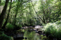
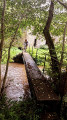
(2) 150m further on, at the bend, head down a grassy path to the bottom of the valley, into a woodland. At the junction of the paths, carry on straight ahead towards the south-west, cross a footbridge over the Abloux and then head back up the path.
Cross the D94 county road and continue along the path opposite. Take the small road on the right for 100 metres towards the hamlet of Les Places, then turn left at the three-way junction.
(3) 20 metres further on, turn left onto a stony track that climbs at the start and follow it for about 700 metres.
(4) Follow the D32 on the left to rejoin the D94; cross this road and take the path leading to the village of Charpenet.
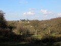
(5) Take a 50-metre detour to the left to enjoy a beautiful view of the Abloux Valley on the outskirts of the village.
Back at the junction, walk 20 metres into the village and take the grassy path on the left for 100 metres.
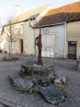
At the corner of a house, head down a stony path on the left which leads to a fountain and the bottom of a small valley. It then climbs back up to the D32 road, which you should follow down to the left through the woods.
(6) Reach the D10 road, cross it carefully, turning left to cross two bridges over the Abloux, then turn right onto the small path along the embankment of the village pond.
Walk along the left-hand side of the pond to reach a car park; cross this to rejoin the D10 and follow it to the right for 20 metres.
(7) Cross over to take the second stony path opposite, heading north-west. It passes above the old 16th-century Fontmorand farm and then climbs through the woodland.
(8) At a bend as you emerge from the woods, at the junction with another track, head up to the right to reach a plateau of pastures and cultivated fields. Continue straight on until you reach a gravel road. Take the second street on the left, Rue de la Pompe.
(9) Turn right onto Rue des Gerbauds at the small square, which takes you back to your starting point, Place de l’Église (S/E).

 Visorando Member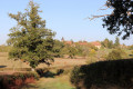
 Average