The Chéniers iron mines

This walk is route no. 54 of the Brenne Regional Nature Park, which takes you along small roads and lovely paths to explore Chéniers, its surroundings and its mining heritage. Indeed, iron brought wealth to the village of Chéniers, so it’s no surprise that the earth and the houses are often red. Part of the route allows us to follow the traces left by ore mining, which dates back to Ancient Rome.

Details

13835185
Creation:
Last update:
Last review:
  • Walking
    Activity: Walking
  • ↔
    Distance: 7.10 mi
  • ◔
    Average duration: 3h 45 
  • ▲
    Difficulty: Moderate

  • ⚐
    Back to start: Yes
  • ↗
    Ascent: + 548 ft
  • ↘
    Descent: - 525 ft

  • ▲
    Highest point: 787 ft
  • ▼
    Lowest point: 479 ft

Photos

Description of the walk

The start is in Chéniers, at the car park with a bus shelter, near the wash house.
Follow the yellow markings for route no. 54 of the Brenne Regional Nature Park, entitled: ‘The Chénier Iron Mines’.

(S/E) With your back to the bus shelter, take the street on the left and head down to the wash house. Walk back up a grassy slope which leads to another car park. Turn left onto Rue d’En Bas, then take Rue du Charlet.

(1) On leaving Chénier, follow the D93a to the left towards Dunet for about 1 km.

(2) Turn left onto a track suitable for vehicles. Follow it to a T-junction: turn left, then turn right onto the access road to the hamlet of La Barre.

(3) At the junction, follow the D93 to the right.

(4) When you reach the Z.A. de la Bouige, turn right, leaving the return route on your left. Walk along the right-hand side of the farm buildings. At the next junction, turn left.

(5) Follow the D 93 to the right again, then take the small road on the left.

(6) Just before a right-hand bend, head up a forest track on the left, then continue uphill to the left.
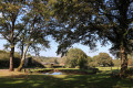
The track leads out onto a meadow, which you should follow along a grassy path on the right, at the edge of the forest. The path then widens and winds its way through the meadows.

(7) At the next crossroads, turn left (signposted) onto a wide, carriageable track.
Carry on straight ahead along a grassy track until you reach another junction.

(8) Just before reaching the road, turn right onto the grassy path which takes you to the Fosse de l’Effe. Then rejoin the D 93 on the right to return to the junction at the Z.A. de la Bouige.

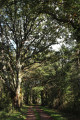
(4) Then take the track on the right, which soon becomes a forest track; follow this, ignoring various turn-offs to the left and right.

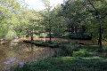
(9) You’ll reach the Grand Place Carrée (signposted), a former open-air gallery now filled with water. Continue along the forest track, which becomes increasingly grassy. At the next junction (not marked on the IGN map), turn left and then follow the yellow markings closely, always keeping to the far right.
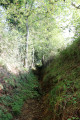
The path becomes a sunken track and, on leaving the woods, turns into a farm track.

(10) Follow the small gravel road to the left, which takes you to the Grange Dauphin. Cross the hamlet, continuing along a small tarmac road.

(11) Turn left at the pumping station to cross through Nougerette. After leaving the hamlet, turn left to follow a small road that takes you back to Chéniers.

(12) At the entrance to Chéniers, continue along the road, pass the chapel, then turn right and return to the starting point (S/E).

Waypoints

  1. S/E : mi 0 - alt. 584 ft - Car park: bus shelters, near the wash house
  2. 1 : mi 0.21 - alt. 604 ft - Turn left onto the D 93a, towards Dunet
  3. 2 : mi 0.88 - alt. 633 ft - Path on the left
  4. 3 : mi 1.58 - alt. 561 ft - Chéniers exit: D93 on the right
  5. 4 : mi 1.68 - alt. 558 ft - La Bouige Industrial Estate. Common junction (out and return)
  6. 5 : mi 2.39 - alt. 630 ft - Turn right onto the D 93, then left onto the road
  7. 6 : mi 3.1 - alt. 479 ft - Forest track: turn left twice
  8. 7 : mi 3.82 - alt. 679 ft - Vehicle track on the left
  9. 8 : mi 4.32 - alt. 607 ft - On the right, Fosse de l’Effe
  10. 9 : mi 4.83 - alt. 604 ft - Grand Place Carrée: open-cast mine
  11. 10 : mi 5.42 - alt. 735 ft - On the left, the Grange Dauphin
  12. 11 : mi 5.95 - alt. 758 ft - On the left, Nougerette
  13. 12 : mi 6.85 - alt. 607 ft - Chéniers, chapel, on the right
  14. S/E : mi 7.1 - alt. 584 ft - Car park: bus shelters, near the wash house

Notes

Make sure you wear good walking shoes and trousers: the terrain varies, and the paths can be very grassy and damp.

Worth a visit

Reviews and comments

4.5 / 5
Based on 2 reviews

Reliability of the description
4.5 / 5
Ease of following the route
5 / 5
Route interest
4 / 5
balou17
balou17

Overall rating : 4.3 / 5

Date of your route : Apr 10, 2023
Reliability of the description : ★★★★☆ Good
Ease of following the route : ★★★★★ Very good
Route interest : ★★★★☆ Good
Very busy route : No

A lovely walk through the meadows. Beautiful, large farms, reflecting a livestock-farming tradition.

Machine-translated

JoséBernard
JoséBernard

Overall rating : 4.7 / 5

Date of your route : May 08, 2022
Reliability of the description : ★★★★★ Very good
Ease of following the route : ★★★★★ Very good
Route interest : ★★★★☆ Good
Very busy route : Yes

A lovely route with its remnants of a bygone era.
Well-maintained and signposted. Thanks to the ploughing of certain sections, we were able to
see the truly red colour of the soil – impressive!

Machine-translated

Other walks in the area

For more walks, use our search engine .

The GPS track and description are the property of this route's author. Please do not copy them without permission.