Exploring a dry valley in the Beauce region

La Beauce harbours well-kept secrets. Yet some of them are revealed to us during this walk, around a dry valley. Roe deer, wild hares, grape hyacinths and orchids reveal themselves to those who know how to look.

Details

1066774
Creation:
Last update:
Last review:
  • Walking
    Activity: Walking
  • ↔
    Distance: 5.56 mi
  • ◔
    Average duration: 2h 35 
  • ▲
    Difficulty: Easy

  • ⚐
    Back to start: Yes
  • ↗
    Ascent: + 46 ft
  • ↘
    Descent: - 46 ft

  • ▲
    Highest point: 407 ft
  • ▼
    Lowest point: 351 ft
  • ⚐ Country: France
  • ⚐ City: Baccon (45130)
  • ⚑
    Start/End: N 47.879696° / E 1.619936°
  • ❏
    IGN map(s): Ref. 2119E, 2119O, 2120E, 2120O
  • Hour-by-hour weather

Photos

Description of the walk

The starting point is on the wide verge of Rue de Moquesouris in Baccon. To get there, head towards the stadium at the Baccon roundabout (towards Cravant) and continue for 1.4 km from the roundabout. The car park is at the edge of a small copse on the left-hand side of the road, just before the hamlet of Gléneau.

(S/E) Take the path running alongside the small wood on your left and continue across open ground until you reach the Bois de Fontaine. Turn right, then veer left at the edge of this wood. The path eventually leads into the Bois de la Fontaine until you reach a crossroads marking the exit from the woods. Turn right to reach the Bois Raubardeau.

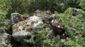
(1) At the next crossroads, turn left along the edge of the Bois Raubardeau (if you go straight on, the path leads to a badly damaged dolmen, which is barely visible from the path as it is surrounded by vegetation). You will see a dry valley on your left, just before the model aeroplane airfield. Continue along the hard-packed track until you reach a T-junction.

(2) Turn left onto the lane. This veers to the right before reaching a crossroads.

(3) Turn right onto the grassy path. At the junction of four tracks, head straight on towards the hamlet of Thorigny after passing a farm on your left. Ignore Rue de Thorigny on your right and continue in the same direction along the gravelled path until you reach a three-way junction.

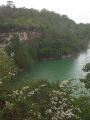
(4) Head left along the grassy path to go round the Thorigny valley. To do this, take the hard-packed track that runs alongside the lake left by a former quarry, on your left.

(5) At the crossroads, leave the gravel track behind and turn right onto the grassy path which describes a circular curve to the right. At the Fork in the road, take the left-hand track, which then turns left before reaching a junction.

(6) Turn right onto the grassy path. When you reach the small copse, turn right and then immediately left to go round it and follow its edge. Pass a first path on the right and then a second on the left.

(7) Turn right at the junction onto the grassy path leading to Rue Moquesouris, which you took on the way out, after passing through a small copse. You will find the car park on your right (S/E).


Waypoints

  1. S/E : mi 0 - alt. 397 ft - Verge of Rue de Moquesouris
  2. 1 : mi 0.93 - alt. 367 ft - On the left, on the edge of the Raubardeau woods
  3. 2 : mi 1.39 - alt. 358 ft - On the left along the path
  4. 3 : mi 1.76 - alt. 374 ft - Turn right onto the grassy path
  5. 4 : mi 2.73 - alt. 371 ft - Turn left onto the grassy path
  6. 5 : mi 3.12 - alt. 364 ft - Turn right at the crossroads
  7. 6 : mi 3.69 - alt. 400 ft - Turn right onto the grassy path
  8. 7 : mi 4.69 - alt. 407 ft - Turn right onto the grassy path
  9. S/E : mi 5.56 - alt. 397 ft - Verge of Rue de Moquesouris

Notes

The paths can be muddy in winter. The Beauce region is renowned for its ‘earth of friendship’, which sticks to your shoes.
In summer, the lack of shade should be borne in mind.
Where there are no signposts, caution is advised.

Worth a visit

During the walk, take time to enjoy observing nature. You may wish to use a spotting scope or binoculars to admire the roe deer, which are numerous on the edges of the small woods.

You can explore the dolmens, remnants of a rich civilisation (IGN map). A megalithic site is visible from the crossing point (1). It is situated 1.2 km away, near a quarry, in a slight depression just before the mound of topsoil accumulated when the limestone was stripped for quarrying. The site known as the Dolmen de la Mouise is situated on fallow land (private property surrounded by barbed wire) a few metres from the path. You can recognise the spot on the left-hand side by the shrubbery that surrounds and protects the prehistoric megalith. It was listed as a historic monument in 1979.

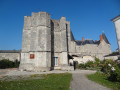
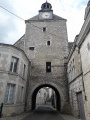
The Chappe Telegraph Tower in Baccon is a place of interest that can bevisited on the first Sunday of each month from April to September.

Reviews and comments

4.5 / 5
Based on 2 reviews

Reliability of the description
4.5 / 5
Ease of following the route
4.5 / 5
Route interest
4.5 / 5
Jean-Louis Pinault
Jean-Louis Pinault

Thank you for the information,
Jean-Louis

Machine-translated

dampierre
dampierre

Overall rating : 4 / 5

Date of your route : Sep 03, 2018
Reliability of the description : ★★★★☆ Good
Ease of following the route : ★★★★☆ Good
Route interest : ★★★★☆ Good

A walk we went on in September in glorious sunshine and, thankfully, with a breeze, as there is, in fact, very little shade.
This can be combined with a visit to the Chappe telegraph tower in Baccon.

Machine-translated

JACKY-MARYLENE
JACKY-MARYLENE

Overall rating : 5 / 5

Date of your route : Jun 02, 2018
Reliability of the description : ★★★★★ Very good
Ease of following the route : ★★★★★ Very good
Route interest : ★★★★★ Very good

A very pleasant walk, but best avoided on a sweltering day – there’s not much shade!

Machine-translated

Other walks in the area

For more walks, use our search engine .

The GPS track and description are the property of this route's author. Please do not copy them without permission.