A circular walk between Huisseau-sur-Mauves and Montpipeau

A circular route steeped in history, taking in the Beauce plateau with its farmland, the Bois de Bucy – a mixed woodland popular with chestnut lovers and mycologists – and Montpipeau Castle, of which only the ‘Favéant’ towers remain, vestiges of a prestigious past.

Details

1621553
Creation:
Last update:
Last review:
  • Walking
    Activity: Walking
  • ↔
    Distance: 7.77 mi
  • ◔
    Average duration: 3h 35 
  • ▲
    Difficulty: Moderate

  • ⚐
    Back to start: Yes
  • ↗
    Ascent: + 39 ft
  • ↘
    Descent: - 39 ft

  • ▲
    Highest point: 387 ft
  • ▼
    Lowest point: 344 ft

Photos

Description of the walk

Park in the car park of the Huisseau-sur-Mauves village hall, at the foot of the water tower.

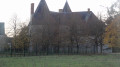
(S/E) Turn left onto Rue du Bois de Deure towards the village centre. Continue along Rue du Parc with the castle on your left and walk alongside the curtain wall, ignoring Rue Boussier on your right. Turn left onto Rue des Caillots to go round the castle grounds.

(1) At the first junction, turn left onto the small tarmac road, Rue du Cas Rouge, towards the Grand Chêne. Continue in this direction through the hamlet of Carouge, ignoring the first narrow lane on your left (signposted ‘le Petit Pré’) and taking the ‘No Entry’ road (towards the Grand Chêne). Pass the Grand Chêne then carry on straight ahead along the dirt track, ignoring the lane branching off to the right.

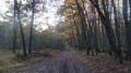
(2) Enter the Bois de Bucy and stay on the main path until you reach a junction with the Allée d’Ingré.

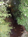
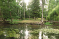
(3) Turn left onto the Allée d’Ingré, which winds around a wetland area before exiting the Bois de Bucy. Walk alongside the Bois d’Escure until you reach the D3, then turn right onto it and follow it for 300 metres.
Take care whilst walking along the departmental road.

(4) Leave the D3 just before the bend and take Rue de Montpipeau towards the former Château de Montpipeau, now converted into a guesthouse; go round it on the left. Ignore the lane leading to the new Château de Montpipeau and turn right onto the footpath at the Fork in the road. This footpath turns into a wide, straight grassy track running through the fields.

(5) Turn left when you come to a cross-path. Ignore the paths branching off to the left.

(6) At the junction, turn left onto the wide cross-path towards the hamlet of Châtre.

(7) Pass through the hamlet and turn right onto Rue de Châtre, continuing to the cemetery.

(8) Go past the cemetery and take Allée des Uxellois on the right, which leads to the water tower and on to the car park at the village hall – the starting point of the walk (S/E).


Waypoints

  1. S/E : mi 0 - alt. 348 ft - Car park at the village hall
  2. 1 : mi 0.54 - alt. 354 ft - On the left, a small tarmac road
  3. 2 : mi 1.69 - alt. 358 ft - Entrance to the woods
  4. 3 : mi 2.72 - alt. 387 ft - Turn left onto the Allée d’Ingré
  5. 4 : mi 4.52 - alt. 361 ft - Turn left onto Rue de Montpipeau
  6. 5 : mi 5.58 - alt. 371 ft - Turn left at the junction with a cross-path
  7. 6 : mi 6.18 - alt. 354 ft - Turn left onto the wide cross-path
  8. 7 : mi 6.79 - alt. 364 ft - Turn right onto Rue de Châtre
  9. 8 : mi 7.56 - alt. 348 ft - Allée des Uxellois on the right
  10. S/E : mi 7.77 - alt. 348 ft - Car park by the village hall

Notes

The route presents no difficulty and can be walked in all seasons, except during periods of heavy rain.

Worth a visit

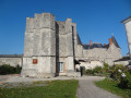
One of the highlights of the walk is Huisseau-sur-Mauves Castle, dating from the 12th, 15th and 18th centuries.
The castle’s façades, sides and roofs, the postern gate and the moat are listed in the register of historic monuments.

Reviews and comments

4.3 / 5
Based on 2 reviews

Reliability of the description
5 / 5
Ease of following the route
5 / 5
Route interest
3 / 5
martin dominique
martin dominique

Overall rating : 4.7 / 5

Date of your route : May 04, 2021
Reliability of the description : ★★★★★ Very good
Ease of following the route : ★★★★★ Very good
Route interest : ★★★★☆ Good
Very busy route : No

The section through the woods is very pleasant; the start along the road and the finish through the fields are a little less so, but we found the route interesting overall. Thank you to your website and to everyone who works hard to make our walks such an enjoyable experience.

Machine-translated

Jean-Louis Pinault
Jean-Louis Pinault

It’s true that October isn’t the best month to visit the Beauce. It’s also worth bearing in mind that the ground can get quite muddy, particularly after the autumn rains. The best time of year is late spring and early summer, when you can enjoy the splashes of colour from the various crops. The Beauce plateau remains flat but is a riot of colour, which makes for a lovely walk outside the magnificent Bois de Bucy, not to mention the châteaux of Huisseau and Montpipeau!
Have a lovely day,
Jean-Louis

Machine-translated

pierre1er
pierre1er

Overall rating : 4 / 5

Date of your route : Oct 07, 2020
Reliability of the description : ★★★★★ Very good
Ease of following the route : ★★★★★ Very good
Route interest : ★★☆☆☆ Disappointing
Very busy route : No

A desert of earth stretching as far as the eye can see. Forest tracks rutted by loggers. It’s not exactly the ideal place to film *Romeo and Juliet*, but once in a lifetime it’s worth making a detour to see the flat Beauce region. You find yourself confined there automatically.

Machine-translated

Other walks in the area

For more walks, use our search engine .

The GPS track and description are the property of this route's author. Please do not copy them without permission.