Unexpected views in Beaugency

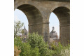
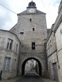
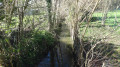
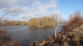
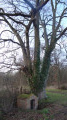
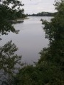
A word to photographers. Simply stroll along paths, through urban areas and beside rivers, and yet unexpected views suddenly appear. How many will you manage to capture?

Details

n°21799830
Creation:
Last update:
Last review:
  • Walking
    Activity: Walking
  • ↔
    Distance: 4.54 mi
  • ◔
    Average duration: 2h 10 
  • ▲
    Difficulty: Easy

  • ⚐
    Back to start: Yes
  • ↗
    Ascent: + 69 ft
  • ↘
    Descent: - 66 ft

  • ▲
    Highest point: 354 ft
  • ▼
    Lowest point: 276 ft
  • ⚐ Country: France
  • ⚐ City: Beaugency (45190)
  • ⚑
    Start/End: N 47.780778° / E 1.630119°
  • ❏
    IGN map(s): Ref. 2120E
  • Hour-by-hour weather

Photos

Description of the walk

Park in the car park on Rue de l’Abreuvoir, opposite the viaduct.

(S/E) Walk towards the viaduct for a few metres, then turn right and walk alongside it.
Cross the road and continue along the Levrault path. Join Rue de Châteaudun.

(1) Turn left onto it under the viaduct, cross the road and turn into Rue de l’Abattoir, which curves to the right. Take thefirst path on the right and, after a 90° bend, follow it to Rue de la Pointe Maubinée. Turn right onto it and continue to the roundabout.

(2) Cross the roundabout and continue straight ahead along the same road, keeping to the clear verge. Head towards the town exit indicated by the town boundary sign.

(3) Just before the sign, turn left onto Chemin de la Californie, heading across the fields. Then make a slight left-right detour, before continuing along the edge of the field on a slightly less defined path. First, find Chemin des Fourneaux, then carry on straight ahead to reach Route de Messas. Turn left onto it and follow it for a few metres until you reach the junction with Rue de Châteaudun.

(4) Cross the road with great care, using the pedestrian crossing situated a little further up on the right. Then take Chemin du Verger aux Lauriers. Follow this path until you reach Rue du Colombier, then continue straight on for a good hundred metres (past No. 76).

(5) Turn right onto a path that slopes down slightly. Cross the stream and then walk along the edge of the woods. Stay at the edge of the woods, turning left at the next junction. Continue to Rue des Tanneurs, then carry on along the left bank of the stream until you come out onto Rue des Marais.

(6) Turn left onto it and carry on straight ahead until you reach the viaduct. Continue straight ahead along Rue de Beauvilliers until you reach Rue Nationale, then cross it. Carry on to the right until you reach the steps on the left leading down to Rue du Rû. Follow Rue du Rû then Rue du Pont until you reach the junction with Rue de la Bonde.

(7) Turn right into Rue du Pouët Chaumont, then left into thefirst street, Rue des Marmousets.
At the end of this street, turn right into Rue de la Cordonnerie. Take Passage Pellieux on the left; it will feel as though you’re entering someone’s home. At the end, you’ll emerge opposite the Tour César.
Walk past the Abbatiale and head up the street on your right to Place Saint-Firmin. Walk to the left of the Tour Saint-Firmin and continue along Rue Porte Tavers. After passing under the archway, take the Petit Mail on the left until you reach the viewpoint overlooking the Loire. Walk down to the Théâtre de Verdure.

(8) Instead of walking along the quays, take the parallel street winding its way between the houses, Rue du Ravelin.
Then head back to the quays until you reach the bridge. Walk back up Rue du Pont and return to the junction you passed on the way there.

(7) Cross the main road. Opposite you, after the small square, you’ll find the car park on Rue de l’Abreuvoir (S/E).

Waypoints

  1. S/E : mi 0 - alt. 292 ft - Car park on Rue de l’Abreuvoir - Gare de Beaugency
  2. 1 : mi 0.14 - alt. 325 ft - Rue de Châteaudun
  3. 2 : mi 0.66 - alt. 341 ft - Roundabout
  4. 3 : mi 1.01 - alt. 341 ft - Chemin de la Californie
  5. 4 : mi 1.73 - alt. 344 ft - Rue de Châteaudun
  6. 5 : mi 2.2 - alt. 315 ft - Rue du Colombier
  7. 6 : mi 2.84 - alt. 299 ft - Rue des Marais
  8. 7 : mi 3.41 - alt. 285 ft - Crossroads circular loop
  9. 8 : mi 3.92 - alt. 295 ft - Théâtre de Verdure. Quais de la - La Loire
  10. S/E : mi 4.54 - alt. 292 ft - Car park on Rue de l’Abreuvoir

Notes

(S/E) It is easily accessible on foot or by bike from the station. There is also a bike park in the car park at the starting point.
This route is not difficult.
The path along the Rû can sometimes be a bit muddy, so make sure you wear proper walking boots.
It can be lovely to have a picnic at (S/E) or at the Théâtre de Verdure (8).
The nearest water point is in front of the Halle on the Place du Petit Marché, above the Place Saint-Firmin.

Worth a visit

Look up whilst you’re walking. You’ll be treated to lovely views of Beaugency’s various distinctive buildings, as well as those of neighbouring villages: the viaduct, the old abattoir, Vernon Church, the Saint-Firmin Tower, the Clock Tower, the César Tower, the castle, Baule Church and Messas Church.

Reviews and comments

3.7 / 5
Based on 3 reviews

Reliability of the description
4 / 5
Ease of following the route
3.7 / 5
Route interest
3.3 / 5
User 8814994

A very pleasant hike with a rather 'unpredictable' surprise: I fell into the little stream... against my will, but my rescuers were there. Good memories. However, this route is very interesting and varied. We really enjoyed it and had a little picnic afterwards along the Loire near the maze. Great!!! And thank you

Machine-translated

Bomardan
Bomardan

Overall rating : 2.7 / 5

Date of your route : Oct 27, 2025
Reliability of the description : ★★★☆☆ Average
Ease of following the route : ★★★☆☆ Average
Route interest : ★★☆☆☆ Disappointing
Very busy route : No

At the start of the route, street names are indicated but there are no street signs nearby. Otherwise, it's easy to follow the route using a smartphone. The route isn't very attractive, passing through industrial areas, housing estates, roundabouts and fallow fields. The end is better.

Machine-translated

User 8814994

Overall rating : 4 / 5

Date of your route : Sep 27, 2025
Reliability of the description : ★★★★☆ Good
Ease of following the route : ★★★☆☆ Average
Route interest : ★★★★★ Very good
Very busy route : Yes

Very pleasant route but lacks signage, especially at the start... which is a shame. Otherwise, it's perfect, very varied and interesting in the town. If possible, put up a sign in the car park on Rue de l'Abreuvoir and signpost Rue de l'Abattoir
Thank you for a wonderful time spent with friends.

Machine-translated

Chrisadel
Chrisadel

Thank you for your feedback! Despite this section appearing rather unremarkable in what seems like a typical industrial area, did you spot the five unexpected views along the way? At a specific point on this walk, there’s a 360° view to discover. Here’s a clue: “At this exact point: the four church spires are within your reach!” Enjoy your second exploration! Please note that this walk is a one-way route! Best regards!

Machine-translated

sutoli@yahoo.fr
sutoli@yahoo.fr

Overall rating : 4.3 / 5

Date of your route : May 29, 2022
Reliability of the description : ★★★★★ Very good
Ease of following the route : ★★★★★ Very good
Route interest : ★★★☆☆ Average
Very busy route : Yes

A stretch through a housing estate and, in particular, a rather dodgy industrial estate.

It should be possible to avoid this section, but it needs to be checked out before the day itself.

Machine-translated

Other walks in the area

For more walks, use our search engine .

The GPS track and description are the property of this route's author. Please do not copy them without permission.