Exploring Armorica from Les Clairventes

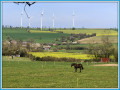
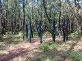
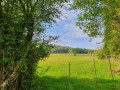
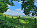
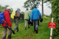
A family walk offering remarkable views of the Pail corniche, a significant area of heathland. The route is dotted with points of interest, including some very unusual tree trunks. The remains of wattle fences, relics of the past, bear witness to traditional farming skills. This route is highly evocative of the history and past and present uses of the Pail heath.

Details

n°20353104
Creation:
Last update:
Last review:
  • Walking
    Activity: Walking
  • ↔
    Distance: 3.80 mi
  • ◔
    Average duration: 2h 05 
  • ▲
    Difficulty: Easy

  • ⚐
    Back to start: Yes
  • ↗
    Ascent: + 338 ft
  • ↘
    Descent: - 335 ft

  • ▲
    Highest point: 1,247 ft
  • ▼
    Lowest point: 873 ft

Photos

Description of the walk

For this walk, head to the Clairventes car park (between Pré-En-Pail and Villaines-la-Juhel, on the D20).

- Coming from Pré-en-Pail, follow signs for VILLAINES LA JUHEL (D20); after 4 km, turn left onto the small local road; after 250 m, turn left – you have arrived.

- Coming from Villaines-la-Juhel, head towards PRE EN PAIL (D20); after 10 km, turn right onto the small local road; after 250 m, turn left – you’ve arrived.

Please note: whilst on the walk, blue ropes blocking the paths indicate that these paths are not part of the circular route; they are connecting paths that are private. Do not take them.

(S/E) On leaving the car park, head right towards the local track and, at the boundary marker (on the right), take the Armorican sandstone path (on the left).

(1) Follow the Armorican sandstone path for 600 m until you reach a crossroads just before a low dry-stone wall.

(2) Take the path on the left and you’ll soon reach the Clairventes farm.

(3) When you reach the Clairventes farm, turn right, then about a hundred metres further on, turn left. Before the houses known as Les Loges du Haut, take the path on the left – not shown on the IGN map but clearly marked on the OSM map – and follow it. Continue along the edge of the woodland until you reach a Y-shaped crossroads.

(4) Turn left to reach the local road.

(5) Continue along the local road to the left for 100 m, then take the path on the right to reach the hamlet of Vieux Saint-Julien.

(6) Turn left. Begin a gentle climb through the woods until you reach the junction with the local track.

(7) Turn right onto the local road and follow it for about a hundred metres, then turn left onto the ridge path to return to the Clairventes car park (S/E).

Waypoints

  1. S/E : mi 0 - alt. 1,198 ft - Clairventes car park
  2. 1 : mi 0.08 - alt. 1,178 ft - Royal corvée marker
  3. 2 : mi 0.47 - alt. 1,237 ft - Dry-stone wall
  4. 3 : mi 0.7 - alt. 1,161 ft - Clairventes Farm
  5. 4 : mi 1.44 - alt. 902 ft - Hairpin bend
  6. 5 : mi 1.69 - alt. 873 ft - Route de la Noë aux Loups
  7. 6 : mi 2.44 - alt. 935 ft - Vieux Saint-Julien crossroads
  8. 7 : mi 3.07 - alt. 1,129 ft - Saint-Julien Wood
  9. S/E : mi 3.8 - alt. 1,198 ft - Clairventes car park

Notes

Route for hiking operated by the Mont des Avaloirs Community of Communes (Mayenne). Full details
Please note: for conservation reasons, certain trails are closed to motorised vehicles either all year round or at specific times: from1 October to 31 March and on Sundays, and all year round from 1 pm to midnight.

Reviews and comments

3.7 / 5
Based on 2 reviews

Reliability of the description
3 / 5
Ease of following the route
4 / 5
Route interest
4 / 5
Laurence d
Laurence d

Overall rating : 4.7 / 5

Date of your route : Aug 06, 2023
Reliability of the description : ★★★★★ Very good
Ease of following the route : ★★★★★ Very good
Route interest : ★★★★☆ Good
Very busy route : No

Hello
Unfortunately, I wasn’t able to complete the whole circular loop.
Near the Breton stables (on Route du Vieux St Julien, not far from the chapel), it’s dangerous – I had to turn back because my dogs and I were attacked by a dog running loose, and the owner of the property was shouting loudly. For our safety, we turned back, even though the path isn’t his.
It’s a shame, as the walk is very pleasant.

Machine-translated

OT Mont des Avaloirs

Hello, we have taken your comments on board and thank you for them. The car park is indeed situated on the boundary between the municipalities of Saint-Cyr-en-Pail and Pré-en-Pail. Road signs have recently been put up to indicate its location. We will revise the route description to make it easier to find. As for the signposting, a member of the local walking club will visit the site to check it and reinforce it in the areas indicated. The blue cord blocking off the paths indicates that these are not part of the circular route; they are connecting paths that are on private land.

Thank you once again for your comments, which help us to improve the experience of exploring our routes, and well done on your photos.

Machine-translated

Jean-Michel F1.
Jean-Michel F1.

Overall rating : 2.7 / 5

Date of your route : Apr 30, 2022
Reliability of the description : ★☆☆☆☆ Very disappointing
Ease of following the route : ★★★☆☆ Average
Route interest : ★★★★☆ Good
Very busy route : No

The start of the route is hard to find – it’s closer to Pré-en-Pail than to St Cyr-en-Pail – and the car park is poorly signposted on the main road (the 5D20, I think). The route description isn’t helpful at all, and the route marked on the map is, in reality, blocked by a blue wire, forcing you to take other, longer paths that are poorly signposted or not signposted at all. At the start, a sign tells you to take route No. 37, but the markings aren’t complete – unless the person who put up the blue wire has rubbed them off. In short, I only managed to complete this route the second time I tried it, after struggling and turning back the day before. That said, there are some lovely views to be discovered.

Machine-translated

Other walks in the area

For more walks, use our search engine .

The GPS track and description are the property of this route's author. Please do not copy them without permission.