To the west of Lake Saint-Cassien

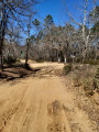
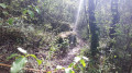
The car park is large and easily accessible. The start of the DFCI is wide and easy. The path then follows hard rock, making the climb up the Tabaroun easier. The rest of the route follows a dirt track beneath the trees. A real treat. The descent is much like the ascent, made easier by the hard rock surface.

Details

n°110529944
Creation:
Last update:
Last review:
–
  • Walking
    Activity: Walking
  • ↔
    Distance: 5.81 mi
  • ◔
    Average duration: 3h 15 
  • ▲
    Difficulty: Moderate

  • ⚐
    Back to start: Yes
  • ↗
    Ascent: + 646 ft
  • ↘
    Descent: - 643 ft

  • ▲
    Highest point: 1,125 ft
  • ▼
    Lowest point: 499 ft

Description of the walk

Park in the car park at the southern tip of Lake Saint-Cassien.

(S/E) Head due north along the track marked GR®49, with red and white markings. Follow this track until you reach a four-way junction.

(1) Carry on straight ahead along this track until you reach a crossroads of paths at a place called Tabaroun.

(2) Leave the track and take the path leading uphill to the left. Stay on this path, ignoring all the turnings to the right. You’ll reach another track at a Fork in the road.

(3) Take this track to the left and now follow the yellow markings. Then begin the descent, passing under a power line and walking alongside a DFCI water tank. Shortly afterwards, you’ll reach another path junction.

(4) Leave the track, turn left onto this path and continue the descent, ignoring the paths branching off to the right and left here as well. At the end of the descent, you’ll return to the original four-way junction.

(1) Turn right onto the GR® to return easily to the lake car park (S/E).

Waypoints

  1. S/E : mi 0 - alt. 512 ft - Car park – Southern tip of the - Lac de Saint-Cassien
  2. 1 : mi 0.87 - alt. 515 ft - Junction of the circular loop
  3. 2 : mi 2.19 - alt. 545 ft - Fork in the road – Tabaroun
  4. 3 : mi 3.4 - alt. 1,017 ft - PR junction
  5. 4 : mi 3.92 - alt. 984 ft - Return junction
  6. S/E : mi 5.81 - alt. 512 ft - Car park – Southern tip of the - Lac de Saint-Cassien

Worth a visit

Always be cautious and plan ahead when you're outdoors. Visorando and the author of this route cannot be held responsible for any accidents occurring on this route.

The GR® and PR® markings are the intellectual property of the Fédération Française de Randonnée Pédestre.

Other walks in the area

For more walks, use our search engine .

The GPS track and description are the property of this route's author. Please do not copy them without permission.