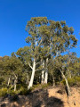
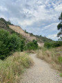
Col du Logis de Paris – Reyran – Malpasset – Lac de l’Avellan

A walk through a little-visited part of the Esterel above Mandelieu. 90 per cent of the route follows tracks. Only the approach to the Malpasset dam and the climb below Lac de l’Avellan are off-track, but present no particular difficulties.

Details

n°3214294
Creation:
Last update:
Last review:
  • Walking
    Activity: Walking
  • ↔
    Distance: 11.72 mi
  • ◔
    Average duration: 6h 25 
  • ▲
    Difficulty: Difficult

  • ⚐
    Back to start: Yes
  • ↗
    Ascent: + 1,207 ft
  • ↘
    Descent: - 1,211 ft

  • ▲
    Highest point: 1,043 ft
  • ▼
    Lowest point: 108 ft

Photos

Description of the walk

Start from the Col du Logis de Paris, on the DN7 (car park; no trouble finding a parking space).

(S/E) Head west along the Font Freye track and immediately ignore a path branching off to the right.

(1) At the next junction, carry on straight ahead (ignore the track leading down to the left – this will be the return route). Stay on the track for about 1.2 km and ignore any side paths.

(2) At the cistern, carry on straight ahead and ignore another track on the right. Stay on the Font Freye track for a further 1.6 km or so.

(3) Turn left. The track, heading south, climbs and then descends.

(4) At the crossroads (water tank), turn sharply right. Follow the Marre à Trache track, which winds around a few bends.

(5) At the junction (water tank), veer left and leave a track on your right. Further on, pass another water tank then descend via a series of hairpin bends.

(6) At the next water tank, turn right. Follow the A8 motorway, which runs high up on the right. Just before the next landmark, note the ruins of a Roman aqueduct on the left.

(7) At the junction (water tank), turn right and cross the Reyran at the ford. Stay on the track which immediately turns left (do not take thefirst path signposted on the right). Cross the river at the ford again.

(8) Shortly afterwards, at a junction, take the sharp right-hand bend and pass under the motorway. Continue along the track which crosses a car park,

(9) Leave the track and take a path on the right. Head uphill to reach the dam site, just under a kilometre away.

(10) Return along the same route to the junction after the ford on the Reyran (water tank).

(7) Take the track opposite, heading uphill (east), and follow theGR®51(red and white markings).

(11) At the junction, turn left (let theGR® head off to the right).

(12) At a hairpin bend to the left, leave the track and take the path opposite. Walk up the Vallon de l’Avellan to the lake of the same name.

(13) At the T-junction, turn left and cross a ford. Immediately afterwards, veer right and follow the path closest to the lake. Walk along the right-hand side of the lake and begin your circuit in a clockwise direction. Ignore all paths branching off to the left.

(14) At the eastern tip of the lake, just before another ford, take a track on the left and head uphill. Stay on the track and ignore any side paths.

(1) At the junction you passed at the start of the walk, turn right and continue straight on to the pass and the car park where you started (S/E).

Waypoints

  1. S/E : mi 0 - alt. 1,037 ft - Col du Logis de Paris
  2. 1 : mi 0.17 - alt. 997 ft - First junction on the circular loop
  3. 2 : mi 0.94 - alt. 860 ft - Citerne
  4. 3 : mi 1.92 - alt. 699 ft - Junction
  5. 4 : mi 2.72 - alt. 892 ft - Carrefour – Citerne
  6. 5 : mi 3.39 - alt. 636 ft - Citerne
  7. 6 : mi 4.26 - alt. 318 ft - Junction – Citerne
  8. 7 : mi 5.67 - alt. 121 ft - Second junction on the circular route – Reyran ford
  9. 8 : mi 5.75 - alt. 121 ft - Junction
  10. 9 : mi 6.1 - alt. 157 ft - Junction
  11. 10 : mi 6.66 - alt. 151 ft - Barrage de Malpasset
  12. 11 : mi 8.2 - alt. 226 ft - Junction
  13. 12 : mi 9 - alt. 259 ft - Start of the trail
  14. 13 : mi 9.83 - alt. 561 ft - T-junction - Lac de l'Avellan
  15. 14 : mi 10.76 - alt. 571 ft - Eastern Point of the - Lac de l'Avellan
  16. S/E : mi 11.72 - alt. 1,037 ft - Col du Logis de Paris

Notes

There are no water sources along the route.
Best undertaken in autumn, winter or spring.

Always be cautious and plan ahead when you're outdoors. Visorando and the author of this route cannot be held responsible for any accidents occurring on this route.

The GR® and PR® markings are the intellectual property of the Fédération Française de Randonnée Pédestre.

Reviews and comments

4.2 / 5
Based on 2 reviews

Reliability of the description
4.5 / 5
Ease of following the route
4.5 / 5
Route interest
3.5 / 5
User 28910645

Overall rating : 4 / 5

Date of your route : Apr 23, 2026
Reliability of the description : ★★★★☆ Good
Ease of following the route : ★★★★☆ Good
Route interest : ★★★★☆ Good
Very busy route : No

A pleasant walk that’s generally well signposted and easy to follow using GPS, although there are a few places where the route has been altered, particularly around Malpasset due to the number of stream crossings on the Reyran
The climb up towards Les Adrets is easy at first but becomes more challenging on the steep path overlooking the stream flowing down from Lac de l’Avelan
The section descending towards Malpasset alongside the motorway remains noisy due to the heavy traffic
Hike undertaken in spring with plenty of water; in the height of summer it must be tougher due to the intense heat

Machine-translated

Ventupresident
Ventupresident

Overall rating : 4.3 / 5

Date of your route : Jun 18, 2023
Reliability of the description : ★★★★★ Very good
Ease of following the route : ★★★★★ Very good
Route interest : ★★★☆☆ Average
Very busy route : No

Done in June in 32 degrees… most of the route is on tracks, so it’s out in the open – so do remember to take some water.
If you have a water filter, you can refill your water at the dam (halfway through the walk, point 10) or at the lake (at the end of the walk, point 13).
There aren’t any particularly steep climbs; the only challenge might be the length of the walk or the heat if you’re doing it in summer.

The main sights to see are the Roman aqueduct, the Malpasset Dam and Lake Lavellan.

Please note: the start near the road means you’ll have to put up with the noise of motorbikes (especially in summer, between the start and point 2); from point 3 to 8 you’ll be alongside the motorway, where you’ll also hear a bit of noise; on the return journey between point 13 (the lake) and the finish, you’ll hear the motorbikes again – you’ve been warned.

Another point to note: almost the entire area is a hunting zone, with numerous hunting posts (see photos), so it’s best to avoid it during the hunting season.

Machine-translated

Other walks in the area

For more walks, use our search engine .

The GPS track and description are the property of this route's author. Please do not copy them without permission.