


No description
prévue lundi 15 septembre de Livron-sur-Drôme

This walk is part of a multi-day hike: Voyage à vélo (+qq TER) de Lorry-lès-Metz à Marseille et retour
Details
Creation:
Last update:
–
–
-
 Activity: Touring/Gravel
 -
 Distance: 73.42 mi
 -
 Duration according to the author: 10 hrs
 -
 Difficulty: Difficult
 -
-
 Back to start: No
 -
 Ascent: + 272 ft
 -
 Descent: - 636 ft
 -
-
 Highest point: 472 ft
 -
 Lowest point: 82 ft
-
 Country:
France
Country:
France
-
 Area: Dauphiné
 -
 City:
Livron-sur-Drôme (26250)
City:
Livron-sur-Drôme (26250) -
 Start: N 44.799364° / E 4.884425°
 -
 End: N 44.040668° / E 4.893087°
 -
 IGN map(s): Ref. 3036OT, 3037SB, 3038SB, 3039ET, 3040ET, 3040OT, 3041OT
 -
-
 Type of surface: Not specified
 -


 Hour-by-hour weather
Description of the route
Waypoints
- S : mi 0 - alt. 472 ft - 685 chemin du plateau, Livron-sur-Drôme
- 1 : mi 7.14 - alt. 292 ft - entrée sur la Via Rhôna - Drôme
- 2 : mi 8.93 - alt. 305 ft - Rhône (River)
- 3 : mi 9.22 - alt. 302 ft - rue Marcel Nicolas, Le Pouzin
- 4 : mi 35.36 - alt. 197 ft - L'île des Perriers
- 5 : mi 35.93 - alt. 210 ft - VRbis
- 6 : mi 36.83 - alt. 217 ft - sortie de la Via Rhôna, alternative rive gauche - Rhône (River)
- 7 : mi 48.72 - alt. 200 ft - avenue Jean Monnet
- 8 : mi 49.79 - alt. 200 ft - Chemin Vieux
- 9 : mi 50.93 - alt. 203 ft - Chemin des Ramières
- 10 : mi 51.44 - alt. 220 ft - D994, Les Ramières
- 11 : mi 51.98 - alt. 253 ft - Chemin de la Genouine
- 12 : mi 54.91 - alt. 325 ft - Chemin de la Galère
- 13 : mi 55.37 - alt. 338 ft - Chemin du Moulin, Rochegude
- 14 : mi 56.06 - alt. 344 ft - Chemin des Ribagnans
- 15 : mi 57.61 - alt. 436 ft - Chemin des Serres, Lagarde-Paréol
- 16 : mi 57.96 - alt. 420 ft - Chemin Les Peyrasses
- 17 : mi 60.33 - alt. 272 ft - Chemin de Saint-Marcel, Sérignan-du-Comtat
- 18 : mi 60.88 - alt. 262 ft - Chemin du Prieur
- 19 : mi 61.08 - alt. 266 ft - Chemin Derrière le Parc
- 20 : mi 61.83 - alt. 226 ft - Chemin du Roard
- 21 : mi 62.07 - alt. 240 ft - Chemin du Vieux Pont
- 22 : mi 63.21 - alt. 230 ft - Avenue Jean-Henri Fabre, Camaret-sur-Aigues
- 23 : mi 63.33 - alt. 230 ft - Rue Constant Latour
- 24 : mi 63.43 - alt. 226 ft - Rue du Patiol
- 25 : mi 63.54 - alt. 223 ft - Rue Alphonse Daudet
- 26 : mi 65.5 - alt. 207 ft - Chemin de Nogaret
- 27 : mi 65.66 - alt. 197 ft - Chemin Saint-Damian
- 28 : mi 66.79 - alt. 184 ft - Chemin du Clos d'Enfer, Jonquières
- 29 : mi 67.62 - alt. 171 ft - Avenue des Bourgades
- 30 : mi 67.73 - alt. 174 ft - Chemin des Cantons
- 31 : mi 69.18 - alt. 144 ft - Route de Beauregard, Courthézon
- 32 : mi 69.69 - alt. 131 ft - Gare de Courthézon
- 33 : mi 71.99 - alt. 121 ft - Chemin de la Baumette
- E : mi 73.42 - alt. 98 ft - départ en train pour Avignon 17h42 - Gare de Bédarrides
Notes
(S) camping "Chez Philippe"
(3) boulangerie "Le Fournil du Pouzin" au n°4
(3) supérette "Vival" au n°12
(4) table de pique-nique
(7) La gare de Bollène-Croisière est à moins de 4km à droite. Train pour Avignon à 17h19
(32) train pour Avignon 17h37
(E) réserver les vélos !
Other walks in the area
From the Via Rhôna to the gates of the Monts d'Ardèche Regional Nature Park.
 Visorando Member
 40.46 mi
+1,309 ft
-1,325 ft
4 hrs
Difficult
Departure from Livron-sur-Drôme (Drôme)
40.46 mi
+1,309 ft
-1,325 ft
4 hrs
Difficult
Departure from Livron-sur-Drôme (Drôme)
This route will take you along the entire length of the Payre cycle path, which starts in Pouzin and ends in Privas, the gateway to the Monts d'Ardèche Natural Park. The route starts from the car park in the small village of Les Petits Robins, near the Rhône. You will cycle part of the way along the Via Rhôna to Le Pouzin, which you will cross, before rejoining the La Peyre cycle path on the outskirts of the village.
The two banks of the Rhône between Drôme and Ardèche.
 33.03 mi
+66 ft
-66 ft
5 hrs
33.03 mi
+66 ft
-66 ft
5 hrs
 Moderate
Departure from Valence (Drôme) (Drôme)
Moderate
Departure from Valence (Drôme) (Drôme)
Here is a lovely, long cycle ride from Port de l’Épervière to Valence, taking you through Portes-Lès-Valence, Les Petits Robins and the confluence of the Drôme. Then, on the Ardèche side, La Voulte-sur-Rhône, Beauchastel, Charme-sur-Rhône, Soyons and back to the port via the Pont des Lônes.
The foothills of the Valdaine
 Local authority
 21.22 mi
+541 ft
-571 ft
2 hrs
Moderate
Departure from Marsanne (Drôme)
21.22 mi
+541 ft
-571 ft
2 hrs
Moderate
Departure from Marsanne (Drôme)
A short route offering magnificent panoramic views over the Valdaine plain and its hilltop villages.Starting from Marsanne, this circular route offers sweeping views across the Valdaine plain and its many hilltop villages, which you’ll pass through as you go: Roynac, Manas, Saint-Gervais and Bonlieu-sur-Roubion, followed by La Laupie.
10 mountain passes in the Vivarais
32.12 mi
+2,717 ft
-2,713 ft
5 hrs
Moderate
Departure from Saint-Barthélemy-Grozon (Ardèche)
Here is a route for road cyclists that isn’t very long but offers plenty for those keen on tackling mountain passes. The roads of the Vivarais are quiet and the idyllic countryside will delight the cyclist in you.
From the Serre de Tourasson to the Col de Vesc between Rimandoule, Roubion and Jabron
 27.35 mi
+2,441 ft
-2,441 ft
3 hrs
Moderate
Departure from Truinas (Drôme)
27.35 mi
+2,441 ft
-2,441 ft
3 hrs
Moderate
Departure from Truinas (Drôme)
A picturesque walk, mainly along minor roads, starting from the Church of Saint-Jean-Baptiste in Truinas. The route features climbs, winding sections and, of course, descents, offering magnificent views along the way.
The view of the Trois Becs and the Montagne de Couspeau accompanies you for much of the route as you pass through the village of Poët-Célard and its renovated castle, the Château de Saint-André, the Col de Vesc, the church and the Château de Comps.
Around Chatuzange-le-Goubet
15.30 mi
+522 ft
-492 ft
2 hrs
 Easy
Departure from Bourg-de-Péage (Drôme)
Easy
Departure from Bourg-de-Péage (Drôme)
Car-free country lanes, magnificent views, beautiful, peaceful countryside, with few climbs – and those that are present are short and gentle. On one side, the cliffs of the Vercors; on the other, the Drôme des Collines and the Ardèche mountains – all set amidst the countryside, passing through a few hamlets.
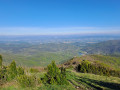
Mont Rachas via the track
 11.22 mi
+1,975 ft
-1,978 ft
2 hrs
Moderate
Departure from Le Poët-Laval (Drôme)
11.22 mi
+1,975 ft
-1,978 ft
2 hrs
Moderate
Departure from Le Poët-Laval (Drôme)
Situated between the Rhône Valley, the Diois and the gateway to Provence, Mont Rachas, thanks to its central location, offers a superb 360° view, from the Trois Becs to Mont Ventoux in the east and over the Tricastin, the Rhône Valley and the foothills of the Ardèche in the west. This route follows a small road, a tarmac track (in poor condition) and finally a narrow path.
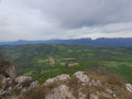
Montagne de Saint-Maurice via the track
 11.80 mi
+1,752 ft
-1,759 ft
2 hrs
Moderate
Departure from Dieulefit (Drôme)
11.80 mi
+1,752 ft
-1,759 ft
2 hrs
Moderate
Departure from Dieulefit (Drôme)
Montagne de Saint-Maurice is famous for its chapel and ridges. This route takes you there via a track suitable for vehicles, allowing you to enjoy a lovely viewpoint with a magnificent 360° panorama: to the north, the Trois Becs, the Grand Delmas and Montagne de Couspeau; to the south, Montagne de la Lance; and on a clear day, Mont Ventoux.
For more walks, use our search engine .
The GPS track and description are the property of this route's author. Please do not copy them without permission.

