


Refine your search for walks in Saint-Vallier (Drôme)
Saint-Vallier (Drôme) walks


 From Saint-Vallier to Beausemblant via the Blacheronde plateau
 Visorando Member
 11.07 mi
 +1,703 ft
 -1,693 ft
 6h 35
6h 35
 Moderate
 Departure from Saint-Vallier (Drôme) (Drôme)
From the banks of the Rhône, climb up to the Blacheronde plateau and follow a circular route via Combe de Laye and the village of Beausemblant. Beautiful views of the Pilat and Vercors mountains and the Rhône valley. You can take a final break in the park along the Galaure river.
 Porte de DrômArdèche – Puy de Serves
 Local authority16.44 mi
+3,077 ft
-3,061 ft
4 hrs
Local authority16.44 mi
+3,077 ft
-3,061 ft
4 hrs
 Difficult
Departure from Ponsas (Drôme)
Difficult
Departure from Ponsas (Drôme)
This stunning route takes you through terrain that is very different from the other trails at the Drôme des Collines mountain biking site. The vegetation and ground conditions – with their mix of roots and stones – are similar to those found in the Ardèche. This physically demanding and technically challenging route offers beautiful views over the Rhône and Ardèche valleys.
Circular around the Sarras stream.
 4.37 mi
+915 ft
-886 ft
2h 50
4.37 mi
+915 ft
-886 ft
2h 50
 Easy
Departure from Sarras (Ardèche)
Easy
Departure from Sarras (Ardèche)
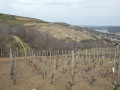
Short hike starting from Sarras, mainly on paths and trails through the Saint-Joseph vineyards and woods. Unofficial route and therefore not marked, so bring your GPS or the Visorando app.
Avoid during the grape harvest so as not to disturb the winegrowers.
Between the Cance and Ay rivers
 9.72 mi
+1,972 ft
-1,982 ft
6h 10
Difficult
Departure from Sarras (Ardèche)
9.72 mi
+1,972 ft
-1,982 ft
6h 10
Difficult
Departure from Sarras (Ardèche)
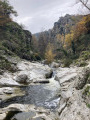
Hike between the Cance and Ay valleys with beautiful views.
Loop in the Ay Valley starting from Sarras
 8.84 mi
+1,490 ft
-1,480 ft
5h 20
Moderate
Departure from Sarras (Ardèche)
8.84 mi
+1,490 ft
-1,480 ft
5h 20
Moderate
Departure from Sarras (Ardèche)
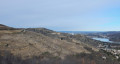
On the outskirts of Sarras, the Ay river winds its way through a gorge that can be seen from certain points along the route, offering beautiful views of a unique landscape of cliffs and rocks.
Béaliaire trail and Grande circular via Riverand
 4.51 mi
+1,115 ft
-1,106 ft
3h 05
Moderate
Departure from Sarras (Ardèche)
4.51 mi
+1,115 ft
-1,106 ft
3h 05
Moderate
Departure from Sarras (Ardèche)
Circular through the Ay valley along the river, passing through the vineyards on the plateau and then descending through the undergrowth on the Rhône valley side via the Chemin des Roches. Varied landscapes, pretty views of different valleys and very little tarmac.
From Sarras to Ardoix through forests and streams to the north, then the southern ridge.
 11.77 mi
+2,169 ft
-2,165 ft
7h 20
Moderate
Departure from Sarras (Ardèche)
11.77 mi
+2,169 ft
-2,165 ft
7h 20
Moderate
Departure from Sarras (Ardèche)
A rural hike along small paths that run alongside streams on the right bank of the Cance valley to near Ardoix and back via the classic ridge route leading back to Sarras.
Vallon d'Ardennes and the Tower of Arras in Arras-sur-Rhône
 7.91 mi
+1,371 ft
-1,365 ft
4h 50
Moderate
Departure from Arras-sur-Rhône (Ardèche)
7.91 mi
+1,371 ft
-1,365 ft
4h 50
Moderate
Departure from Arras-sur-Rhône (Ardèche)
Hike near the Rhône, to the north of Ardèche. You will be surprised to find areas that are this "wild" so close to the Rhône Valley (Ardennes). At the end, the view of the Rhône and the Arras tower is a definite plus.
Plateau above Serves-sur-Rhône
 4.64 mi
+919 ft
-922 ft
2h 55
Easy
Departure from Serves-sur-Rhône (Drôme)
4.64 mi
+919 ft
-922 ft
2h 55
Easy
Departure from Serves-sur-Rhône (Drôme)
Magnificent panoramic views over the Rhône and the vast apricot orchards. The route passes through a very pleasant wooded area. The small roads you’ll be taking are free of traffic.
The Dancing Rocks
 6.81 mi
+925 ft
-922 ft
3h 55
Easy
Departure from Saint-Barthélemy-de-Vals (Drôme)
6.81 mi
+925 ft
-922 ft
3h 55
Easy
Departure from Saint-Barthélemy-de-Vals (Drôme)
In a wood near Saint Barthélémy de Vals, these rocks form a group of 51 blocks arranged in three roughly concentric circles covering nearly 6 hectares, hence the name "Cromlech de la Roche qui danse" (Dancing Rock Cromlech). Legend has it that "at the stroke of midnight on Christmas Eve, the rocks begin to dance".
Please note: see the practical information section.
From Saint-Barthélémy-De-Vals to Claveyson
11.92 mi
+889 ft
-866 ft
6h 15
Moderate
Departure from Saint-Barthélemy-de-Vals (Drôme)
An easy walk through the Drôme hills, including a section near the River Galaure. The route alternates between quiet roads, pebbly or very sandy paths, and deep ravines carved out by erosion.
From Éclassan to the Pont Rouge
 3.48 mi
+427 ft
-436 ft
2h 00
Easy
Departure from Eclassan (Ardèche)
3.48 mi
+427 ft
-436 ft
2h 00
Easy
Departure from Eclassan (Ardèche)
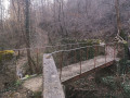
Discover the Chemin du Pont Rouge, once used by the children of Ozon on their way to school! Venture deep into a wooded forest through which the Ruisseau de Rancure flows.
The Cance Valley starting from Talencieux
 11.73 mi
+1,867 ft
-1,877 ft
7h 00
Difficult
Departure from Talencieux (Ardèche)
11.73 mi
+1,867 ft
-1,877 ft
7h 00
Difficult
Departure from Talencieux (Ardèche)
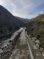
This hike will take you to the Cance Valley, where beautiful wild landscapes await you.
You will need to descend into the Cance Valley, the Combes Druisseau de la Goueille, de la Manoha and the Pralong stream. And of course, you will need to climb back up, which makes this hike varied and challenging at the same time.
You will learn a little history as you pass by the ruins of Oriol Castle.
(Please read the practical information section for a warning about a landslide on this route.)
Lac de Vert, tunnels and viaduct from Talencieux
 9.58 mi
+1,158 ft
-1,145 ft
5h 25
Moderate
Departure from Talencieux (Ardèche)
9.58 mi
+1,158 ft
-1,145 ft
5h 25
Moderate
Departure from Talencieux (Ardèche)
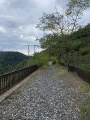
Starting from Talencieux, the route passes by Lac de Vert, then the Midon tunnel and a short detour through the countryside before returning to the old railway line to cross the Thorrenc Viaduct, the Thorrenc Tunnel and the Thorrenson Viaduct. Don't forget a headlamp or other light for crossing the two tunnels.
Cance Valley, southern and northern slopes, via Tourtel and Assuis
 11.75 mi
+2,444 ft
-2,461 ft
7h 30
Difficult
Departure from Talencieux (Ardèche)
11.75 mi
+2,444 ft
-2,461 ft
7h 30
Difficult
Departure from Talencieux (Ardèche)
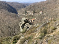
This route follows many unmarked paths along the edge of the Cance Valley. Given the very large number of paths, it is difficult to provide directions at every junction. The use of a GPS is therefore strongly recommended.