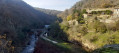
Cance Valley, southern and northern slopes, via Tourtel and Assuis

This route follows many unmarked paths along the edge of the Cance Valley. Given the very large number of paths, it is difficult to provide directions at every junction. The use of a GPS is therefore strongly recommended.

Details

31451048
Creation:
Last update:
Last review:
  • Walking
    Activity: Walking
  • ↔
    Distance: 11.75 mi
  • ◔
    Average duration: 7h 30 
  • ▲
    Difficulty: Difficult

  • ⚐
    Back to start: Yes
  • ↗
    Ascent: + 2,444 ft
  • ↘
    Descent: - 2,461 ft

  • ▲
    Highest point: 1,237 ft
  • ▼
    Lowest point: 472 ft

Photos

Description of the walk

Start from the car park at the Talencieux sports hall, not far from the roundabout.

(S/E) Cross the road, pass by the bar/grocery shop and turn left onto Rue du Viognier.

(1) At the Fork in the road, turn left onto Chemin de la Croze, leaving the return path on your right. Walk past the bottom of a vineyard, then continue straight on until you find a path leading down into the woods.

(2) When you reach the road, turn left and walk along it carefully.

(3) In Assuis, take the path leading down to the right before the house, cross the Cance and, at the next Fork in the road, take the path leading up to the left.

(4) At the top of the climb, once you reach the tarmac road, turn right onto it and then continue straight on along the dirt track that runs to the right of the farm building. Further on, at the bend, turn onto the path on the left.

(5) When you reach the tarmac road at the entrance to Cormes, turn right and follow the flat path through the vineyards.

(6) At the end of the track, turn left, then follow the path to the right. Further on, go round three fallen trees (passable), then follow the path, which becomes faint and overgrown with brambles (towards the ruined house): secateurs will come in handy here.

(7) When you reach a junction by a vineyard plot, turn right. After a few bends, you’ll come out onto a wider path; follow it, turning left.

(8) Before reaching a house visible opposite, take the path on the right.

(9) At this bend in the track, take a path leading down to the right, then another path also leading down to the right. Take care on the winding descent to La Cance.

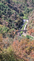
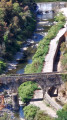
(10) Ford the Ruisseau de la Goueille, climb up opposite, then take a path on the left which joins a track further on at a bend. Follow it downwards to the right. Cross the Cance via the Pont de Tourtel, climb up opposite to reach the Route de la Cance.

(11) Follow it to the right.

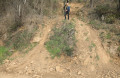
(12) After 700 m along the road, take a path that climbs very steeply to the left. ( Please note: if this climb seems too difficult, see the alternative route in the ‘Practical Information’ section).

(13) When you reach a small level stretch, do not continue along the dirt track heading uphill opposite, but take the flat grassy path to the right. Please note: make sure you follow the route and GPS coordinates carefully, as from this point onwards there are many paths criss-crossing the area!

(14) When you reach a fenced-off sheep paddock, go round it to the right, following the fence.

(15) Do not go down the new dirt track, but cross a small stream and continue straight ahead, skirting the edge of the field and the plateau: the alternative route joins on the right after you have crossed the stream.

(16) When the path turns left, turn right across the field and then, at the far end, follow the lower edge of the field, which leads to the small access road to Fontjean.

(17) Cross the road, follow the path straight ahead, then turn right after a few dozen metres.

(18) At the junction of three footpaths and a track (elevation 352), take the path opposite which descends to the Ruisseau de Vert. Cross this stream and climb a fairly steep but short section.

(19) After leaving the woods, at the Fork in the road, turn right, cross through Balais and exit via the Chemin du Berger. At the next Fork in the road (cross), turn left, which takes you back to the junction of the Chemin de la Croze and Rue du Viognier, which you passed at the start of the walk.

(1) Follow the route back to the car park at the Talencieux sports hall (S/E).

Waypoints

  1. S/E : mi 0 - alt. 1,227 ft - Gym car park
  2. 1 : mi 0.23 - alt. 1,198 ft - Chemin de la Croze / Rue du Viognier
  3. 2 : mi 1.13 - alt. 568 ft - Road on the left
  4. 3 : mi 1.57 - alt. 541 ft - Path on the right. Cross the - Cance (rivière)
  5. 4 : mi 2.6 - alt. 1,099 ft - Road on the right
  6. 5 : mi 3.71 - alt. 1,234 ft - Road on the right
  7. 6 : mi 4.05 - alt. 1,214 ft - Path to the left, then right
  8. 7 : mi 4.78 - alt. 1,165 ft - Path on the right
  9. 8 : mi 5.84 - alt. 1,184 ft - Path on the right
  10. 9 : mi 6.23 - alt. 1,030 ft - Path on the right
  11. 10 : mi 6.58 - alt. 656 ft - Wade across the stream
  12. 11 : mi 7.42 - alt. 810 ft - Route de la Cance on the right
  13. 12 : mi 7.84 - alt. 794 ft - Steep path to the left
  14. 13 : mi 7.98 - alt. 981 ft - Grassy path on the right
  15. 14 : mi 8.38 - alt. 1,089 ft - Follow the wire fence to the right
  16. 15 : mi 8.67 - alt. 1,024 ft - Small stream then field
  17. 16 : mi 8.99 - alt. 1,132 ft - Field on the right
  18. 17 : mi 9.09 - alt. 1,125 ft - Path opposite
  19. 18 : mi 9.63 - alt. 1,148 ft - Path opposite
  20. 19 : mi 10.57 - alt. 1,207 ft - Turn right at the fork in the road
  21. S/E : mi 11.75 - alt. 1,227 ft - Gym car park

Notes

Two climbs that aren’t very long but are quite steep, when leaving the Route de la Cance (which can be avoided by taking a slightly longer route along the road and path indicated in the description) and after crossing the Ruisseau de Vert.
It’s a good idea to bring a pair of secateurs.

The only water source is at Talencieux at the start.

A mobile app with geolocation is very useful.

(12) Alternative route to avoid the very steep climb: continue along the road for 1 km, and, after the second bridge (not before the bridge, otherwise there’s another very steep climb), take a path that joins the route at point (15)

Reviews and comments

3.6 / 5
Based on 4 reviews

Reliability of the description
4 / 5
Ease of following the route
3.3 / 5
Route interest
3.5 / 5
bader
bader

Overall rating : 3.3 / 5

Date of your route : Aug 23, 2025
Reliability of the description : ★★★★☆ Good
Ease of following the route : ★★★☆☆ Average
Route interest : ★★★☆☆ Average
Very busy route : No

Only to be done with a GPS, I lost my way several times, lots of brambles in the way

Machine-translated

MICHEL PETIT
MICHEL PETIT
• Edited:

Overall rating : 3.7 / 5

Date of your route : Aug 27, 2023
Reliability of the description : ★★★★☆ Good
Ease of following the route : ★★★☆☆ Average
Route interest : ★★★★☆ Good
Very busy route : No

I did this this morning at 5.00 am; the main difficulty I encountered was the vegetation that had grown everywhere. The paths were difficult, if not impossible, to follow. Between points 6 and 7, I had to turn back at the end of the vineyard and take other paths to reach point 7. Similarly, at point 16, it’s impossible to get round the sheep paddock – the stinging nettles are up to face height. Moreover, at this same point 16, the route is difficult to follow because of the vegetation; the path has disappeared.
Otherwise, it’s still a good, fairly strenuous walk (point 12 and the climb up to point 15, which is quite a slog at the end of the walk).

Machine-translated

philkikou
philkikou

Hello, thank you for your comments – I agree with them. It’s a shame that point 12 is very difficult, if not impossible; the view of Tourtel is lovely. Otherwise, the alternative route adds more tarmac (motorbikes can help maintain the tracks and paths, but it’s unbelievable that they don’t realise the damage they’re causing!)
As for points 6 and 7, I might need to alter the route if the brambles make it difficult to get through

Machine-translated

MG Delo
MG Delo
• Edited:

Overall rating : 3.5 / 5

Date of your route : Feb 21, 2024
Reliability of the description : Not used / Not applicable
Ease of following the route : ★★★★☆ Good
Route interest : ★★★☆☆ Average
Very busy route : No

Forewarned is forearmed… We took dgedge’s comment on board and, at Cormes, from point 5 onwards, we avoided the section between 6 and 7 by taking a path marked on the IGN map. Otherwise, there were no problems with brambles on the rest of the route. We found the first section up to Tourtel more varied and scenic than the return journey to Assuis. The path leading down towards La Cance is very beautiful (between points 9 and 10).
On the second section (between points 13 and 18), the sheer number of small, intertwining paths makes a GPS essential, in our view. These numerous narrow paths, which wind, weave, cross, climb and descend, whilst pleasant for our wandering feet, offer a rather enclosed landscape. The path is wide enough, but it’s lined with plenty of unsightly dry bushes and brambles. Perhaps it’s worth considering a bit later in the season so that the scenery really comes into its own…
As for the steep section (Point 12 – no doubt more rutted by motorbikes than in Philkikou’s photo), after pausing for a moment, we thought, ‘Let’s give it a go!’ The first of us climbed up using his walking sticks, the second on all fours, clinging to whatever he could (pebbles, tufts of grass…)
All in all, we enjoyed making our way along unmarked paths. We had a very pleasant day, even though we preferred the ‘Between the Cance and Ay Rivers’ walk.
Here: https://www.visorando.com/randonnee-entr...
Thank you, Philkikou, for these two routes.

Machine-translated

philkikou
philkikou

Hello dgedge2607, I agree with your comments, and as for the secateurs, I try not to forget to take them with me on every hike!

Machine-translated

dgedge2607
dgedge2607

Overall rating : 3.7 / 5

Date of your route : Nov 26, 2023
Reliability of the description : ★★★★☆ Good
Ease of following the route : ★★★☆☆ Average
Route interest : ★★★★☆ Good
Very busy route : No

A challenging but lovely walk, enjoyed in cool, sunny weather.
It’s quite varied: scenic views, crossings, fords and bridges, meadows, etc.
A GPS (the Visorando app in my case) does come in handy.
A pair of secateurs, or even a machete 😄, especially between points 6 and 7, might well come in handy.
Thanks, Philikikou.

Machine-translated

Other walks in the area

For more walks, use our search engine .

The GPS track and description are the property of this route's author. Please do not copy them without permission.