Plateau above Serves-sur-Rhône

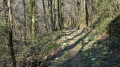
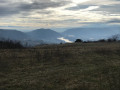
Magnificent panoramic views over the Rhône and the vast apricot orchards. The route passes through a very pleasant wooded area. The small roads you’ll be taking are free of traffic.

Details

20372364
Creation:
Last update:
Last review:
  • Walking
    Activity: Walking
  • ↔
    Distance: 4.64 mi
  • ◔
    Average duration: 2h 55 
  • ▲
    Difficulty: Easy

  • ⚐
    Back to start: Yes
  • ↗
    Ascent: + 919 ft
  • ↘
    Descent: - 922 ft

  • ▲
    Highest point: 1,230 ft
  • ▼
    Lowest point: 427 ft

Photos

Description of the walk

The starting point is at the Puy de Serves viewpoint. To get there, take the Route du Belvédère, which begins at the junction by the town hall in Serves-sur-Rhône; pass the cemetery and head up a narrow road running along a ledge above the Rhône. Once you reach the plateau, at the junction, a sign points to the viewpoint on the right. The site offers a large, pleasant car park with a magnificent view.

(S/E) Drive back up the access road to the junction you passed by car.

(1) Continue straight ahead along the road. Ignore the signposted path branching off to the right and follow the road through the apricot orchards until you approach the hamlet of La Mistrale.

(2) Take the first road on the left and continue across the plateau. “On the right, a view of the Vercors mountains”. Pass the first road on the right, then the one on the left, and continue due north until you reach the next junction.

(3) Turn left to head down to La Rochette. The plateau is still dotted with apricot trees in bloom in March.

(4) When the road bends left and ends in front of a house’s gate, ignore it and leave this road for the grassy path that winds down through the last apricot trees and into the woods. Continue down the main path until you reach a vineyard, then the railway line.

(5) Follow the railway line and cross the stream. Ignore the bridge under the railway line on the right and carry on straight ahead until you come to a path on the left about a hundred metres further on.

(6) The path climbs to the left through a lovely forest. This is the slightly challenging part of the walk. Climb alongside the Ruisseau de Combs until you reach a junction with a path coming from the right. Turn right and continue climbing until you reach the Route du Belvédère at a hairpin bend.

(7) Follow this road to the left. It continues to climb and reaches the junction from the outward journey.

(1) Turn right and head back to the car park (S/E).

Waypoints

  1. S/E : mi 0 - alt. 1,086 ft - Puy de Serves Viewpoint
  2. 1 : mi 0.35 - alt. 1,220 ft - Road junction
  3. 2 : mi 1.26 - alt. 1,119 ft - The hamlet of La Mistrale
  4. 3 : mi 1.63 - alt. 1,165 ft - Road junction at the start of the descent
  5. 4 : mi 1.97 - alt. 1,070 ft - Grassy path
  6. 5 : mi 2.91 - alt. 505 ft - Railway line - Rhône (River)
  7. 6 : mi 3.21 - alt. 449 ft - Start of the ascent path
  8. 7 : mi 3.91 - alt. 1,056 ft - Arrival at the small road
  9. S/E : mi 4.64 - alt. 1,086 ft - Puy de Serves Viewpoint

Notes

(S/E) To return by car, you can avoid the narrow road by heading back to La Mistrale and then to Les Planards, where you’ll rejoin the D630.

Alternative route:
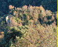
(7) You can take the road on the right. A path cuts across a bend. Return to the tarmac road until you reach the edge of the woods. Above the Château de Serves, a small path starts on the left. This steep path leads to the starting viewpoint.

Reviews and comments

4 / 5
Based on 4 reviews

Reliability of the description
4.3 / 5
Ease of following the route
4.3 / 5
Route interest
3.5 / 5
Danielle / Emmanuel / Shakti

Overall rating : 3.7 / 5

Date of your route : Oct 08, 2025
Reliability of the description : ★★★★☆ Good
Ease of following the route : ★★★★☆ Good
Route interest : ★★★☆☆ Average
Very busy route : No

far too many roads. Only the view from the BELVEDERE is interesting.

Machine-translated

REYNAUD Chantal
REYNAUD Chantal

Overall rating : 4.7 / 5

Date of your route : May 19, 2024
Reliability of the description : ★★★★★ Very good
Ease of following the route : ★★★★★ Very good
Route interest : ★★★★☆ Good
Very busy route : No

A lovely route – it’s quite a climb on the way back, but the hairpin bends make it quite manageable. It’s in full sun up to number 4, and after that you can enjoy the coolness of the lovely forest. We’ll definitely do it again.

Machine-translated

pallandre chantal
pallandre chantal

Overall rating : 4 / 5

Date of your route : Nov 07, 2022
Reliability of the description : ★★★★☆ Good
Ease of following the route : ★★★★☆ Good
Route interest : ★★★★☆ Good
Very busy route : Yes

A bit too much tarmac, but a lovely autumn afternoon stroll.

Machine-translated

dougere
dougere

Hello,
I’d recommend this walk when the apricot trees are in bloom. In September, it’s probably not all that interesting.
The roads you’ll be taking have very little traffic.

Machine-translated

The Best.
The Best.

Overall rating : 3.7 / 5

Date of your route : Sep 26, 2022
Reliability of the description : ★★★★☆ Good
Ease of following the route : ★★★★☆ Good
Route interest : ★★★☆☆ Average
Very busy route : No

A lovely view of the Rhône Valley, but far too much driving.

Machine-translated

Other walks in the area

For more walks, use our search engine .

The GPS track and description are the property of this route's author. Please do not copy them without permission.