Porte de DrômArdèche – Puy de Serves

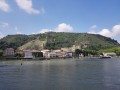
This stunning route takes you through terrain that is very different from the other trails at the Drôme des Collines mountain biking site. The vegetation and ground conditions – with their mix of roots and stones – are similar to those found in the Ardèche. This physically demanding and technically challenging route offers beautiful views over the Rhône and Ardèche valleys.

Details

1214148
Creation:
Last update:
Last review:
  • Mountain biking
    Activity: Mountain biking
  • ↔
    Distance: 16.44 mi
  • ◔
    Duration according to the author: 4 hrs 
  • ▲
    Difficulty: Difficult

  • ⚐
    Back to start: Yes
  • ↗
    Ascent: + 3,077 ft
  • ↘
    Descent: - 3,061 ft

  • ▲
    Highest point: 1,234 ft
  • ▼
    Lowest point: 427 ft
  • ⚐ Country: France
  • ⚐
    Area: Dauphiné
  • ⚐ City: Ponsas (26240)
  • ⚑
    Start/End: N 45.159017° / E 4.835787°
  • ❏
    IGN map(s): Ref. 3035SB

  • ◶
    Type of surface: Not specified
  • ⇧
    Bike carrying: Not specified
  • ▲
    Difficulty: Not specified
  • Hour-by-hour weather

Description of the route

Car park in the centre of the village of Ponsas.
Mountain bike route no. 13

(S/E) From the car park in the village centre, take the road which climbs steeply and quickly turns into a track.

(1) At the top of the long climb, at the ‘Les Forêts’ signpost, take the road opposite.

(2) At Puy de Serves, turn right and begin the rapid descent towards the Rhône.

(3) At Ruisseau des Combs, very close to the N7, take the track on the left and begin the long climb. Initially on a track, it then turns into a somewhat steep and technical single track before descending again towards Érôme.

(4) On reaching Érôme, at the ‘Les Combes’ signpost, take the road on your left.

(5) On leaving the village, at Chemin Vieux, turn left onto a wide path through the woodland which climbs up onto the plateau.

(6) At the top of the climb, at La Mistrale, turn left onto the road, then right at the next junction. Begin the descent along a road, then a path through the woods.

(7) At the Les Fosses signpost, start the climb after a small bridge.

(8) Join a road and follow it to the left for 300 metres. Leave the road and turn right to come out onto a motocross track.

(9) Continue left along the main track to Douévas.

(10) Turn right, then left when you reach the houses.

(11) You’ll arrive at the ‘Roches qui Dansent’. You can visit the bouldering site (rock climbing). Continue along the road and head back up towards Saint-Victor. Carry on to the hamlet of Surey.

(12) Begin the descent towards Saint Vallier. Turn left towards the hospital to return to Ponsas and the car park (S/E)

Waypoints

  1. S/E : mi 0 - alt. 436 ft - Car park at the centre of Ponsas
  2. 1 : mi 1.41 - alt. 1,135 ft - Les Forêts signpost
  3. 2 : mi 1.63 - alt. 1,161 ft - Puy de Serves signpost
  4. 3 : mi 3.24 - alt. 446 ft - Ruisseau des Combs signpost - Rhône (River)
  5. 4 : mi 5.58 - alt. 502 ft - Les Combes signpost
  6. 5 : mi 5.78 - alt. 522 ft - Chemin Vieux signpost
  7. 6 : mi 7.09 - alt. 1,106 ft - La Mistrale signpost
  8. 7 : mi 8.9 - alt. 794 ft - Les Fosses signpost
  9. 8 : mi 9.54 - alt. 1,053 ft - Turn left
  10. 9 : mi 10.54 - alt. 745 ft - Motocross track
  11. 10 : mi 11.34 - alt. 686 ft - Douévas
  12. 11 : mi 12.02 - alt. 843 ft - Les Roches qui Dansent
  13. 12 : mi 13.77 - alt. 1,145 ft - Surey
  14. S/E : mi 16.44 - alt. 436 ft - Car park at the centre of Ponsas

Notes

We strongly recommend that you take the IGN map listed on these pages with you. Mountain bikers must be self-sufficient; professional guides are available if required. Emergency numbers: 18 or 112.
For further information, contactthe Porte DrômArdèche Tourist Office: 04 75 23 45 33

Reviews and comments

4.5 / 5
Based on 2 reviews

Reliability of the description
4 / 5
Ease of following the route
4.5 / 5
Route interest
5 / 5
philding
philding

Overall rating : 4.3 / 5

Date of your route : Nov 12, 2021
Reliability of the description : ★★★★☆ Good
Ease of following the route : ★★★★☆ Good
Route interest : ★★★★★ Very good
Very busy route : No

Hello
Thank you for this guide. It’s really lovely and varied. There really are some beautiful views of the Rhône, and it’s a lovely walk through the fruit orchards on the hillside.
I recommend Philippe

Machine-translated

fredobaroud
fredobaroud

Overall rating : 4.7 / 5

Date of your route : Mar 31, 2019
Reliability of the description : ★★★★☆ Good
Ease of following the route : ★★★★★ Very good
Route interest : ★★★★★ Very good

The first section from Ponsas to Erome is very physical and technical, with some very steep ascents and descents, particularly the descent into Erome. There are numerous magnificent viewpoints throughout the ride, offering views of the Rhône Valley, the Vercors, the Ardèche, and more… A lovely mountain bike ride.

Machine-translated

Other walks in the area

For more walks, use our search engine .

The GPS track and description are the property of this route's author. Please do not copy them without permission.