


Refine your search for walks in Moncontour
Moncontour walks


 Discover Moncontour and its surroundings
 Visorando Member
 6.64 mi
 +449 ft
 -479 ft
 3h 25
3h 25
 Moderate
 Departure from Moncontour (Côtes-d'Armor)
This circular route allows you to discover the small medieval town by strolling through its narrow streets, then walking along the leat and through sunken paths to the Notre-Dame-du-Haut Chapel. The last part of the walk offers beautiful views of the town and its ramparts.
Moncontour et ses châteaux
 5.19 mi
+469 ft
-469 ft
2h 50
5.19 mi
+469 ft
-469 ft
2h 50
 Easy
Departure from Hénon (Côtes-d'Armor)
Easy
Departure from Hénon (Côtes-d'Armor)
The area around Moncontour, an ancient fortified town, is home to several châteaux and manor houses. This circular route through the countryside and woods takes in three of them: Château Bellevue, Château des Granges and Manoir du Vauclair. The last part of the route also offers lovely views of the town of Moncontour.
The Ecce Homo route in Trédaniel
2.98 mi
+371 ft
-351 ft
1h 40
Easy
Departure from Trédaniel (Côtes-d'Armor)
This route takes you up the Chemin de Justice (the Ecce Homo), the path along which those condemned to death were dragged by cart from the castle to be hanged. You also pass close to chapels and ponds, through woodland and a beautiful green valley.
The Ascent of Mont Bel Air
8.74 mi
+784 ft
-784 ft
4h 40
Moderate
Departure from Trédaniel (Côtes-d'Armor)
Admittedly, this isn’t the Alps, but this circular route still takes you up to the highest point in the Côtes d’Armor (339 m above sea level). The walk starts at the very pretty Notre-Dame du Haut chapel and climbs via sunken paths, farm tracks and small roads to the Notre-Dame du Mont-Carmel chapel. These two places of worship were once popular pilgrimage destinations and sites of indulgences. The route offers some beautiful views of the countryside stretching as far as the shores of Saint-Brieuc Bay.
Boishardy’s Hideout in Bréhand
 3.42 mi
+62 ft
-66 ft
1h 40
Easy
Departure from Bréhand (Côtes-d'Armor)
3.42 mi
+62 ft
-66 ft
1h 40
Easy
Departure from Bréhand (Côtes-d'Armor)
This easy route will immerse you in the place where General Boishardy hid during the Chouannerie in the 1790s.
Route through the ages in Plémy
7.86 mi
+328 ft
-348 ft
3h 55
Moderate
Departure from Plémy (Côtes-d'Armor)
The route follows small, undulating roads, passing a few crosses, chapels and very old houses. After the hamlet of Carfort, the landscape changes, featuring woodland, moorland and a consistently undulating terrain.
Launay Cross Circular in Bréhand
 2.27 mi
+26 ft
-26 ft
1h 05
Easy
Departure from Bréhand (Côtes-d'Armor)
2.27 mi
+26 ft
-26 ft
1h 05
Easy
Departure from Bréhand (Côtes-d'Armor)
A relaxing, peaceful walk through the woodland.
Short circular ‘Deer Loop’ walk in Tréby
 6.23 mi
+545 ft
-574 ft
3h 20
Moderate
Departure from Trébry (Côtes-d'Armor)
6.23 mi
+545 ft
-574 ft
3h 20
Moderate
Departure from Trébry (Côtes-d'Armor)
This route is part of the Circuit des Chevreuils,a PR® trail marked in yellow and 18 km long. The 10 km section described here focuses on the upper part of the commune of Trébry and starts at Bel Air which, at an altitude of 339 m, is the highest point in the Côtes d’Armor.
Circuit du chemin de la Patouille par le hameau des Fermes à Bréhand
 2.01 mi
+56 ft
-56 ft
1h 00
Easy
Departure from Bréhand (Côtes-d'Armor)
2.01 mi
+56 ft
-56 ft
1h 00
Easy
Departure from Bréhand (Côtes-d'Armor)
Cette boucle vous immergera dans un sous-bois pour continuer sur des petites routes tranquilles.
Chemin de la Patouille au départ de Bréhand
 1.76 mi
+20 ft
-20 ft
0h 50
Easy
Departure from Bréhand (Côtes-d'Armor)
1.76 mi
+20 ft
-20 ft
0h 50
Easy
Departure from Bréhand (Côtes-d'Armor)
Ce petit circuit vous permettra de visualiser les différents aspects caractérisés par le dynamisme de la commune de Bréhand.
The Washerwomen’s Path and the Cambourg waterfall, starting from the village of Bréhand
 5.02 mi
+295 ft
-292 ft
2h 35
Easy
Departure from Bréhand (Côtes-d'Armor)
5.02 mi
+295 ft
-292 ft
2h 35
Easy
Departure from Bréhand (Côtes-d'Armor)
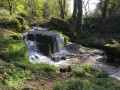
Setting off from the village of Bréhand to the hikers’ centre, this walk takes you through a wooded valley featuring a river, a jumble of rocks and a small waterfall.
Circular route around the hamlets of Bréhand from the Écuries d’Ydill
 6.92 mi
+105 ft
-105 ft
3h 15
Moderate
Departure from Bréhand (Côtes-d'Armor)
6.92 mi
+105 ft
-105 ft
3h 15
Moderate
Departure from Bréhand (Côtes-d'Armor)
This walk starts at the Écuries d’Ydill riding centre. This walk will immerse you in an area frequented only by farmers. The wildlife here is abundant, with deer, hares and other animals.The route has been mapped out by the municipality of Bréhand with the help of local volunteers and in agreement with the landowners. You can park your car near the stables; sometimes the dogs (Raven and Ydill), who are extremely friendly, will come over to beg for a stroke. We ask that you show great respect for the areas you pass through
Croquélien, in the footsteps of the Margot fairies
 0.98 mi
+121 ft
-121 ft
0h 35
Easy
Departure from Le Gouray (Côtes-d'Armor)
0.98 mi
+121 ft
-121 ft
0h 35
Easy
Departure from Le Gouray (Côtes-d'Armor)
Brittany is a land of legends. The site of Croquélien, with its chaotic granite boulders, was once reputed to be the home of the Margot fairies. This short walk will allow you to discover this pretty spot, searching for the evocative shapes of the rocks – the fairies’ bathtub, the armchair… or the fabulous treasure they are said to have hidden there.
La Roche au Cerf circular starting from Langast
 7.24 mi
+394 ft
-377 ft
3h 40
Moderate
Departure from Langast (Côtes-d'Armor)
7.24 mi
+394 ft
-377 ft
3h 40
Moderate
Departure from Langast (Côtes-d'Armor)
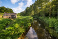
A circular route, mainly on footpaths and sunken lanes, takes you from the village of Langast, with its very old church, to the thousand-year-old site of the Roche au Cerf ford and along streams and then the Lié valley.
Route des moulins autour de Plouguenast-Langast
 9.82 mi
+574 ft
-577 ft
5h 00
Moderate
Departure from Plouguenast (Côtes-d'Armor)
9.82 mi
+574 ft
-577 ft
5h 00
Moderate
Departure from Plouguenast (Côtes-d'Armor)
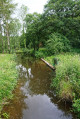
The commune of Plouguenast-Langast offers numerous walking, horse-riding and cycling routes. This walk avoids tarmac roads as much as possible, favouring footpaths and sunken lanes through the countryside, woodland and valley floors. It passes close to numerous watermills which, until the mid-20th century, were an essential part of rural life.