Launay Cross Circular in Bréhand

A relaxing, peaceful walk through the woodland.

Details

24279897
Creation:
Last update:
Last review:
  • Walking
    Activity: Walking
  • ↔
    Distance: 2.27 mi
  • ◔
    Average duration: 1h 05 
  • ▲
    Difficulty: Easy

  • ⚐
    Back to start: Yes
  • ↗
    Ascent: + 26 ft
  • ↘
    Descent: - 26 ft

  • ▲
    Highest point: 374 ft
  • ▼
    Lowest point: 338 ft
  • ⚐ Country: France
  • ⚐ City: Bréhand (22510)
  • ⚑
    Start/End: N 48.391774° / W 2.584255°
  • ❏
    IGN map(s): Ref. 0917SB
  • Hour-by-hour weather

Photos

Description of the walk

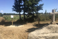
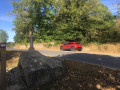
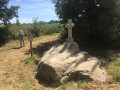
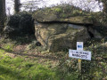
Park at the side of the road by the small Croix de Launay standing on a rock (see photo; GPS is useful for finding the starting point). Please ensure you do not obstruct traffic. If you are a cyclist, you can park your bike safely.

The route is signposted with white arrows on a mauve background.

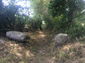
(S/E) Take the path behind the Croix de Launay heading south. Follow the path for 1.3 km along a somewhat winding route.

(1) At the junction with a farm track, turn left. (If you opt for a shortcut, turn right.)

(2) At the next junction, go straight on to complete a circular route that brings you back to this junction.

(2) Turn left to follow the route back along the way you came until the next junction.

(1) Continue straight on, join the tarmac road, turn right to reach the cross 50 m away (S/E).
In front of you, a sign indicates the presence of Launay Castle, a private property which is not open to visitors; here is its history:
http://patrimoine.bzh/gertrude-diffusion...

Waypoints

  1. S/E : mi 0 - alt. 364 ft - Croix de Launay
  2. 1 : mi 0.84 - alt. 341 ft - Junction
  3. 2 : mi 1.65 - alt. 348 ft - Junction
  4. S/E : mi 2.27 - alt. 364 ft - Croix de Launay

Notes

If you are a motorhome owner, a motorhome stopover and service area has been set up in Bréhand, on Rue de Launay near the stadium.

This route has been created by the local council with the help of volunteers from the local community

Reviews and comments

3.8 / 5
Based on 2 reviews

Reliability of the description
4.5 / 5
Ease of following the route
4 / 5
Route interest
3 / 5
MiiiLiii
MiiiLiii

Overall rating : 3.3 / 5

Date of your route : Apr 06, 2023
Reliability of the description : ★★★★☆ Good
Ease of following the route : ★★★☆☆ Average
Route interest : ★★★☆☆ Average
Very busy route : No

We went on this hike today, but we had to stop halfway through because the path was impassable (it rained this morning).

You shouldn’t attempt this hike if it has rained recently; you risk getting stuck.

Otherwise, we didn’t see anyone else at this time of year and the walk looked lovely.

Machine-translated

BVL28
BVL28

Hello,
Nearby, we have created a route called “La cache de Boishardy”, named after a local rebel from the time of the Revolution in the 1790s. Thank you for your feedback.

Machine-translated

J VUADELLE
J VUADELLE

Overall rating : 4.3 / 5

Date of your route : Aug 23, 2022
Reliability of the description : ★★★★★ Very good
Ease of following the route : ★★★★★ Very good
Route interest : ★★★☆☆ Average
Very busy route : No

I was surprised to find this route so well signposted.
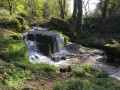
In fact, it’s a lovely walk through the woods that I would have liked to have been longer.

Machine-translated

Other walks in the area

For more walks, use our search engine .

The GPS track and description are the property of this route's author. Please do not copy them without permission.