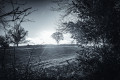
The Washerwomen’s Path and the Cambourg waterfall, starting from the village of Bréhand

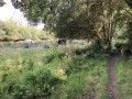
Setting off from the village of Bréhand to the hikers’ centre, this walk takes you through a wooded valley featuring a river, a jumble of rocks and a small waterfall.

Details

58231769
Creation:
Last update:
Last review:
  • Walking
    Activity: Walking
  • ↔
    Distance: 5.02 mi
  • ◔
    Average duration: 2h 35 
  • ▲
    Difficulty: Easy

  • ⚐
    Back to start: Yes
  • ↗
    Ascent: + 295 ft
  • ↘
    Descent: - 292 ft

  • ▲
    Highest point: 413 ft
  • ▼
    Lowest point: 279 ft
  • ⚐ Country: France
  • ⚐ City: Bréhand (22510)
  • ⚑
    Start/End: N 48.40218° / W 2.57282°
  • ❏
    IGN map(s): Ref. 0917SB
  • Hour-by-hour weather

Photos

Description of the walk

Parking is available in the church car park on the north side, opposite the mini-market.
- If you’re driving an electric car, a 22 kW charging point is available.
You’ll reach the starting point by walking through the city park (children’s playground).
- If you are parked in the motorhome area, follow Rue de Launay towards the church.

The walk is signposted with white arrows on a red background

(S/E) From the Maison du Randonneur (Alain Glâtre Hall), follow Rue du Mené until you reach a Fork in the road.

(1) Turn right towards Ville Louët. On your left, you’ll see the Manoir de la Ville-Louët (16th–18th century). You’ll come to a road.

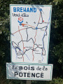
(2) Turn left towards the Bois de la Potence and you’ll come to a crossroads.

(3) Carry on straight ahead, keeping the woodland on your right, then turn left towards the hamlet of Les Landes.

(4) In the hamlet, turn right to reach the hamlet of Prè Simon.

(5) Turn left, pass through the hamlet of Le Routy and follow the path leading to the Ruisseau de la Touche or Truite.

(6) Cross the small bridge; at the next junction, turn right and continue along the stream, which is on your right. The path climbs to the left to reach a stony track.

(7) Turn left heading due north, follow the stream on your left-hand side once more, pass under a power line and turn right to head up the path.

(8) At the gravel track, turn left towards a telephone mast on your left. Carry on to Moulin Hesry, past the house situated below.

(9) Turn left, then right at the entrance to the property and cross the same stream again over the small bridge. Next, follow the sunken path, which has a hairpin bend to the right, then turn left at the end of this climb to reach the hamlet of Les Landes.

(2) Carry on straight ahead and follow the route back in the opposite direction to the outward journey, returning to the church car park on the north side, opposite the mini-market (S/E).

Waypoints

  1. S/E : mi 0 - alt. 282 ft - Convenience store car park - Église Notre-Dame (Bréhand)
  2. 1 : mi 0.28 - alt. 295 ft - Fork in the road
  3. 2 : mi 0.61 - alt. 325 ft - Fork in the road
  4. 3 : mi 0.83 - alt. 361 ft - Crossroads
  5. 4 : mi 1.11 - alt. 367 ft - Les Landes hamlet
  6. 5 : mi 1.67 - alt. 384 ft - The hamlet of Pré Simon
  7. 6 : mi 2.1 - alt. 315 ft - Ruisseau de la Touche
  8. 7 : mi 2.37 - alt. 413 ft - Cobbled path
  9. 8 : mi 3.2 - alt. 335 ft - Telephone exchange
  10. 9 : mi 3.45 - alt. 292 ft - Hesry Mill
  11. S/E : mi 5.02 - alt. 282 ft - Convenience store car park - Église Notre-Dame (Bréhand)

Notes

For the more active, the route can be done by mountain bike or even on horseback.

This route was developed by the local council with the help of volunteers from the area.

To find out a little more:

The ‘Chemin des Lavandières’ was used by the washerwomen to carry their baskets of laundry down in a wooden wheelbarrow from the Landes region to the Moulin Hesry. (between points (4) and (9))

Their tools included a brush, a beater and a washing pot for boiling the laundry. And let’s not forget the bar of Marseille soap.

One local woman recalls that in her youth she used to tend the cows near the Doué (washhouse) and that the washerwomen would make her move further away so she wouldn’t overhear their conversations.

Radio Lavoir stopped broadcasting over 60 years ago when electricity and the first washing machines arrived

Worth a visit

To find out a little more about the history of the village of Bréhand:
http://www.infobretagne.com/brehand.htm.

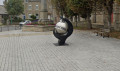
Originally on Place de Foucaud: Bréhand’s motto, ‘Bréhand’s word is worth more than money’. The German-born artist Simone Seebruck, a specialist in metalwork and ironwork, designed the piece in her studio in Dolo, in accordance with the wishes of the local council.

Manoir de la Ville-Louët (16th–18th centuries): owned by Robin Chardel in 1514, and by Guillemette Bougault or Rougeault in 1536. In 1795, it was the home of Joséphine Quintin de Kercadio, fiancée of Boishardy (born 13 October 1762, son of Boishardy and Anne Du Bosc de Quimby).

Find out all about General Boishardy:
http://www.infobretagne.com/boishardy.ht...

Reviews and comments

4.2 / 5
Based on 4 reviews

Reliability of the description
4.5 / 5
Ease of following the route
4.5 / 5
Route interest
3.5 / 5
User 4991502

Overall rating : 4.7 / 5

Date of your route : May 04, 2026
Reliability of the description : ★★★★★ Very good
Ease of following the route : ★★★★★ Very good
Route interest : ★★★★☆ Good
Very busy route : No

It’s a shame it’s a bit of a drive to get there, but otherwise it’s very pretty

Machine-translated

User 27858330

Overall rating : 4.7 / 5

Date of your route : Mar 23, 2026
Reliability of the description : ★★★★★ Very good
Ease of following the route : ★★★★★ Very good
Route interest : ★★★★☆ Good
Very busy route : No

A very pleasant walk, a stunning valley

Machine-translated

Ricou et Domi
Ricou et Domi

Overall rating : 3.7 / 5

Date of your route : Aug 17, 2024
Reliability of the description : ★★★★☆ Good
Ease of following the route : ★★★★★ Very good
Route interest : ★★☆☆☆ Disappointing
Very busy route : No

A walk I went on today.
Half of this route is on tarmac; the rest is more enjoyable but not particularly interesting.
The route is easy to follow and very well signposted.

Machine-translated

BVL28
BVL28

Hello,

Thank you for your feedback, which is very valuable to us.
You are among the first to follow this route, which has only just been published online; the signposting is currently being installed and had not yet been completed when you were there.
Kind regards, Christian

Machine-translated

Hillion
Hillion

Overall rating : 3.7 / 5

Date of your route : Aug 05, 2024
Reliability of the description : ★★★★☆ Good
Ease of following the route : ★★★☆☆ Average
Route interest : ★★★★☆ Good
Very busy route : Yes

Hello, I went on the ‘Chemin des lavandières et cascades de Cambourg’ walk, starting from the village of Bréhand, today, 5 August 2024.
It was an interesting walk; in the wooded section, information boards along the path recounted the history of the people who once lived in this area.
However, I couldn’t find the path to get from point 7 to point 8. It was impossible to follow the stream.
A shame.
Hillion

Machine-translated

Other walks in the area

For more walks, use our search engine .

The GPS track and description are the property of this route's author. Please do not copy them without permission.