


Refine your search for walks in Locquirec
Locquirec walks


 Locquirec and its beaches
 Visorando Member
 5.69 mi
 +410 ft
 -430 ft
 3h 00
3h 00
 Easy
Easy
 Departure from Locquirec (Finistère)
A small seaside resort, Locquirec is the gateway to Finistère when approaching from the east via the north coast. The D142 crosses the River Douron, which marks the boundary between the Côtes d’Armor and Finistère.During this walk, before reaching the golden sandy beaches, you’ll discover the rocky headland of Le Corbeau, then, further inland, some beautiful holiday homes, before arriving at the small fishing harbour and finally reaching the second rocky headland: the Pointe du Château.
Circular route around Locquirec via Île Blanche and Les Sables Blancs
10.08 mi
+581 ft
-607 ft
5h 10
 Moderate
Departure from Locquirec (Finistère)
Moderate
Departure from Locquirec (Finistère)
This easy hike will take you from one side of the Locquirec headland to the other, following the left bank of the Douron estuary, then through the countryside, vegetable fields and pretty valleys hiding small streams, until you reach the north-western coast of the headland. The GR® 34 offers beautiful views from the rocky points of Corbeau and Château. You will also walk along beautiful beaches, such as Sables Blancs, Porz Biliec and Fond de la Baie, where you can walk along the shore as you please, depending on the tide. You will also pass through part of Locquirec, where you can admire the church, the narrow streets, the small harbour and the seafront, which you will follow to the end.
Discovering Locquirec
7.40 mi
+325 ft
-312 ft
3h 40
Moderate
Departure from Locquirec (Finistère)
The Pointe de Locquirec offers wonderful landscapes! From Pointe Blanche, the whole bay of Locquirec opens up to walkers, with a different landscape depending on the sea level, followed by the beauty of Kerboulic and its second homes, bursting with sunshine on the Plage des Sables Blancs and Pointe du Corbeau, and finally ending with Pointe du Château and the small port of Locquirec.
Tour of Pointe de Loquirec
8.31 mi
+682 ft
-682 ft
4h 25
Moderate
Departure from Locquirec (Finistère)
To walk around the Pointe de Locquirec, this route begins with a stretch through the countryside, past fields of artichokes and cereals, and through hamlets, before reaching the coast at the Douron estuary. It then follows the GR®34 coastal path, passing through the centre of Locquirec. You can enjoy Moulin de la Rive Beach on your return from the walk.
Poul Rodou
 17.01 mi
+1,837 ft
-1,818 ft
9h 25
17.01 mi
+1,837 ft
-1,818 ft
9h 25
 Difficult
Departure from Locquirec (Finistère)
Difficult
Departure from Locquirec (Finistère)
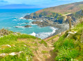
Long and beautiful walk overlooking the bay, with some difficulties due to the length and elevation gain.
The Douron Valley
6.64 mi
+381 ft
-361 ft
3h 25
Moderate
Departure from Plestin-les-Grèves (Côtes-d'Armor)
Discover the banks of the Douron, the coastal river that separates the Côtes d'Armor and Finistère departments. Right from the start, you will have to cross a pass: the Col de Saint-Haran (24 metres!), as indicated on the sign at the top. You will cross into a different department when you cross the bridge next to the Moulin de Moualhic, and again at Pont Menou.
The tip of Armorique
 4.43 mi
+328 ft
-318 ft
2h 20
Moderate
Departure from Plestin-les-Grèves (Côtes-d'Armor)
4.43 mi
+328 ft
-318 ft
2h 20
Moderate
Departure from Plestin-les-Grèves (Côtes-d'Armor)
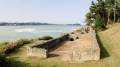
A beautiful hike, much of it taking place along the seafront corniche. Along the way, you can add a visit to a Gallo-Roman site and take a refreshing dip!
Saint-Haran circular
 4.78 mi
+135 ft
-135 ft
2h 20
Easy
Departure from Plestin-les-Grèves (Côtes-d'Armor)
4.78 mi
+135 ft
-135 ft
2h 20
Easy
Departure from Plestin-les-Grèves (Côtes-d'Armor)
Hike along the banks of the Douron: nature, birds, tranquillity. The Saint-Haran circular route is part of the chapel route.
The Grand Rocher of Saint-Efflam
3.69 mi
+469 ft
-476 ft
2h 05
Moderate
Departure from Plestin-les-Grèves (Côtes-d'Armor)
The Grand Rocher towers 84 m above the Lieue de Grève and offers stunning views in all directions. You’ll climb to the top during this walk, which also takes you along the beach and through the countryside, past beautiful country houses and the Saint-Efflam Fountain.
Pointe de l’Armorique from Saint-Efflam
5.25 mi
+344 ft
-341 ft
2h 45
Easy
Departure from Plestin-les-Grèves (Côtes-d'Armor)
A circular walk starting from Saint-Efflam, initially through the countryside, dotted with fountains and a few pretty houses, before reaching the Douron estuary and continuing along the coastal path beside the Douron cove, then along the Pointe de l’Armorique cliff-top path, between the headlands of Plestin and Beg Douar. You’ll pass by the ancient Roman baths at Hogolo and have the option of heading down to some small beaches.
Circular route in Plestin-les-Grèves from Saint-Efflam to Sainte-Barbe and the Grand Rocher.
8.21 mi
+830 ft
-814 ft
4h 30
Moderate
Departure from Plestin-les-Grèves (Côtes-d'Armor)
This beautiful circular walk is divided into two parts.
The first part follows the customs officers' path and runs along the seafront, passing numerous viewpoints, headlands and beaches until it reaches the banks of the Douron estuary.
The second part winds through the countryside of valleys and hamlets, revealing pretty manor houses before reaching its climax at the seaside, at an altitude of 84 metres, at the top of the Grand Rocher, which offers an exceptional view of almost the entire bay of Lannion and the Plestinaise countryside.
The Corniche de l'Armorique starting from Plestin-les-Grèves
 6.80 mi
+407 ft
-410 ft
3h 30
Moderate
Departure from Plestin-les-Grèves (Côtes-d'Armor)
6.80 mi
+407 ft
-410 ft
3h 30
Moderate
Departure from Plestin-les-Grèves (Côtes-d'Armor)
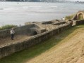
Setting off from Plestin-les-Grèves, you very quickly catch sight of Grève Saint-Michel, where, at low tide, the English Channel recedes into the horizon, creating a vast expanse for all kinds of wind sports: sand yachting, windsurfing, kite flying, etc...
Then, following theGR®34, you walk along the Corniche de l’Armorique, discovering Lannion Bay and the mouth of the Douron. Opposite lies Locquirec and Finistère.
History is also present in the form of the Gallo-Roman thermal baths.
Route from Beg An Fry to Moulin de la Rive in Guimaëc
 9.79 mi
+404 ft
-446 ft
4h 50
Moderate
Departure from Locquirec (Finistère)
9.79 mi
+404 ft
-446 ft
4h 50
Moderate
Departure from Locquirec (Finistère)
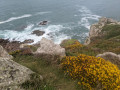
This route follows the Sentier des DouaniersGR®®34coastal path for a third of the way and takes us along country lanes for the rest. Blue highlights: the sea cliffs, the headland and hillside of Beg an Fry, the sweeping views over the beaches. Green highlights: the tree-lined paths, the restored mill at Trobodec, the Chapelle de Christ and its fountains, the springs... A fine showcase of Northern Brittany.
The Grand Rocher and the Pointe de l'Armorique
 8.90 mi
+823 ft
-810 ft
4h 50
Moderate
Departure from Plestin-les-Grèves (Côtes-d'Armor)
8.90 mi
+823 ft
-810 ft
4h 50
Moderate
Departure from Plestin-les-Grèves (Côtes-d'Armor)
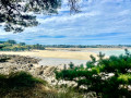
Discovering Grève Saint-Michel: a bay where the sea recedes more than 2 km; first by climbing the Grand Rocher for a breathtaking panorama, then, up close, by walking along the beach, and finally, by admiring it from across the bay on the famousGR®®34. You’ll continue to admire Lannion Bay as you round the Pointe de l’Armorique and, in particular, the Pointe de Plestin, before following the Douron estuary, admiring the chapel and fountain, and returning to Saint-Efflam.
The circular routes of the Chapelles route south of Plestin-les-Grèves
7.68 mi
+384 ft
-413 ft
3h 50
Moderate
Departure from Plestin-les-Grèves (Côtes-d'Armor)
This is an easy walk, except for the distance, which combines sunken paths and wide forest lanes, as well as chapels and castles, not to mention streams and brooks, with the English Channel as a backdrop.
Pont Menou Route
 3.23 mi
+197 ft
-226 ft
1h 40
Easy
Departure from Plouégat-Guérand (Finistère)
3.23 mi
+197 ft
-226 ft
1h 40
Easy
Departure from Plouégat-Guérand (Finistère)
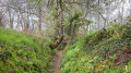
An easy short route starting from the foot of the Douron at Pont Menou, taking you through the Plouégat countryside via Kelumec and Kerforn, just a few metres from the Cozmezou cider house.
The lower Douron valley
8.71 mi
+361 ft
-348 ft
4h 20
Moderate
Departure from Plouégat-Guérand (Finistère)
Starting from the village of Pont Menou, follow the River Douron to its estuary between the headlands of Locquirec and l’Armorique. After enjoying a few views of the open sea, you’ll return via the higher ground of the valley. The route passes through numerous hamlets, some with beautiful houses, chapels and fountains, as well as ancient Roman baths. You’ll also enjoy stunning views of the Tour d’Argent and Île Blanche manor houses.