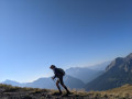
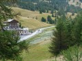
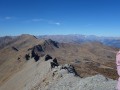
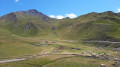
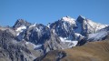
Col de Crachet, Lac de Crévoux and Col de Crévoux from Vars-Les-Claux.

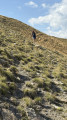
A long, wild hike for those who enjoy circular walks and aren’t put off by occasionally challenging paths. Indeed, the ascent from the Crachet hut towards the Col de Crévoux (or Col de Jaffeuil) follows a path that is often on a slope, so you need sure-footedness (see ‘Practical information’ section). But it’s truly wild!
You can shorten this circular route by taking the shuttle bus up to the Col de Vars and, on the way back, taking a chairlift (if possible) to return to the resort.

Details

2405696
Creation:
Last update:
Last review:
  • Walking
    Activity: Walking
  • ↔
    Distance: 10.87 mi
  • ◔
    Duration according to the author: 8 hrs 
  • ▲
    Difficulty: Very difficult

  • ⚐
    Back to start: Yes
  • ↗
    Ascent: + 4,291 ft
  • ↘
    Descent: - 4,295 ft

  • ▲
    Highest point: 8,619 ft
  • ▼
    Lowest point: 6,293 ft

Description of the walk

Start from the large car park at the top of the Vars-Les Claux resort.

(S/E) Head towards the Col de Vars via L’Écuelle along a path that climbs southwards.

(1) Continue straight on towards the Cabane de l’Écuelle and the Col de Vars.

(2) Descend 3 m to join the path leading from the chapel; head due south.

(3) Leave the valley and turn right onto a path that climbs towards the Col du Crachet.

(4) At around 2,250 m, do not head back down but climb to the right towards the pass. The slope is steep in places.

(5) At the pass, head back down, following as closely as possible a marked and cairn-marked path towards Lac du Crachet. Ignore the paths leading uphill to the right.

(6) Continue descending to the sheepfold.

(7) At the sheepfold, turn right to join a track you will have spotted during the descent; climb 50 metres to reach it (you’ll need to look for it a bit).
Follow this often sloping path as it winds its way round the mountain to a pass, then continue along the ridge to cross three ravines before descending into a large valley and reaching the Jaffueil hut.

(8) Head back up the valley along a path to the base of a ski lift, then continue towards the pass across the grassy slopes.

(9) At the Col de Crévoux, head back down the slopes, keeping to the right of Lac de Chabrières, to reach the resort and the car park (S/E).


Waypoints

  1. S/E : mi 0 - alt. 6,325 ft - Car park at the top of the Vars-Les Clots resort
  2. 1 : mi 0.94 - alt. 7,031 ft - Straight ahead
  3. 2 : mi 2.53 - alt. 6,923 ft - Col de Vars
  4. 3 : mi 2.99 - alt. 7,014 ft - Vallon
  5. 4 : mi 3.37 - alt. 7,297 ft - turn right
  6. 5 : mi 4.35 - alt. 8,619 ft - Col du Crachet
  7. 6 : mi 5.9 - alt. 7,362 ft - Lac du Crachet
  8. 7 : mi 6.43 - alt. 6,909 ft - Bergerie
  9. 8 : mi 7.69 - alt. 7,392 ft - Jaffeuil Hut
  10. 9 : mi 8.34 - alt. 8,202 ft - Col de Jaffueil
  11. S/E : mi 10.87 - alt. 6,325 ft - Car park at the top of the Vars-Les Clots resort

Notes

Small streams.

Important: walking poles are essential on the return path, which is often on a slope and can be slippery.

Worth a visit

Vars: a lovely ski resort. Downhill trails for mountain bikes.

Reviews and comments

3.8 / 5
Based on 5 reviews

Reliability of the description
4.3 / 5
Ease of following the route
3.2 / 5
Route interest
3.8 / 5
Galopin
Galopin

Overall rating : 4.7 / 5

Date of your route : Jul 12, 2026
Reliability of the description : ★★★★★ Very good
Ease of following the route : ★★★★★ Very good
Route interest : ★★★★☆ Good
Very busy route : Yes

Lovely 360° view • at the pass.

Machine-translated

User 15203070

Overall rating : 4 / 5

Date of your route : Jun 19, 2025
Reliability of the description : ★★★★☆ Good
Ease of following the route : ★★★★☆ Good
Route interest : ★★★★☆ Good
Very busy route : No

Very beautiful hike, but be careful ⚠️ the last part of the climb to the Col du Crachet is very dangerous. Take your time to analyse the terrain and locate the path.

⚠️ ⚠️ ⚠️ Col de Crevoux: collapsed paths, the three narrow passages are extremely dangerous with loose rocks and very unstable ground.

Machine-translated

Marie-Claire Pierret

Overall rating : 3 / 5

Date of your route : Aug 15, 2024
Reliability of the description : Not used / Not applicable
Ease of following the route : ★★☆☆☆ Disappointing
Route interest : ★★★★☆ Good
Very busy route : No

(Following on from the last comment): Three months on, the Crachet Pass is still not cleared, which makes the climb very (very) dangerous and difficult.
We regret not having checked Visorando before setting off on this impromptu hike during our holiday in the area! Definitely avoid this route until the path has been cleared.

Machine-translated

Lilivaut
Lilivaut

Overall rating : 2.5 / 5

Date of your route : Jun 22, 2024
Reliability of the description : Not used / Not applicable
Ease of following the route : ★★☆☆☆ Disappointing
Route interest : ★★★☆☆ Average
Very busy route : No

Hello, the start of this hike went very well; however, from km 6 onwards, the path became narrow due to recent avalanches. The climb up to the Col du Crachet is therefore very difficult and dangerous, as it is slippery and there is no path – the existing one has been buried by rockfalls. We do not recommend undertaking this hike until the trail is once again stable and clearly visible. Beyond the pass, the hike is difficult but manageable.

Machine-translated

pouget yves
pouget yves

Thank you for this important additional information, which helped to make this walk less challenging – it wasn’t planned that way to begin with, but we adapted it as the day went on.
It’s a bit challenging in places, but it takes you off the beaten track.

Machine-translated

icathou
icathou

Overall rating : 3.7 / 5

Date of your route : Jul 09, 2022
Reliability of the description : ★★★★☆ Good
Ease of following the route : ★★★☆☆ Average
Route interest : ★★★★☆ Good
Very busy route : No

You can shorten the hike to 6 hours and 12 km by parking at the Col de Vars. On the way back, take the TELEMIX ski lift down (it’s free) and head back up to the pass on the free shuttle bus – get off at the Tourist Office stop heading towards the Col de Vars.

It should be read as “les Claux” and not “les clots”!

Please note that from point 7 onwards, you must follow the GPS track to find the route – there are few cairns and, to quote the person at the sheepfold, ‘it’s a bit of a slog’.

Machine-translated

Other walks in the area

For more walks, use our search engine .

The GPS track and description are the property of this route's author. Please do not copy them without permission.