


Refine your search for walks in Col de Jaffueil
Col de Jaffueil walks


 Col de Crachet, Lac de Crévoux and Col de Crévoux from Vars-Les-Claux.
 Visorando Member
 10.87 mi
 +4,291 ft
 -4,295 ft
 8 hrs
 Very difficult
 Departure from Vars (Hautes-Alpes)
A long, wild hike for those who enjoy circular walks and aren’t put off by occasionally challenging paths. Indeed, the ascent from the Crachet hut towards the Col de Crévoux (or Col de Jaffeuil) follows a path that is often on a slope, so you need sure-footedness (see ‘Practical information’ section). But it’s truly wild!
You can shorten this circular route by taking the shuttle bus up to the Col de Vars and, on the way back, taking a chairlift (if possible) to return to the resort.
Walks near Col de Jaffueil
Basse Rua - Maljasset
10.62 mi
+4,688 ft
-4,186 ft
9h 00
Very difficult
Departure from Vars (Hautes-Alpes)
There is a long crossing before the Col des Houerts, which takes you into the Ubaye Valley.
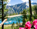
In the cool shade of the larch trees at Les Orres
 Tourist office
 2.96 mi
+246 ft
-2,123 ft
1h 35
 Easy
Departure from Les Orres (Hautes-Alpes)
A long, cool downhill walk through the larch forest, passing through Grand-Clos, where the water reservoir transforms into a mirror-like lake.
This walk is a downhill route from the top of the Pic Vert chairlift to the 1650 resort (L’Épervière car park).
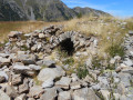
Lac Sainte-Marguerite and Source de Jérusalem
 5.97 mi
+1,903 ft
-2,156 ft
4h 25
 Moderate
Departure from Les Orres (Hautes-Alpes)
A very pleasant circular above Les Orres resort, allowing you to discover a beautiful lake, Sainte-Marguerite, and the springs that feed Les Orres, named Jerusalem.
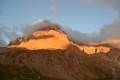
Trek around Chambeyron Mountain Range
 36.21 mi
+13,120 ft
-13,783 ft
5 days
 Difficult
Departure from Saint-Paul-sur-Ubaye (Alpes-de-Haute-Provence)
Reaching over 3000 metres in altitude, Aiguilles de Chambeyron and Brec de Chambeyron form an impressive mountain range halfway between Queyras and the Moncantour. This hike offers a trek with no techincal difficulty, with passes over 2700 m in altitude and a summit of over 3000 m. Set in an outstanding landscape and for the most part within a high mountain setting.
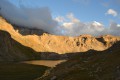
Trek around Chambeyron Mountain Range (1) Fouillouse - Refuge du Chambeyron
 3.88 mi
+2,470 ft
-36 ft
3h 55
Moderate
Departure from Saint-Paul-sur-Ubaye (Alpes-de-Haute-Provence)
First stage around the Chambeyron Mountain Range which, after a steady climb, takes you to the shelter with the same name. You'll end up in a breath-taking setting, at the foot of Brec de Chambeyron.
From Fouillouse to Bousiéyas
 21.25 mi
+6,686 ft
-6,667 ft
15h 35
Very difficult
Departure from Saint-Paul-sur-Ubaye (Alpes-de-Haute-Provence)
This sixteenth stage completes the crossing of the Chambeyron Massif and, after Larche, enters the Mercantour Massif. From Les Granges de Fouillouse, the GR®5 follows the Riou de Fouillouse upstream, passing the ruins of Fort de Plate Lombarde, then, via the Plate Lombarde valley, reaches the Col du Vallonnet. It then descends to Lac du Vallonnet Inférieur, where it heads due south to join an old military road that climbs towards the Viraysse barracks. From there, the GR®5 crosses the Col de Mallemort and descends to the hamlet of Larche. The route follows the Ubayette, then crosses it and reaches the Pont Rouge car park, which marks the entrance to the Mercantour National Park. It then heads due south, climbing to Lac du Lauzanier, then on to Lac de Derrière la Croix, before reaching the Pas de la Cavale. The descent starts off quite steep but then becomes gentler. After the Salse Morene plateau, the path climbs the Col des Fourches and, from the Camp des Fourches, reaches the hamlet of Bousiéyas.
Trek around Chambeyron Mountain Range (3) Refuge du Chambeyron - Maljasset
 10.64 mi
+2,454 ft
-4,764 ft
8 hrs
Very difficult
Departure from Saint-Paul-sur-Ubaye (Alpes-de-Haute-Provence)
The most demanding stage of the hike during which you'll go through at least 4 passes at over 2700 metres in altitude. Beautiful scenery all along the way! The "Lacs Marinet" offer the opportunity for refreshments before the final descent.
Chambeyron Mountain Hut – Saint-Ours
 Association / Club / Walk leader
 10.40 mi
+1,660 ft
-4,400 ft
6h 15
Difficult
Departure from Saint-Paul-sur-Ubaye (Alpes-de-Haute-Provence)
A walk through the valleys and passes of the Vallonnet in the high-altitude mountain pastures, passing by the old fortifications.
Saint-Ours – Larche
 5.26 mi
+1,102 ft
-1,417 ft
3h 25
Moderate
Departure from Meyronnes (Alpes-de-Haute-Provence)
Return to the starting point in Larche via theGRP® de la Frontière Fortifiée.
From Ceillac to Fouillouse
 13.37 mi
+4,452 ft
-4,216 ft
10h 00
Difficult
Departure from Ceillac (Hautes-Alpes)
This fifteenth stage crosses the Escreins massif (not to be confused with the Écrins massif) and, via the Ubaye valley, enters the Chambeyron valley. From the Refuge de la Cime, the route—off the GR®5—crosses the Torrent du Mélezet valley and climbs up the Pré Girardin valley via the ski runs; then, on the plateau, it skirts the rocky ridge overlooking Lac Miroir, reaches the lake and rejoins the GR®5. The route climbs up the valley between the shoulder of the Pic des Heuvières and the Crête de Coste Belle, passing the small pass of Sainte-Anne and then the lake of the same name before reaching the Col Girardin. It descends towards a basin, where the Torrent des Séchoirs has its source, and follows it. Clinging to the side of a steep slope, it joins the D25 road in the upper Ubaye valley and continues downstream, alternating between the road and paths close to the river. It leaves the D25 for the Fouillouse road, passes the vertiginous Pont du Châtelet, a tunnel and, via a path, reaches the hamlet of Fouillouse.