


La plupart des étapes du parcours commencent et se terminent dans des gares. Celles qui ne le font pas sont desservies soit par le bus express X40, qui relie Reading à Oxford, soit par le X20, qui relie Oxford à Aylesbury. Cela permet d’effectuer chaque étape en une journée au départ de toutes les villes situées sur le parcours. Les gares et arrêts de bus intermédiaires offrent une plus grande flexibilité quant aux distances parcourues à pied.
Railways and Waterways, entre Oxford et Londres


Une randonnée circulaire principalement plate d’environ 150 miles le long des voies navigables entre Oxford et la banlieue de Londres. Elle peut être effectuée en excursion d’une journée en train ou en bus express depuis toutes les villes situées sur le parcours.
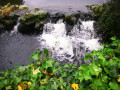
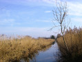
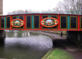
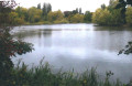
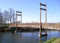
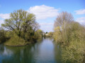
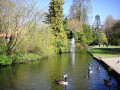
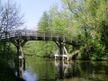
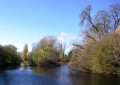
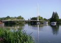
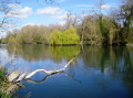
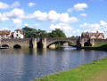
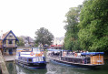
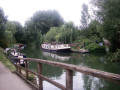
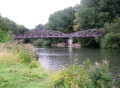
Ce sentier circulaire de grande randonnée part de la campagne de l’Oxfordshire, puis longe le Grand Union Canal – où vit une communauté très soudée de plaisanciers en péniche – pour s’enfoncer dans les Chilterns avant de serpenter à travers la banlieue de Londres. Il traverse les terrains de sport d’Eton pour rejoindre le Thames Path, qui serpente jusqu’à Oxford. L'itinéraire passe au-dessus et en dessous de ponts de toutes sortes, traverse des parcs naturels, des villages idylliques aux cottages au toit de chaume, de grands domaines et des bourgs historiques comme Aylesbury, Henley-on-Thames et Wallingford. Les lacs, les rivières calcaires et les prairies inondables abritent une faune et une flore variées, tandis que les pubs traditionnels au bord de l'eau offrent un rafraîchissement bienvenu.
Fiche technique
Création :
Mise à jour :
Dernier avis :
–
–
-
 Activité : Randonnée Pédestre
 -
 Distance : 242,00 km
 -
 Durée moyenne : 14 jours
 -
 Difficulté : Difficile
 -
-
 Retour au départ : Non
 -
 Dénivelé positif : + 479 m
 -
 Dénivelé négatif : - 499 m
 -
-
 Point haut : 132 m
 -
 Point bas : 16 m
-
 Pays :
Royaume-Uni
Pays :
Royaume-Uni
-
 Commune :
Forest Hill with Shotover
Commune :
Forest Hill with Shotover -
 Départ : N 51.762171° / O 1.181665°
 -
 Arrivée : N 51.753333° / O 1.269678°
 -


 Météo détaillée heure par heure
Photos

Pour continuer à proposer des fonctionnalités gratuites et pratiques en randonnée, soutenez-nous en donnant un petit coup de pouce !
Je donne un coup de pouceRandonnée étape par étape
Cette randonnée se fait sur plusieurs jours, voici le détail de chacun.
Informations pratiques
À voir
Pour plus d’informations sur ces randonnées, consultez le site web «Railways and Waterways Walk ».
Autres randonnées dans le secteur
D'Oxford à Thame
 Visorandonneur
 20,94 km
+87 m
-123 m
6h 15
Difficile
Départ à Forest Hill with Shotover (Oxfordshire)
20,94 km
+87 m
-123 m
6h 15
Difficile
Départ à Forest Hill with Shotover (Oxfordshire)
Il s’agit de la première étape de l’itinéraire de plusieurs jours « Chemins de fer et voies navigables, entre Oxford et Londres ».
Une randonnée à la campagne très variée qui relie des terres agricoles à perte de vue, un parc paysager et un parcours de golf de renommée mondiale, avec comme points forts notamment le manoir et les jardins de Waterperry, la première vue sur la Tamise à Bow Bridge et la chapelle de Rycote.
Circuit circulaire de Cowley à Shotover, Oxford
8,77 km
+115 m
-115 m
2h 50
 Facile
Départ à Oxford (Oxfordshire)
Facile
Départ à Oxford (Oxfordshire)
Cette balade en boucle traverse trois sites d'intérêt scientifique particulier (SSSI) depuis la ville d'Oxford. En partant du quartier urbain de Cowley, marchez jusqu'au sommet du parc naturel Shotover (SSSI) pour profiter de la nature et de la vue vers le sud-ouest, puis traversez le site Rock Edge (SSSI) pour découvrir des calcaires du Jurassique supérieur, et enfin le site Lye Valley (SSSI) pour découvrir un habitat de fens calcaires rare au niveau national, datant de la dernière période glaciaire.
Pour continuer à proposer des fonctionnalités gratuites et pratiques en randonnée, soutenez-nous en donnant un petit coup de pouce !
Je donne un coup de pouce
Circuit de Wolvercote
10,00 km
+21 m
-21 m
2h 55
Facile
Départ à Oxford (Oxfordshire)
Une randonnée circulaire presque plate qui suit le Thames Path et l'Oxford Green Way. La randonnée commence à Wolvercote, passe par l'abbaye de Godstow, puis longe les rives de la Tamise, en passant par des îles et des barrages intéressants. Le retour passe par Wytham Woods et traverse des champs, pour revenir par le Trout Inn où vous pourrez prendre un rafraîchissement bien mérité à la fin de la randonnée.
De Radley à Oxford
11,26 km
+11 m
-9 m
3h 15
 Moyenne
Départ à Radley (Oxfordshire)
Moyenne
Départ à Radley (Oxfordshire)
Il s'agit de la quatorzième et dernière étape de l'itinéraire de plusieurs jours « Chemins de fer et voies navigables, entre Oxford et Londres ».
Cette promenade au bord de la rivière passe en douceur des prairies inondables paisibles, en passant par les écluses de Sandford et d’Iffley, à travers une réserve naturelle, jusqu’à la périphérie animée d’Oxford, où les hangars à bateaux des différents collèges d’Oxford témoignent de la forte culture de l’aviron de la ville.
Hampton Gay
 Association / Club / AMM4,80 km
+12 m
-12 m
1h 25
Facile
Départ à Hampton Gay and Poyle (Oxfordshire)
Association / Club / AMM4,80 km
+12 m
-12 m
1h 25
Facile
Départ à Hampton Gay and Poyle (Oxfordshire)
Promenez-vous à travers les prairies jusqu'à une église isolée et un manoir en ruines du XVIe siècle.
Vallée de Cherwell
6,75 km
+8 m
-8 m
1h 55
Facile
Départ à Hampton Gay and Poyle (Oxfordshire)
Visitez quatre églises historiques, ainsi qu'un manoir en ruines et un joli retour au bord de la rivière.
Hampton Poyle et Bletchingdon
7,07 km
+41 m
-41 m
2h 10
Moyenne
Départ à Hampton Gay and Poyle (Oxfordshire)
Montez dans un joli village avec une église historique, une maison de campagne et un village verdoyant.
Cothill Wild
 Office de tourisme6,40 km
+16 m
-16 m
1h 55
Facile
Départ à Wootton (Oxfordshire)
Office de tourisme6,40 km
+16 m
-16 m
1h 55
Facile
Départ à Wootton (Oxfordshire)
Explorez Cothill : la zone la plus diversifiée de l'Oxfordshire en matière de faune sauvage. Au départ de Wootton, cette balade circulaire de 5 kilomètres traverse trois réserves naturelles du BBOWT : Dry Sandford Pit, Parsonage Moor et Lashford Lane Fen.
Pour plus de randonnées, utilisez notre moteur de recherche .
Les descriptions et la trace GPS de ce circuit restent la propriété de leur auteur. Ne pas les copier sans son autorisation.