


Refine your search for walks in Zonza
Zonza walks


 In Alta Rocca, around Zonza and Quenza
 Visorando Member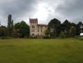
 9.14 mi
 +1,755 ft
 -1,772 ft
 5h 45
5h 45
 Moderate
 Departure from Zonza (Corse-du-Sud)
A beautiful walk in the Alta Rocca, following shaded paths cooled by the proximity of numerous streams. You also pass through the village of Quenza, where you can stop for a bite to eat. Best done in mid-season or even in summer when it is very hot.
I have been informed (September 2024) that the walk now starts from the restaurant La Ferme A Stadda, just below Zonza, 200 metres below point no. 1.
The Three Villages Trail starting from Quenza
 Local authority
 9.52 mi
+2,119 ft
-2,119 ft
6h 15
Moderate
Departure from Quenza (Corse-du-Sud)
9.52 mi
+2,119 ft
-2,119 ft
6h 15
Moderate
Departure from Quenza (Corse-du-Sud)
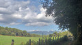
The Three Villages Trail offers a beautiful day's hike. Passing mainly through the Mare à Mare, this route allows you to discover authentic villages in the Alta Rocca region (Quenza, Serra di Scopamena and Sorbollano). You will follow connecting paths once used by locals to travel from village to village.
Fumicosa Pass or Bocca di Fumicosa
 4.30 mi
+1,198 ft
-1,194 ft
3h 00
Moderate
Departure from Zonza (Corse-du-Sud)
4.30 mi
+1,198 ft
-1,194 ft
3h 00
Moderate
Departure from Zonza (Corse-du-Sud)
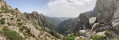
This is a hike off the beaten track where you are unlikely to meet many other walkers.
The name Fumicosa in the Corsican language evokes a smoky place, a metaphor here for a place where fog is quite common.
Return trip from Cucuruzzu to the footbridge towards Zonza
 5.67 mi
+725 ft
-725 ft
3h 15
5.67 mi
+725 ft
-725 ft
3h 15
 Easy
Departure from Levie (Corse-du-Sud)
Easy
Departure from Levie (Corse-du-Sud)
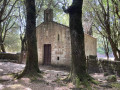
A beautiful historical and cultural walk on a variant of the Mare à Mare Sud. A well-maintained and signposted trail for an easy family hike, mostly shaded, to a ruined mill and a beautiful footbridge. Return via the same route.
Luviu sheepfolds and Monte Calva from the Illarata pass
 6.65 mi
+1,752 ft
-1,736 ft
4h 35
Moderate
Departure from Zonza (Corse-du-Sud)
6.65 mi
+1,752 ft
-1,736 ft
4h 35
Moderate
Departure from Zonza (Corse-du-Sud)
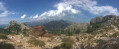
In Alta Rocca, in the Ospédale forest, a beautiful hike leads first along a shaded path to the Luviu sheepfolds in a beautiful clearing. From Monte Calva, after a short climb, there is a magnificent view of both sides of the island, to the south and the bay of Porto-Vecchio. At the Col d'Illarata (start and finish), to the west, the beautiful summit of the Pointe du Diamant (1,227 m) is clearly visible.
Bavella - Velaco - Promontoire - Bavella loop
 4.85 mi
+1,631 ft
-1,647 ft
3h 40
4.85 mi
+1,631 ft
-1,647 ft
3h 40
 Difficult
Departure from Quenza (Corse-du-Sud)
Difficult
Departure from Quenza (Corse-du-Sud)
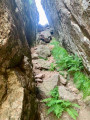
This loop allows you to visit the various remarkable points of the southern Bavella massif (Velacu massif), including Punta Velacu, the Promontory, the Campanile de Sainte-Lucie, the tafonu di u Cumpuleddu (incorrectly called "trou de la bombe" or "bomb hole"), the belvedere and the chapel, through the forest and rocky peaks. Magnificent views of the ravines of Punta Velacu and Calanca Murata, all with less than 500 m of elevation gain.
Col de Bavella: "U Cumpuleddu" (The Bomb Hole)
 3.54 mi
+643 ft
-663 ft
2h 10
Moderate
Departure from Quenza (Corse-du-Sud)
3.54 mi
+643 ft
-663 ft
2h 10
Moderate
Departure from Quenza (Corse-du-Sud)
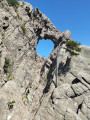
This hike will take you to "U Cumpuleddu", more commonly known as "Trou de la Bombe" (Bomb Hole), a geological formation caused by erosion. The route also offers beautiful views of the Aiguilles de Bavella mountain range. Much of the hike takes place under the cover of Laricio pine trees.
Tour of the Aiguilles de Bavella
 6.82 mi
+2,841 ft
-2,854 ft
7 hrs
6.82 mi
+2,841 ft
-2,854 ft
7 hrs
 Very difficult
Departure from Quenza (Corse-du-Sud)
Very difficult
Departure from Quenza (Corse-du-Sud)
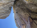
A sublime hike around the Aiguilles de Bavella.
A long and demanding hike (see practical information).
The Cavu pools and the Sainte-Lucie stream
 5.58 mi
+843 ft
-837 ft
3h 20
Moderate
Departure from Zonza (Corse-du-Sud)
5.58 mi
+843 ft
-837 ft
3h 20
Moderate
Departure from Zonza (Corse-du-Sud)
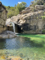
Walk and swim in the beautiful pools of Cavu.
Cavu – Paliri – San-Martinu circular loop
 14.18 mi
+3,839 ft
-3,829 ft
9h 50
Very difficult
Departure from Zonza (Corse-du-Sud)
14.18 mi
+3,839 ft
-3,829 ft
9h 50
Very difficult
Departure from Zonza (Corse-du-Sud)
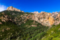
A circular route which, from the Cavu valley, takes you to theGR®20and then on to the Paliri refuge. The return journey follows theGR® towards Conca, then onto a path that descends towards the San-Martinu track in the Cavu valley.
The Brèche du Carciara... and a little further
 9.33 mi
+2,661 ft
-2,631 ft
6h 35
Very difficult
Departure from Zonza (Corse-du-Sud)
9.33 mi
+2,661 ft
-2,631 ft
6h 35
Very difficult
Departure from Zonza (Corse-du-Sud)
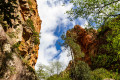
A hike towards the Brèche du Carciara, and a little further, amidst a landscape of rocky chaos and numerous magnificent waterfalls and crystal-clear pools! The final section requires climbing metal rungs, scaling a rope ladder and ascending with the aid of a cable (but without additional equipment), which may put some people off. Furthermore, many sections involve walking over rocks and can therefore be very tricky.
Sainte-Lucie River and Cavu pools
 7.13 mi
+961 ft
-942 ft
4h 05
Moderate
Departure from Zonza (Corse-du-Sud)
7.13 mi
+961 ft
-942 ft
4h 05
Moderate
Departure from Zonza (Corse-du-Sud)
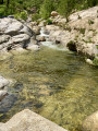
This hike starts in the same way as the one described under no. 4375623, from which I have taken the opening paragraphs, but returns via a different route, including a section of water hiking, and ends at the three pools, which avoids the need to go back and forth as on the original route we had chosen.
Cavu Valley - Mandria - Oriu Carbunari
 4.42 mi
+1,726 ft
-1,703 ft
3h 30
Moderate
Departure from Zonza (Corse-du-Sud)
4.42 mi
+1,726 ft
-1,703 ft
3h 30
Moderate
Departure from Zonza (Corse-du-Sud)
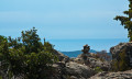
A hike through scrubland and undergrowth on a properly marked trail, steep in places.
Same starting point as the "La Vallée du Cavu" hike suggested on Visorando, but avoids the entire second part on the track.
On the other side of U Cavu
 3.92 mi
+1,411 ft
-1,411 ft
3h 00
Moderate
Departure from Zonza (Corse-du-Sud)
3.92 mi
+1,411 ft
-1,411 ft
3h 00
Moderate
Departure from Zonza (Corse-du-Sud)
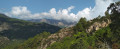
Follow this challenging circular route along the Cinaghja and Barola paths towards Li Ponti di Marionu and return via the path of the same name, which runs along the left bank of the Cavu.
The Cavu Valley
 6.49 mi
+1,430 ft
-1,430 ft
4h 15
Moderate
Departure from Zonza (Corse-du-Sud)
6.49 mi
+1,430 ft
-1,430 ft
4h 15
Moderate
Departure from Zonza (Corse-du-Sud)
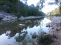
The Cavu Valley is characterised by natural pools and large slabs of bleached granite with rounded shapes along its course.
The hike follows the river before climbing through the scrubland along a discreet path leading to a first viewpoint (401m) and then a second (509m), offering panoramic views over the Cavu and the mountainous cirque at the bottom of the valley dominated by Punta de Quercitello (1461m). To the east, Pinarello Bay beckons.
Luviu sheepfold, starting from Tagliu Rossu
 9.45 mi
+3,907 ft
-3,904 ft
7h 45
Difficult
Departure from Zonza (Corse-du-Sud)
9.45 mi
+3,907 ft
-3,904 ft
7h 45
Difficult
Departure from Zonza (Corse-du-Sud)
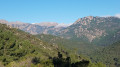
The Luviu sheepfolds are spread out along the ridges of a pine forest, facing Monte Calva. The ascent passes through woods and scrubland, and the route is mostly in the shade. Throughout the walk, you’ll be treated to views of the bays of Pinarello and Saint-Cyprien, the Gulf of Porto Vecchio, and the islands (Monte Cristo, Elba, the Cerbicales and the Lavezzi), stretching as far as Sardinia.
More walks in Zonza
Select a point of interest below: