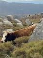
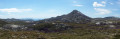
The Punta di Ghjavingnolu walk will take you past numerous pozzines (peat bogs) and, at the summit, offers a stunning panoramic view of the Cuscionu plateau, the Gulf of Ajaccio and the Valinco. Depending on the season, you may come across horses, cows, pigs and flocks of sheep.
(S/E) Continue along the track on foot until you reach a gate. Turn left, before the gate, onto the path that descends towards the stream below. Cross the stream and continue along the path. You will reach a crossroads and a wooden sign indicating Punta di Ghjavingnolu.
(1) Turn right and, about a hundred metres further on, cross a small gully on the slope. Continue along the path marked by cairns. You will reach the junction with the Water Trail (Violu di l’Acqua) and the Avinta di Ghjavingnolu.
(2) Follow the yellow markings to the left. Join the Avinta di Ghjavingnolu. You will then reach another junction.
(3) Head in the direction of the wooden sign for Punta di Ghjavingnolu. Leave the yellow markings and follow the cairns. The path climbs through the scrubland before reaching the ridge. Continue on to reach the summit of Punta di Ghjavingnolu, marked by a large cairn. Carry on a little further to reach the start of the descent.
(4) Begin this descent and you will soon reach the junction with the yellow-marked path.
(5) Leave this marked path and follow the cairns, cross a large pozzine and then come out onto an old track before reaching the junction you passed on the way up.
(1) Turn right and retrace your steps along the route you took on the way there to return to the car park at the Refuge de Bucchinera (S/E).
Waypoints
S/E : mi 0 - alt. 5,030 ft - Bucchinera Refuge car park
1 : mi 0.37 - alt. 5,052 ft - Crossroads of the circular loop
2 : mi 0.8 - alt. 5,184 ft - Punta di Ghjavingnolu sign
3 : mi 1.23 - alt. 5,269 ft - Punta di Ghjavingnolu sign
4 : mi 1.79 - alt. 5,522 ft - Start of the descent
5 : mi 2.01 - alt. 5,292 ft - Signpost back
S/E : mi 3.08 - alt. 5,030 ft - Bucchinera Refuge car park
Notes
Please note: to reach the car park at the Refuge de Bucchinera, which is the starting point for the hike, you will need to take a 12 km track from the village of Quenza. As the track is in very poor condition (numerous potholes and ruts), it will take between 45 minutes and an hour by car to reach the car park. The building is currently disused. There are no toilets, no water supply and no catering facilities. You must not drive through the barrier or continue along the track. You will need to follow the signposts and cairns (piles of stones). Please do not add stones to the cairns. Only the section between (2) and (3) is marked with yellow markings. This path is not open to mountain bikes. Mountain bikes must remain on the main track.
Always check the current and forecast weather conditions so that you can pack your rucksack accordingly.
The weather can deteriorate rapidly on the Cuscionu plateau (thunderstorms, rain, hail, strong winds and fog), which can lead to a drop in temperature and make the hike more difficult. Stay alert. It can get very hot.
There are no water sources along the route. Remember to take a sufficient supply of water for each person.
Wear appropriate clothing for mountain hiking (walking or trail running shoes).
Please behave in a way that respects the mountain environment: be discreet (drones are prohibited), keep the area clean (take your litter and rubbish away with you), keep your dog on a lead, do not plant parasols on the pozzines, do not use walking sticks on the pozzines, and be considerate. This is not a picnic area but a protected natural site where wild camping is prohibited (including in the car park).
Reviews and comments
4.4 / 5
Based on 3 reviews
Reliability of the description 4.7 / 5
Ease of following the route 4 / 5
Route interest 4.7 / 5
francois stéphane
Overall rating :
4 / 5
Date of your route : Aug 04, 2025 Reliability of the description : ★★★★★ Very good Ease of following the route : ★★★☆☆ Average Route interest : ★★★★☆ Good Very busy route : No
Just to let you know that someone in 2025 said that the trail had been redone to reach the refuge... maybe it was a joke... 1 hour to cover 14 km in ruts! It's worth a look, but if you have low clearance, it will be a nightmare.
Machine-translated
Shay
Overall rating :
4.3 / 5
Date of your route : Aug 02, 2024 Reliability of the description : ★★★★☆ Good Ease of following the route : ★★★★☆ Good Route interest : ★★★★★ Very good Very busy route : No
A rather unique landscape in Corsica. No major difficulties.
However, the road leading there is very bumpy.
We couldn’t make it all the way in our Clio. We had to park the car and walk the last kilometre.
Machine-translated
Fumélia
Overall rating :
5 / 5
Date of your route : Jun 24, 2024 Reliability of the description : ★★★★★ Very good Ease of following the route : ★★★★★ Very good Route interest : ★★★★★ Very good Very busy route : No
We’re lost in the middle of nowhere in a dreamlike setting with a few animals roaming completely free! Simply magnificent!
To open this route on your smartphone, you must have the Visorando app installed. If not, got to the Apple Store (iPhone) or Google Play Store (Android) to download the app.



 Country:
 City:
City:



 Local authority
 Moderate
 Visorando Member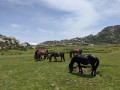
 Difficult

 Very difficult
