


Refine your search for walks in Réserve naturelle nationale de Py
Réserve naturelle nationale de Py walks


 Les Mates Roges and the Mariailles Refuge from Coll de Jou
 Visorando Member
 8.04 mi
 +2,277 ft
 -2,267 ft
 5h 40
5h 40
 Difficult
 Departure from Sahorre (Pyrénées-Orientales)
From Coll de Jou, a scenic hike with vantage points offering beautiful panoramic views.Passing through Collada de Botifarra, Mates Roges, Refuge de Mariailles, Coll del Cavall Mort, Coll de Creu.This is a much more pleasant way to reach the Refuge de Mariailles, where you may wish to stay overnight.This route is signposted and presents no difficulty apart from the steep gradient between (2), (3) and (4).
Roca Colom via Portella de Callau from Mantet
 10.30 mi
+3,409 ft
-3,389 ft
7h 40
Difficult
Departure from Mantet (Pyrénées-Orientales)
10.30 mi
+3,409 ft
-3,389 ft
7h 40
Difficult
Departure from Mantet (Pyrénées-Orientales)
Another way to climb Roc Colom.A good path leads to Jaça del Callau. Then you have to climb up to Portella del Callau, where a path leads up to Roca Colom. From Mort de l'Escolà, a good cairned path leads down to Coll de Mentet, where the GR® 10 takes you back to the hamlet of Mantet.
The GPX track and a sense of direction are essential.
Le Pla Guillem
 11.05 mi
+3,816 ft
-3,809 ft
8h 25
Difficult
Departure from Sahorre (Pyrénées-Orientales)
11.05 mi
+3,816 ft
-3,809 ft
8h 25
Difficult
Departure from Sahorre (Pyrénées-Orientales)
Explore one of the largest plateaus in the Pyrénées-Orientales, the Pla Guillem. You’ll be transported to a world reminiscent of the Scottish moors.
Les Esquerdes de Rotjà from Les Conques via the source of the Tech
 10.23 mi
+3,051 ft
-3,038 ft
7h 20
Difficult
Departure from Prats-de-Mollo-la-Preste (Pyrénées-Orientales)
10.23 mi
+3,051 ft
-3,038 ft
7h 20
Difficult
Departure from Prats-de-Mollo-la-Preste (Pyrénées-Orientales)
A very lovely walk in Vallespir, on a signposted path, but one that is rarely used, allowing you to spot chamois and marmots.
See the ‘Practical Information’ section regarding the crossing of the Tech at the Ouillat huts ¹.
Thués-Entre-Valls – Fillols Route
 34.29 mi
+14,088 ft
-14,383 ft
5 days
34.29 mi
+14,088 ft
-14,383 ft
5 days
 Moderate
Departure from Thuès-Entre-Valls (Pyrénées-Orientales)
Moderate
Departure from Thuès-Entre-Valls (Pyrénées-Orientales)
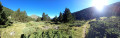
A 5-day route in the Catalan Pyrenees, offering the chance to explore the stunning Carença Gorges before finishing with an ascent of the Catalan giant: the Canigou.
From the Refuge des Conques to the Refuge de Mariailles
 9.37 mi
+2,628 ft
-2,352 ft
6h 35
Difficult
Departure from Prats-de-Mollo-la-Preste (Pyrénées-Orientales)
9.37 mi
+2,628 ft
-2,352 ft
6h 35
Difficult
Departure from Prats-de-Mollo-la-Preste (Pyrénées-Orientales)
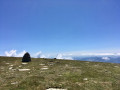
First stage of the: Loop from the Refuge des Conques to the Refuge de Mariailles
Mountain hike with beautiful scenery, particularly from Coll de Bise to Collada de la Roqueta.
Classified as difficult: exposed, steep slopes in places. See practical information.
Allow 6 hours of sustained walking.
Circular Pla Guillem via Coll des Basses – Cabane des Cums – Coll del vent
 10.31 mi
+2,589 ft
-2,589 ft
7h 00
Moderate
Departure from Prats-de-Mollo-la-Preste (Pyrénées-Orientales)
10.31 mi
+2,589 ft
-2,589 ft
7h 00
Moderate
Departure from Prats-de-Mollo-la-Preste (Pyrénées-Orientales)
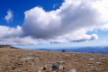
A very pleasant circular route on well-marked paths. However, a good sense of direction is still required, as there are different markings to follow.Warning: the Pla Guillem area is very hazardous in foggy conditions and it is often very cold there. The GPX track is essential: the weather changes very quickly.*This hike can be classified as difficult. The 7-hour duration indicated by the software is fairly accurate. Not all the paths are easy to walk on.The scenery is very beautiful. The Cums hut and the Pla Guillem refuge offer places to rest.This hike should be avoided during heatwaves and in heavy snow.Please note the restricted access to the car park at La Togne towards Coll de les Basses: see practical information.
Le Pla Guillem from the Cabane Pastorale des Forquets
 11.38 mi
+2,556 ft
-2,530 ft
7h 30
Difficult
Departure from Prats-de-Mollo-la-Preste (Pyrénées-Orientales)
11.38 mi
+2,556 ft
-2,530 ft
7h 30
Difficult
Departure from Prats-de-Mollo-la-Preste (Pyrénées-Orientales)
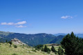
A fairly long hike, mostly on open terrain. Plenty of 360° views.Passes by watering holes, mountain passes, stone-paved paths, stone huts and a refuge.Trails at the start and finish of this beautiful hike.Please note: Nature Reserve. Specific regulations apply.Avoid this hike during heatwaves and when there is heavy snow.Classified as difficult as a basic sense of direction is required.Warning: the Pla Guillem area is very hazardous in foggy conditions and it is often very cold there. The GPX track is essential: the weather changes very quickly.Outside the summer season, when the barrier is raised at the Forquets car park: you can start at (1). This saves 3 km on the return journey.
Collada del Vent – Puig de la Collade Verda – Collada de Roques Blanques
 10.45 mi
+3,140 ft
-3,143 ft
7h 30
Moderate
Departure from Prats-de-Mollo-la-Preste (Pyrénées-Orientales)
10.45 mi
+3,140 ft
-3,143 ft
7h 30
Moderate
Departure from Prats-de-Mollo-la-Preste (Pyrénées-Orientales)
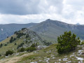
From Las Conques, a lovely walk through pastures that are still well maintained.
Ridge walk (2,403 m). The route passes beneath the Esquerdes de Rotjà. Springs, shelters, shepherds’ huts and scenic viewpoints are all on the itinerary.
Circular Portella de Mantet, del Callau - Mort de l'Escolà from Mantet
 12.56 mi
+3,438 ft
-3,425 ft
8h 45
Difficult
Departure from Mantet (Pyrénées-Orientales)
12.56 mi
+3,438 ft
-3,425 ft
8h 45
Difficult
Departure from Mantet (Pyrénées-Orientales)
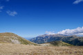
Circular hike from Mantet with the climb to the border and then towards Roc Colom.From Mantet, the climb via theGR®® to the Refuge de l'Almany is not difficult.The only difficulty is the steep climb to Portella de Mantet. Your efforts will be rewarded when you reach the top.Then the path to Pla de Segala is easy and beautiful with magnificent 360° views.The hike may be classified as very difficult by some due to its length and duration.
Pla Segala – Roca Colom – Portella / Rotjà Hut from Coll de Mentet
 10.50 mi
+2,917 ft
-2,920 ft
7h 20
Moderate
Departure from Mantet (Pyrénées-Orientales)
10.50 mi
+2,917 ft
-2,920 ft
7h 20
Moderate
Departure from Mantet (Pyrénées-Orientales)
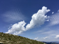
A round-trip hike to Roc Colom (2,507 m), the Cabane de Rotjà and the Porteilla de Rotjà (2,377 m). As soon as you reach Pla de Segala (2), the landscape opens up to offer 360° views.This hike should be avoided in bad weather, especially in fog, unless you have the GPX track. Once you emerge from the forest, the route is exposed and open to the elements. Appropriate kit is essential in all seasons. *
 Pla Segalà from Col de Mantet
 4.70 mi
+1,450 ft
-1,450 ft
6 hrs
Difficult
Departure from Mantet (Pyrénées-Orientales)
4.70 mi
+1,450 ft
-1,450 ft
6 hrs
Difficult
Departure from Mantet (Pyrénées-Orientales)
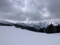
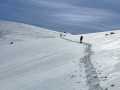
A lovely circular route starting from the Col de Mantet and passing through Pla Segalà. Apart from a few animal tracks, pristine white snow is guaranteed throughout the route.
Pla Segalà
 5.62 mi
+1,864 ft
-1,860 ft
5 hrs
Moderate
Departure from Mantet (Pyrénées-Orientales)
5.62 mi
+1,864 ft
-1,860 ft
5 hrs
Moderate
Departure from Mantet (Pyrénées-Orientales)
We really enjoyed this round-trip snowshoe hike, made possible by exceptional snow cover and, above all, the fresh snow that had fallen the previous day. Starting via the track makes for an easier start to the hike, allowing you to warm up rather than immediately taking the GR® 177, which climbs quite steeply through the woods. Leaving the track, the path climbs a little further to join the GRP® and begins a slightly steeper ascent to reach Pla Segalà, the day’s destination.
From Plat d'Hospitalet to the Mariailles Refuge
 13.33 mi
+2,041 ft
-3,025 ft
7h 55
Difficult
Departure from Setcases (Girona)
13.33 mi
+2,041 ft
-3,025 ft
7h 55
Difficult
Departure from Setcases (Girona)
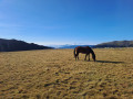
A beautiful hike between Spain and France from Plat d'Hospitalet to the Mariailles Refuge at the foot of Canigou. The route is varied with splendid views when crossing the mountain passes.
From the Mariailles refuge to the Conques refuge
 10.00 mi
+2,490 ft
-2,785 ft
6h 45
Difficult
Departure from Casteil (Pyrénées-Orientales)
10.00 mi
+2,490 ft
-2,785 ft
6h 45
Difficult
Departure from Casteil (Pyrénées-Orientales)
Second stage of the: Loop from the Refuge des Conques to the Refuge de Mariailles
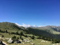
Mountain hike with a permanent view of Pla Guillem at Porteilla des Avets
Classified as difficult: open terrain, paths sometimes with old or no markings, steep slopes in places. See practical information.
Allow 6 hours of sustained walking.
Loop from the Refuge des Conques to the Refuge de Mariailles
19.38 mi
+5,089 ft
-5,102 ft
2 days
Difficult
Departure from Casteil (Pyrénées-Orientales)
This two-day hike, with an overnight stay at the Refuge de Mariailles, allows for shorter variations each day depending on the weather or individual needs. This hike is not fully signposted. However, the suggested variations allow you to stay on the marked trails.
Two days in the mountains, from one refuge to another. It is possible to start from the Mariailles Refuge, but add 2 hours from the Coll de Jou to climb up to it.
From Collada de Roques Blanques to Pla Guillem via the ridges
 10.51 mi
+3,228 ft
-3,268 ft
7h 40
Difficult
Departure from Prats-de-Mollo-la-Preste (Pyrénées-Orientales)
10.51 mi
+3,228 ft
-3,268 ft
7h 40
Difficult
Departure from Prats-de-Mollo-la-Preste (Pyrénées-Orientales)
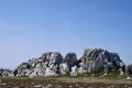
Most of the walk is out in the open, with some very beautiful scenery. First, a steep climb to Puig de Collada Verda (marker 2403) and a geodesic marker. This is followed by a route along the ridge and a passage to Collada del Vents. Then watch out for the rocky Cingle dels Pelegrins, where there is no fence or protection. Keep away from them by following the path marked on the ground. A large cairn marks the end of the ridge. A return trip to Pla Guillem (signpost) allows you to enjoy the scenery.
Classified as difficult due to the length and number of ascents and descents throughout the hike and a dangerous zone (15) at (17).