Country:

 City:
City:


On reaching Villefranche-de-Conflent via the D66, continue to the right at the roundabout, follow the fortifications and, at a right-hand bend before the ‘Train Jaune’ railway line, turn left onto the D6 towards Sahorre. Pass through the three hamlets of Fulla, then the hamlet of Sahorre; cross Py with care and head up to the much higher Coll de Mentet. Park in the car park.
Yellow markings. There are no GR®T77 markings
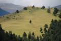
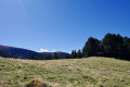
(S/E) Leave the road and track to your left. Head up the slope opposite into the pasture. There is a steel post in the middle of the path right from the start. Head due south, then south-east towards the forest. Continue along the rough track, which eventually becomes a damaged path. Pass through a gap in the fence and continue the climb. Pass a first spring on the right, then come to a second one. Continue climbing and emerge into a pasture at the edge of the forest.
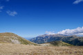
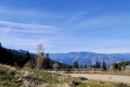
(1) A few metres further on, there is a stunning panoramic view of the Franco-Spanish ridges in the distance.
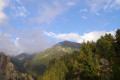
Carry on climbing, to the left, due east, through a clearing in the forest. Further up, after a wide bend to the right, towards the south, you’ll reach another pasture; a signpost (alt. 2200 m), to the left of the path, against the rocks, points towards Pla Segala. Follow the signs for Portella de Rotjà (2 hrs).
End of the yellow markings. A few cairns at the start
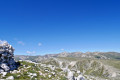
(2) Continue climbing at a gentler gradient, heading south. Further on, climb more steeply towards the clearly visible peaks. Enjoy the stunning 360° views. Plenty of places to stop and rest.
(3) A pile of rocks on the left with a superb view of the Esquerdes and the Portelle de Rojtà. A lovely spot for a break. Continue the ascent, keeping to the right of the fence. Large cairns help guide your way up to the Mort de l’Escolà plateau (2,412 m)
No signposting or cairns
(4) Carry on straight ahead, due south, to reach the junction on the Mort de l’Escolà plateau. Directional signpost.
No signposting
(5) Climb to the right up the grassy, stony ridge. Follow a well-marked path, at times running along the edge of the border ridge. Reach Roc Colom, with its wind-sheltered enclosure and its weather-beaten signpost indicating the location and altitude.
(6) Turn back and head for the signpost for La Mort de l’Escolà, which you passed earlier.
Yellow and red markings of the GRP® Tour du Canigou
(5) Continue along the mountainside, on almost level ground, until you reach the top of the Cabane de la Rotjà and head towards it.
A lovely spot for a break. Please remember to close the hut door and wedge it shut with a large stone. Thank you. The hut is very useful, especially in winter, for shelter from the wind that often blows in this area.
(7) Head to the Portella de la Rojà. Enjoy another panoramic view over the Rotjà valley. Descend down the other side for about fifteen metres.
(8) After two hairpin bends on the scree, look out for a path on the left that climbs up beneath the ridge. The trail to follow is clearly visible due west. It’s easy to spot where Pla Segala is.
Yellow markings are very sparse. There are no GR®T77 markings
(4) Continue to the right, crossing the electric fence. Then follow the route back in the opposite direction to the way out
(2) Make sure to turn left, heading west, and look out for the signpost on the right against the rocks and the yellow markings. You’ll reach the car park much further down (S/E).
You can head down to visit the charming hamlet of Mantet, either by taking a return trip via the GR®10 or by car (brasserie open in summer).
Further down the return route, in the hamlet of PY, there is also an inn, bar and grocery shop open in season.


 Visorando Member
 Difficult