


 Country:

 City:


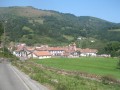
The walk starts from the car park at the Baztan Adventure Park (alt. 362 m).
(S/E) Continue along the small tarmac road.
(1) Ignore the return path on the left and continue along the small tarmac road to the entrance to the hamlet of Bearzun (sign).
(2) Turn right and cross the stream via the bridge. The road gives way to a track and then to a stony path with a gradient that gradually steepens.
(3) At Largain lepoa (elevation 474), leave the small path on the left that leads to an ancient Roman road called Napoleonen Bidea (Napoleon’s Path), which heads for the Col de Berderitz, and instead take the main path leading up to the Col de Belaun. Enter a beautiful forest.
(4) The Col de Belaun (elevation 763) lies on the border.
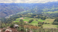
(5) Head left up to the nearby Zarkindegi (860) via a short but steep slope. On the ridge, take in the superb panoramic view over the Aldudes Valley (three villages), dominated in the distance by the lofty silhouette of Mount Adi. A little further on, reach the junction with Napoleon’s Path and turn right.
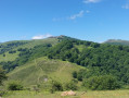
(6) Descend gently to the Col de Berdaritz (or Berderiz, depending on the map, elevation 691) and turn immediately left, at the border marker, onto the path heading north towards Elizondo. It is best to take the pleasant footpath slightly higher up rather than the track. Follow this well-marked path along the eastern flank of the Beartzun valley towards Goisemets.
(7) At a crossroads (signposted) at the Basagar Pass, near a farmhouse on the left (Basargako erreka), take the wide dirt track on the left which descends slightly.
(8) You’ll reach a bend in the track where a guesthouse is situated opposite (Casa rural Caserio Gamioa). Take the path that climbs up to the right.
(9) After climbing up the stony track, turn left as you head up onto the ridge. From there, follow this well-marked path, which, after a few zigzags, leads back to the tarmac road.
(1) Follow it to the right, in the opposite direction to the way you came, and you’ll reach the Adventure Park car park (S/E).
 Visorando Member

 Easy
 Difficult

