Wissembourg - Obersteinbach

The first stage of the account of a north-south crossing of the Vosges, from Wissembourg to the Ballon d’Alsace, with Passion Vosges, the magazine dedicated to hiking. This stage is recounted by Franck Buchy in Passion Vosges.

Details

69216437
Creation:
Last update:
Last review:
  • Walking
    Activity: Walking
  • ↔
    Distance: 18.06 mi
  • ◔
    Average duration: 10h 50 
  • ▲
    Difficulty: Very difficult

  • ⚐
    Back to start: No
  • ↗
    Ascent: + 2,936 ft
  • ↘
    Descent: - 2,654 ft

  • ▲
    Highest point: 1,657 ft
  • ▼
    Lowest point: 515 ft
  • ⚐ Country: France
  • ⚐
  • ⚐ City: Wissembourg (67160)
  • ⚑
    Start: N 49.032096° / E 7.950676°
  • ⚑
    End: N 49.036218° / E 7.68608°
  • Accessible from the train station Gare de Wissembourg.
  • ❏
    IGN map(s): Ref. 3814ET, 3914OT
  • Hour-by-hour weather

Photos

Description of the walk

Starting from Wissembourg station.

Red Rectangle markings, unless otherwise indicated

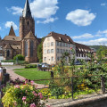
(S) With your back to the station, join and follow the GR®53 to the left. Go round the roundabout on the right and head towards the square with the Joseph von Stichaner monument.

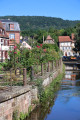
(1) Cross the road, walk along the southern ramparts, then after the bridge on the right, cross Boulevard Clemenceau (D334) to the left. Then go up Rue du Château d’Eau to the left, take a path between the houses on the left and continue straight on until you find yourself in fields and orchards.

(2) Turn onto the path on the right through the fields and head up towards the pylon.

(3) Please note: at the mast (a few dozen metres before it), take the path on the right (do not stay on the wide track). The path overlooks the wine-growing village of Rott and leads out onto the road (D77).

(4) Continue straight on along the path that leads into the forest. You will arrive at the Scherhol Forest House.

(5) Take the path to the right, then turn left twenty metres further on towards the tower. Pass to the left of the redoubt to reach a track. Cross it and head straight ahead. Then take the forest track to the left for 50 metres and follow the path which climbs to the right towards Scherhol. When the path reaches the ridge, take the path to the left and head for the Scherhol Tower. 

(6) Descend to the right to reach the Col du Pigeonnier (elevation 432m).

(7) From the Col du Pigeonnier, follow the path carefully as it veers to the right, then to the left. At each junction, follow the paths running alongside the D3 to the north until you reach it.

(8) Continue straight ahead until the second junction. Turn right onto Rue de la Hardt, leave the houses behind and arrive at a fork.

(9) Turn left. Then keep going straight on until you reach the road.

(10) Cross it, go downhill opposite, then back uphill and keep left until you reach a multi-way junction at Petit Wingen.

(11) Follow the D503, Rue des Châteaux Forts, to the right. Cross Petit-Wingen (drinking fountain). After the cross, you’ll come to a left-hand bend.

(12) Continue straight on, uphill along the stream, on a track. You will reach a junction.

(13) Turn left, join the road and follow it to the left before taking the path that branches off to the right towards the Col du Litschof. Continue on this path to the pond, then keep left on the track. You will reach a fork with a path leading downhill. Take this path to reach a junction and turn left to reach the road.

(14) Turn left onto the path and stay on the southern side of the road until you reach the Col du Litschof (335m).

(15) Make sure you take the path on the left, then immediately right, which leads to the Col du Hohenbourg (475m). Reach this pass by continuing straight ahead.

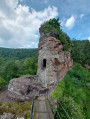
(16) Head down to the left, then to the right towards Fleckenstein Castle (338m). At the track, turn left towards the castle, then right towards the castle and the forest house.

(17) Continue descending to the left and then follow the path down towards the Étang du Fleckenstein. Take the path on the right that descends into the valley, keeping in the same direction, and continue downhill to the road and the Étang du Fleckenstein (D925).

(18) Cross the road and, once past Étang du Fleckenstein, the route takes you past castle ruins, including Froensbourg (alt. 305 m). Continue climbing straight ahead to a pass. Keep heading in the same direction, then follow the path uphill until you approach a pass on the right. Then follow the track and descend to the left towards Château du Froensbourg.

(19) Climb to the right then head left to the track. Continue along the path to the right until you reach a wide bend on the Falkenberg track. Follow it and descend to the left to reach the Hichtenbach Pass (alt. 358 m).

(20) Keep level to the left and continue climbing straight ahead and to the right until you reach the pass. Keep following the path uphill to the Rocher des Bohémiens.

(21 ) Continue along the path and keep straight ahead until you reach the road.

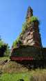
(22) Cross the road and follow it to the left until you reach the hairpin bend. Head straight on towards Wasigenstein Castle (alt. 350 m).

(23) Head down to the left towards Obersteinbach and keep going straight ahead until you reach the stream.

(24) Cross the stream, then turn left. At the road, continue straight ahead to the D3. Head up to the right to the town hall (E).

Waypoints

  1. S : mi 0 - alt. 518 ft - Gare de Wissembourg
  2. 1 : mi 0.28 - alt. 518 ft - Square von Stichaner - Lauter (rivière)
  3. 2 : mi 0.97 - alt. 673 ft - The start of the fields and orchards
  4. 3 : mi 1.22 - alt. 784 ft - Antenna mast
  5. 4 : mi 1.83 - alt. 906 ft - By road
  6. 5 : mi 2.48 - alt. 1,030 ft - Forest House
  7. 6 : mi 3.63 - alt. 1,657 ft - Scherhol
  8. 7 : mi 3.95 - alt. 1,430 ft - Col du Pigeonniet (432m)
  9. 8 : mi 5.51 - alt. 1,152 ft - By road
  10. 9 : mi 5.99 - alt. 1,201 ft - Fourche
  11. 10 : mi 6.57 - alt. 1,129 ft - By road
  12. 11 : mi 7.29 - alt. 833 ft - Petit Wingen
  13. 12 : mi 7.77 - alt. 869 ft - Virage
  14. 13 : mi 8.6 - alt. 928 ft - Crossroads
  15. 14 : mi 9.9 - alt. 1,142 ft - Crossroads
  16. 15 : mi 10.16 - alt. 1,099 ft - Col du Litschhof (335 mètres)
  17. 16 : mi 10.93 - alt. 1,555 ft - Col du Hohenbourg (475m)
  18. 17 : mi 11.69 - alt. 1,106 ft - Château du Fleckenstein
  19. 18 : mi 12.33 - alt. 676 ft - Fleckenstein Pond - Sauer (rivière)
  20. 19 : mi 13.64 - alt. 1,063 ft - Ruins of Froensbourg
  21. 20 : mi 15.09 - alt. 1,175 ft - Col de Hichtenbach (358 mètres)
  22. 21 : mi 16.06 - alt. 1,437 ft - Lindelsberg
  23. 22 : mi 16.38 - alt. 1,309 ft - By road
  24. 23 : mi 16.72 - alt. 1,129 ft - Château de Wasigenstein
  25. 24 : mi 17.38 - alt. 801 ft - Stream
  26. E : mi 18.06 - alt. 787 ft - Obersteinbach Town Hall

Notes

(17) You can make a detour via the Gimbelhof (for lunch or an overnight stay) and reach the castle via the beautiful Roches/Felsenpfad trail (Red Triangle).

Alsace Verte Tourist Office,www.alsace-verte.com, 03 88 80 89 70.

To purchase the magazine featuring this hike, visit the L'ALSACE-DNA Shop

Passion Vosges invites you to explore the Vosges mountains, whether on your own, with family or friends, to discover its majestic peaks, lush foothills and picturesque valleys. With hiking routes, practical advice, local anecdotes and captivating articles from our editorial team, let us guide you into the heart of a region rich in nature and history.

With Passion Vosges, the Vosges mountains will hold no more secrets for you!

Find the full collection of magazines atLa Boutique L'ALSACE-DNA.

Getting to Wissembourg: by train from Strasbourg station (www.fluo.grandest.fr)

Worth a visit

Numerous fortified castles, among the most beautiful in the Northern Vosges, line this first stage and give it a distinctive character. Hohenbourg, Loewenstein, Froensbourg, and of course the semi-troglodytic Fleckenstein Castle perched on its sandstone outcrop. 

Always be cautious and plan ahead when you're outdoors. Visorando and the author of this route cannot be held responsible for any accidents occurring on this route.

The GR® and PR® markings are the intellectual property of the Fédération Française de Randonnée Pédestre.

Reviews and comments

4.8 / 5
Based on 4 reviews

Reliability of the description
4.3 / 5
Ease of following the route
5 / 5
Route interest
5 / 5
Galoupipau
Galoupipau

Overall rating : 5 / 5

Date of your route : May 11, 2026
Reliability of the description : ★★★★★ Very good
Ease of following the route : ★★★★★ Very good
Route interest : ★★★★★ Very good
Very busy route : No

A lovely, easy walk... though it is 30km long!

Machine-translated

User 27429770

Overall rating : 5 / 5

Date of your route : Oct 10, 2025
Reliability of the description : ★★★★★ Very good
Ease of following the route : ★★★★★ Very good
Route interest : ★★★★★ Very good
Very busy route : Yes

High-quality signage, no confusion whatsoever; paths open except for forestry work that blocked access (no alternative route available)
High traffic due to public holiday in Germany

Machine-translated

Fanny Pil.
Fanny Pil.

Overall rating : 5 / 5

Date of your route : Aug 17, 2025
Reliability of the description : Not used / Not applicable
Ease of following the route : ★★★★★ Very good
Route interest : ★★★★★ Very good
Very busy route : No

Trail route. No particular difficulties apart from the length. The trail is very well marked, so there was no need to refer to the description. The route is shaded most of the way.
- two small changes to the route compared to the original trail, between points 3 and 4, then 6 and 7, but again very well marked
- there is a fountain at the stop in Wingen, but you can also get water at the Climbach cemetery and at Fleckenstein Castle (during opening hours, I assume)
- i also followed the rock trail as indicated in the previous comment.

Machine-translated

RandoAnne
RandoAnne

Overall rating : 4.3 / 5

Date of your route : May 10, 2025
Reliability of the description : ★★★☆☆ Average
Ease of following the route : ★★★★★ Very good
Route interest : ★★★★★ Very good
Very busy route : No

Arrived in Wissembourg on the first train.
A walk with no particular difficulties apart from the length.
The route description is not very helpful or precise. You just need to follow the red rectangular signs all the way, and with the GPS track that’s enough.
It’s all in the forest, but it’s varied nonetheless. I really enjoyed it – it’s wild.
Bakery in Climbach.
Dry fountain in Petit Wingen.
Point 16: follow the ‘Sentier des Roches’ path, which runs parallel to the GR but is more scenic.
Nice picnic at Fleckenstein; food available.
In Obersteinbach I hitchhiked to
Reichshoffen and then took the train.
Can’t wait to continue the Vosges crossing!

Machine-translated

Other walks in the area

For more walks, use our search engine .

The GPS track and description are the property of this route's author. Please do not copy them without permission.