


 Country:

 City:
City:


Park in the free car park at the Scherhol Forest House (MF), which is situated on the D3 between the Col du Pigeonnier and Wissembourg.
(S/E) Head north-west, following the ‘Green Ring’ signposting. You’ll soon reach a fork; keep to the right, following the same signposting. Continue down a gentle slope until you reach a multi-way junction at a hairpin bend.
(1) Take the path on the right, which winds downwards in a hairpin bend and is signposted with the Green Ring and Green Triangle. At the end of the descent, you’ll reach another crossroads.
(2) Turn right, following the same signposting, to reach the car park at the National Necropolis.
(3) Continue straight ahead, walk alongside the necropolis and you’ll reach a junction at the cemetery.
(4) Turn left and now follow the shared ‘Green Ring’ and ‘Yellow Disc’ markings. After 300 m, turn left and, 400 m further on, turn right to reach a four-way junction.
(5) Turn left, following the same signposting. Walk along the Franco-German border. After about 250 m, the path climbs into the hills. You’ll reach the crossroads at a place called Bannholz.
(6) Take the path on the right signposted ‘Green Ring’. Pass to the left of Wissembourg Civil Hospital.
After the hospital, at the junction, turn right; 300 m further on, you’ll come out onto the D334. Follow it to the left. At the roundabout, turn right to continue on the D334. After about 250 m, turn left onto a footpath towards Wissembourg town centre and follow it for 400 m, crossing the bridge to reach the Quai du 24 Novembre.
(7) Continue straight ahead, following the ‘Green Ring’ signposts. Cross the bridge over the River Lauter and you’ll come out onto Boulevard Clemenceau (D334). Continue along this boulevard until you reach the Route des Vosges (D77).
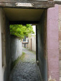
(8) Take the small path opposite, between two houses, signposted ‘Green Ring’ and ‘Green Disc’. Pass by the Wissembourg cemetery, turn right and you’ll find yourself a few metres from the D77.
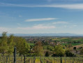
(9) Turn left, then immediately right. Cross the D3 with care. Carry on straight ahead, then through fields and vineyards to reach a crossroads in the hamlet of Roetzmuehle.
(10) Turn slightly right to enter the village of Rott, carry on and arrive at the crossroads opposite the town hall.
(11) Turn right, then take thefirst street on the left, following the same signposting. Pass the lay-by. Then cross the D77, turn left and head for the car park at the Scherhol MF (S/E).

 Visorando Member
 Tourism professional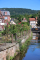
 Very difficult
 Easy
Easy 
