Strangenberg and a visit to Rouffach

This route takes us around the dry Strangenberg hill and to the old episcopal town of Rouffach. As a large part of the route runs through vineyards, you should expect, in places, cobbled or concrete vineyard paths.

Details

n°65498159
Creation:
Last update:
Last review:
  • Walking
    Activity: Walking
  • ↔
    Distance: 7.30 mi
  • ◔
    Average duration: 4h 10 
  • ▲
    Difficulty: Moderate

  • ⚐
    Back to start: Yes
  • ↗
    Ascent: + 935 ft
  • ↘
    Descent: - 922 ft

  • ▲
    Highest point: 1,299 ft
  • ▼
    Lowest point: 669 ft

Photos

Description of the walk

Car park behind Westhalten cemetery.

(S/E) Head up the vineyard path towards the Strangenberg and, further on, turn left.

(1) Follow the path to the right, which joins the Red Triangle-marked trail; follow this to the left. This path reaches the summit of the Strangenberg, leading to the starting point of the trail that runs along the ridge.

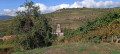
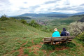
(2) Follow this path northwards, which offers breathtaking views of Westhalten, the Zinnköepfle, the Hohberg, Orschwihr and the entrance to the Vallée Noble, with the Grand Ballon and the Petit Ballon in the background.

(3) Leave this path on the right to join a wider track, which you should follow to the left. Then head right to reach the mobile phone mast.

(4) A path on the left leads to the Oelberg Chapel, winding its way through the thickets.

(5) Follow the wine trail marked with the Red Cross, ignoring the paths on either side. At the crossroads where four paths meet, turn right.

(6) At the water reservoir, follow the bend to the left, leaving the path on the right, and you’ll come out at the roundabout at the foot of Isenbourg Hill.

(7) Turn right onto Rue Pasteur, then left onto Rue du Schauenberg and Rue des Récollets. Walk along the outer wall of the Récollets Convent until you reach Rue des Spahis Marocains.

(8) Turn right onto this street, then left to follow the Promenade des Remparts.

(9) After Rue de la Poterne, head left towards Place de la République and join Rue de la Poterne. Visit the Church of Notre-Dame de l’Assomption, then walk up Rue du Marché, followed by its continuation, Rue du Maréchal Joffre.

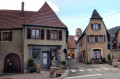
(10) Turn right onto Rue Poincaré, admire the old patrician houses with their oriel windows, and head towards the Restaurant Bohrer (Chez Julien).

(11) Take the small Rue du Château on the left, then turn right onto Rue Ris and follow it to reach the roundabout you passed earlier.

(7) Head back up towards Strangenberg, following the route in the opposite direction to the way out.

(6) This time, turn left onto the path marked ‘Red Ring’. This path forms a circular walk. At the junction, 100 metres further on, it is best to take the upper path, which winds its way up the mountain through the vineyards of the Vorbourg Grand Cru.

(12) Just before the sharp bend to the left on the Red Ring marked path, where it joins the lower path, turn right to reach the Luzelthal.

(13) Turn left at the T-junction, then right 80 metres further on.

(14) Take the hairpin bend to the left and ignore a path on the right to follow the track that skirts the Schlossberg via a fairly steep, unmarked path leading down to Westhalten. Ignore a path leading uphill to the right and, 100 metres further on, you’ll reach a concrete track.

(15) Follow it to the right, then take the road to the left and, before the first houses, turn right onto a path that takes you across the meadows to the cemetery and the car park (S/E).

Waypoints

  1. S/E : mi 0 - alt. 840 ft - Car park above the cemetery. Near the - Croix du Lutzelberg (Westhalten)
  2. 1 : mi 0.35 - alt. 1,010 ft - Path on the right
  3. 2 : mi 0.83 - alt. 1,194 ft - Path running along the ridge
  4. 3 : mi 1.17 - alt. 1,289 ft - Leaving the ridge path
  5. 4 : mi 1.52 - alt. 1,220 ft - Relay station
  6. 5 : mi 1.76 - alt. 1,211 ft - Chapelle de l'Oelberg
  7. 6 : mi 2.68 - alt. 771 ft - Junction point for the outward and return journeys
  8. 7 : mi 2.82 - alt. 709 ft - Roundabout, Rouffach circular loop
  9. 8 : mi 3.18 - alt. 673 ft - Rue des Spahis Marocains
  10. 9 : mi 3.47 - alt. 676 ft - Towards the Place de la République - Église Notre-Dame-de-l'Assomption (Rouffach)
  11. 10 : mi 3.9 - alt. 673 ft - Rue des Spahis Marocains
  12. 11 : mi 4.15 - alt. 673 ft - Restaurant Bohrer
  13. 12 : mi 5.8 - alt. 945 ft - Chemin du Luzelthal
  14. 13 : mi 6.25 - alt. 994 ft - Crossroads
  15. 14 : mi 6.54 - alt. 1,056 ft - Path winding around the Schlossberg
  16. 15 : mi 6.96 - alt. 846 ft - Concrete path
  17. S/E : mi 7.3 - alt. 840 ft - Westhalten, cemetery car park

Notes

There are several restaurants in Rouffach.

Worth a visit

The town of Rouffach, off the beaten track, is well worth a visit for the architecture of its houses (dating from the 14th to the 19th centuries) and for the Church of Notre Dame de l’Assomption. Don’t miss a stroll along the ramparts, the Place de la République with the old Halle aux Grains, the former Town Hall, the former Chapter House and the Church of Notre Dame. It is also a pleasure to treat yourself to a leisurely stroll through the narrow streets of the old town, such as the Rue de la Poterne. Rouffach, now the administrative centre of the canton, is a sleepy town that once enjoyed a prestigious past as the capital of the Obermundat, an episcopal possession.

There are, however, two regrets: the Église des Récollets, which has been left to fall into disrepair and is closed to visitors, and the baffling closure of the Musée du Baillage.

Reviews and comments

3.7 / 5
Based on 2 reviews

Reliability of the description
3.5 / 5
Ease of following the route
3 / 5
Route interest
4.5 / 5
jmpc
jmpc

Overall rating : 3.3 / 5

Date of your route : Mar 23, 2025
Reliability of the description : ★★★☆☆ Average
Ease of following the route : ★★☆☆☆ Disappointing
Route interest : ★★★★★ Very good
Very busy route : No

A lovely walk. We saw some beautiful views and flora and fauna we’d never seen before.
It’s lovely to walk amongst the vineyards.
We didn’t take the right route at the start, which meant we began the walk on a lovely cobbled path; it’s worth taking a wrong turn as this path is absolutely lovely.
As for Rouffach, we couldn’t follow the signposts as it was carnival day. That didn’t stop us from visiting the town, though.
On the way back, thank goodness for the Grand Ballon and the Petit Ballon, and our mobile phone to help us find our way.
We’d highly recommend it.

Machine-translated

Nature57
Nature57

Overall rating : 4 / 5

Date of your route : Nov 18, 2024
Reliability of the description : ★★★★☆ Good
Ease of following the route : ★★★★☆ Good
Route interest : ★★★★☆ Good
Very busy route : No

A lovely way to explore Rouffach and its vineyards on this walk, which offers lovely views both before and after your tour of the town. The app is very useful for following the suggested route through the vineyards.

Machine-translated

Other walks in the area

For more walks, use our search engine .

The GPS track and description are the property of this route's author. Please do not copy them without permission.