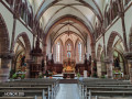
Notre-Dame du Hubel and Saint-Marc Convent, starting from Westhalten

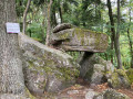
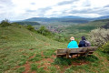
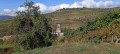
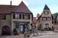
This walk takes you across the Hohberg plateau and its beautiful forests, passing by the Lutzelberg and Plaies Crosses. You can also enjoy the view of the plain before Notre-Dame du Hubel and the beauty of the forest on the Hohberg plateau.

Details

97478450
Creation:
Last update:
Last review:
  • Walking
    Activity: Walking
  • ↔
    Distance: 10.68 mi
  • ◔
    Average duration: 6h 30 
  • ▲
    Difficulty: Moderate

  • ⚐
    Back to start: Yes
  • ↗
    Ascent: + 1,864 ft
  • ↘
    Descent: - 1,857 ft

  • ▲
    Highest point: 1,890 ft
  • ▼
    Lowest point: 833 ft

Description of the walk

Park in the car park at Westhalten cemetery.

(S/E) Take the road leading up to the vineyard; you will very quickly reach the Lutzelberg Cross.

(1) Continue straight ahead along the Discovery Trail, passing the Cross of the Wounds. Continue uphill to reach the multi-directional junction at the Col du Neuland.

(2) Keep left on the road following the Sentier Découverte, marked by a Red Triangle. Then continue to the right to reach Notre-Dame du Hubel.

(3) Turn right, following the Red Triangle markings, to reach the rest area at the junction with the Chemin du Hohberg.

(4) Carry on straight ahead and follow a path running almost parallel to the Chemin du Hohberg. Continue uphill, finishing at the junction by the Heiliger Baum shelter.

(5) Leave the Red Triangle markings here and take the Blue Diamond-marked path to the right. Then cross the Chemin de Saint-Georges and rejoin it a few steps further on.

(6) Continue, then turn left to reach the Saint-Marc inn

(7) Turn left onto the Red Diamond-marked path, then turn right to reach the Saint-Marc Convent.

(8) Retrace your steps along this route to return to the car park at Westhalten Cemetery (S/E).

Waypoints

  1. S/E : mi 0 - alt. 833 ft - Westhalten cemetery car park
  2. 1 : mi 0.08 - alt. 860 ft - Croix du Lutzelberg (Westhalten)
  3. 2 : mi 0.74 - alt. 1,155 ft - Col du Neuland
  4. 3 : mi 1.5 - alt. 1,519 ft - Parking Notre Dame du Hubel
  5. 4 : mi 2.07 - alt. 1,752 ft - Facilities at Hohberg
  6. 5 : mi 3.33 - alt. 1,890 ft - Heiliger Baum
  7. 6 : mi 4.05 - alt. 1,621 ft - Saint-Georges Trail
  8. 7 : mi 4.5 - alt. 1,421 ft - Auberge Saint-Marc
  9. 8 : mi 5.33 - alt. 1,621 ft - Couvent Saint-Marc
  10. S/E : mi 10.68 - alt. 833 ft - Westhalten cemetery car park

Notes

There are two shelters along the route: one at the Vieux Chêne crossroads (former forest house) and the other at (5) Heiliger Baum. Both are pleasant, open spaces but sheltered from the rain.
(7) Auberge Saint-Marc: meals (often by reservation) and drinks available.
Note: on the return journey, it is possible to cross the dry hills of the Zinnkoepfle or the Strangenberg.

Worth a visit

Other walks in the area

For more walks, use our search engine .

The GPS track and description are the property of this route's author. Please do not copy them without permission.