Tro Sant Diboan in Leuhan

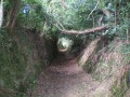
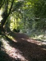
A countryside route along beautiful sunken paths (small ravines in places) and quiet country lanes
Panoramic views of the Montagnes Noires and the countryside, dominated by cattle farming.

Route not accessible in winter (see practical information).

Details

84096
Creation:
Last update:
Last review:
  • Walking
    Activity: Walking
  • ↔
    Distance: 6.62 mi
  • ◔
    Average duration: 3h 30 
  • ▲
    Difficulty: Moderate

  • ⚐
    Back to start: Yes
  • ↗
    Ascent: + 568 ft
  • ↘
    Descent: - 551 ft

  • ▲
    Highest point: 784 ft
  • ▼
    Lowest point: 413 ft
  • ⚐ Country: France
  • ⚐ City: Leuhan (29390)
  • ⚑
    Start/End: N 48.100009° / W 3.785201°
  • ❏
    IGN map(s): Ref. 0618OT
  • Hour-by-hour weather

Photos

Description of the walk

Start: church car park

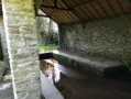
(S/E) From the car park, walk round the church and then take the road opposite that leads down towards the lagooning area. Look out for an old wash house on the left. The arrangement of the stones clearly shows how the women used to stand to wash the laundry. Continue and, at the Roz Ar Goyou three-way junction, take a wide path on the right. Follow it until you reach a small road at a pumping station.

(1) Turn left and continue along the road, which climbs gradually. Pass Ty ar Galant and Saint-Nicolas (viewpoint). After Saint-Nicolas, look out for a small fountain with a gabled roof on the left. Continue until you come out of a bend

(2) Turn right onto a small path (on the left, access path to Roz Ven farm).
Follow this path down to a small road. Cross it.

(3) Find the continuation of the path slightly to the left opposite a house with blue shutters (the path entrance is not very visible). Continue along the path, which becomes a little muddy in places. When you reach a small road, turn right and continue to the entrance to the courtyard of Kerdréoret farm. (Pass the entrance to the yoga centre on your right)

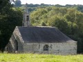
(4) Turn right onto a steep, narrow path that descends (some sections may be a little slippery). At the three-way junction, take the path on the right, cross the stream and continue left to climb up to the Sant-Diboan chapel in Gouélet (ideal for a break)

(5) Then follow the small road. Pass Kerlinou, and continue along the same road, ignoring the side paths, until you reach the sign for Pen-Harz (Penhars on the map) on the left.

(6) Take this road to the house (watch out for the dog on a lead as it is quite long) and head down to the right along a very steep, narrow path that leads to a wide stream, Stêr Roudou, which often overflows (you can partly avoid it by going through the field on the right)

(7) Continue uphill to join the D51, which you take to the right. Follow this road.

(8) At the crossroads, leave the D151 leading to Leuhan on your right and take the D51 opposite, which climbs. After about 300m, at a bend, turn right onto a path that runs alongside a field (view of the village of Leuhan). Continue along this path, which turns right and becomes more steep-sided.

(9) When you reach a stretch of road, turn right to continue along a path leading to Guernévé (Guernevez on the map).

(10) Turn right and follow Rue du Stade, then right onto Rue de la Mairie to return to the church and the car park (S/E).

Waypoints

  1. S/E : mi 0 - alt. 564 ft - Church car park
  2. 1 : mi 0.94 - alt. 617 ft - Pumping station
  3. 2 : mi 1.54 - alt. 774 ft - Path on the left
  4. 3 : mi 1.87 - alt. 725 ft - : Path opposite
  5. 4 : mi 2.4 - alt. 640 ft - Steep, narrow path
  6. 5 : mi 3.05 - alt. 528 ft - Sant-Diboan Chapel
  7. 6 : mi 4.18 - alt. 525 ft - On the left, road leading down to Penhars
  8. 7 : mi 4.51 - alt. 413 ft - Crossing the Stêr Roudou stream
  9. 8 : mi 5.43 - alt. 545 ft - Junction of the D51 and D151
  10. 9 : mi 5.87 - alt. 545 ft - Path continuing along the road
  11. 10 : mi 6.23 - alt. 581 ft - Rue du Stade on the right
  12. S/E : mi 6.62 - alt. 564 ft - Church car park

Notes

Toilets near the church.
Shelter at (5) near the chapel
Ideal route during chestnut-picking season: a guaranteed harvest.

Route impassable in winter: flood-prone sections, mud and slippery ground.

Worth a visit

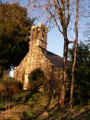
The parish church of Leuhan, dedicated to Saint Thélaus.

The parish church of Leuhan dates from the 16th century and houses a remarkable triptych, polychrome wooden statues of Saint Yves, the poor man and the rich man, and a statue often overlooked depicting the Virgin Mary in pregnancy, a very rare representation.
On the churchyard, the Calvary also dates from the same period. Right next to it is an unusual feature, ‘the town crier’s stone’, from which the town crier would announce good and bad news to the parishioners every Sunday.
Those wishing to visit the church can contact the town hall or local shops (except on Mondays) to obtain the key.

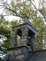
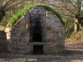
Saint-Diboan Chapel and its fountain: Pilgrims usually take some earth from beneath the chapel’s altar to seek healing. Similarly, the water from the relocated fountain is said to cure leg abscesses when mixed with earth to make a poultice.
Attractive outdoor statue.

Nearby

Trévarez Estate in Trégourez. Trévarez Estate
A must-see site in Central Finistère, listed as a 20th-century heritage site, the Domaine de Trévarez, built at the end of the 19th century by James de Kerjégu, captivates visitors with its ‘Belle Époque’ château of pink brick and Kersanton stone.
Set in the heart of a magnificent 85-hectare woodland and flower park, designated a ‘Remarkable Garden’, the estate is renowned for the beauty of its collections of camellias, rhododendrons (National Collection status) and hydrangeas, offering visitors a display of blooms that changes with the seasons.

Reviews and comments

4.4 / 5
Based on 7 reviews

Reliability of the description
4.6 / 5
Ease of following the route
4.4 / 5
Route interest
4.1 / 5
FLOCH
FLOCH ★

Thank you for this review.
It's a quiet time of year in the countryside.
That's how I discovered it.
It's also an interesting route during the chestnut season.

Machine-translated

catherineQr
catherineQr

Overall rating : 4.7 / 5

Date of your route : Jun 08, 2021
Reliability of the description : ★★★★★ Very good
Ease of following the route : ★★★★★ Very good
Route interest : ★★★★☆ Good
Very busy route : No

Not really suitable in winter, as the path is stony and muddy. However, it's a lovely walk under the canopy of trees, so it's nice and shady. I didn't see anyone else there on Sunday, so it's very peaceful. Plan to stop for a break at the chapel, which is a relaxing spot.

Machine-translated

FLOCH
FLOCH ★

Hello and thank you for your feedback.
I mentioned this issue in the practical information section.
I will add it to the introduction and highlight it.

All the best on Visorando.

Machine-translated

Sylvie Chatalic
Sylvie Chatalic

Overall rating : 5 / 5

Date of your route : Jul 02, 2020
Reliability of the description : ★★★★★ Very good
Ease of following the route : ★★★★★ Very good
Route interest : ★★★★★ Very good
Very busy route : No

DO NOT DO IN WINTER AS IT IS UNFEASIBLE, BUT OTHERWISE A VERY BEAUTIFUL HIKE.

Machine-translated

Héric
Héric

Overall rating : 4 / 5

Date of your route : May 15, 2017
Reliability of the description : ★★★★☆ Good
Ease of following the route : ★★★★☆ Good
Route interest : ★★★★☆ Good

The route is well marked, but signs at key junctions have been vandalised or broken.
A very beautiful route to do in dry weather, as in winter it must be wet... In the last third, there is a very large tree across the path... It is possible to go around it...

Machine-translated

Marcheurs des 4 saisons

Overall rating : 4.7 / 5

Date of your route : May 03, 2017
Reliability of the description : ★★★★★ Very good
Ease of following the route : ★★★★☆ Good
Route interest : ★★★★★ Very good

As hiking is a time for sharing, our mistakes were due to our lack of vigilance.

Machine-translated

Eric B15.
Eric B15.

Overall rating : 4 / 5

Date of your route : Mar 21, 2016
Reliability of the description : ★★★★☆ Good
Ease of following the route : ★★★★☆ Good
Route interest : ★★★★☆ Good

Hello, some sections are difficult due to muddy or flooded paths, but otherwise it's a pleasant walk with interesting sites (fountain, chapel, sunken paths, etc.) and beautiful views.

Machine-translated

Jeannine G1.
Jeannine G1.

Overall rating : 4 / 5

Date of your route : Sep 08, 2015
Reliability of the description : ★★★★☆ Good
Ease of following the route : ★★★★☆ Good
Route interest : ★★★★☆ Good

Hello,

I really enjoyed this walk, which was fairly easy on my own with my two dogs, except on the small roads where I had to put them on a lead for safety reasons.

I just had a bit of trouble finding a path after Saint Nicolas. I crossed a large field thinking that the path had been included in the field... some kind farmers put me "back on the right track".

It was a first for me in many years!

Thank you.

Machine-translated

ramses56
ramses56

Overall rating : 4.3 / 5

Date of your route : Sep 27, 2015
Reliability of the description : ★★★★★ Very good
Ease of following the route : ★★★★★ Very good
Route interest : ★★★☆☆ Average

A route where you can discover beautiful views and a pretty chapel, but which mostly follows the tarmac road, although it is true that very few vehicles use it on a Sunday morning in this small village.

Machine-translated

Other walks in the area

For more walks, use our search engine .

The GPS track and description are the property of this route's author. Please do not copy them without permission.