Kernével and the surrounding area

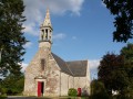
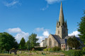
A route starting from Kernével Church to explore the surrounding countryside.

Details

n°1699865
Creation:
Last update:
Last review:
  • Walking
    Activity: Walking
  • ↔
    Distance: 5.77 mi
  • ◔
    Average duration: 2h 50 
  • ▲
    Difficulty: Easy

  • ⚐
    Back to start: Yes
  • ↗
    Ascent: + 203 ft
  • ↘
    Descent: - 213 ft

  • ▲
    Highest point: 495 ft
  • ▼
    Lowest point: 305 ft
  • ⚐ Country: France
  • ⚐ City: Rosporden (29140)
  • ⚑
    Start/End: N 47.958891° / W 3.777526°
  • ❏
    IGN map(s): Ref. 0620ET
  • Hour-by-hour weather

Photos

Description of the walk

Park in the car park at Place de l’Eglise.

(S/E) Walk round the church, past the bakery, and turn into Rue du Cimetière. After the cemetery, take the first left towards Bourg Neuf.

(1) At the end of this road, turn left into Rue de la Métairie. After passing a dead end, turn into the path on the right. At the end of this path, head left onto the road.

(2) At the Croix des Fleurs roundabout, take the road leading to the right. Pass the stadium and take the second road on the right.

(3) After passing under the power line, take the path on the left which forms a hairpin bend. Then cross the road and head towards La Grande Boissière.

(4) At the left-hand bend, carry on straight ahead along the track opposite. At the end of this, follow the road to the right until you reach the crossroads and turn right.

(5) At a place called Bourdel, take the road that branches off to the left after the houses. At the end of this road, turn right and then, at the junction, take the path to the left. When you reach the small road, take the path branching off to the left just before the D782.

(6) At the end of this track, at a place called Kérantou, turn left and, at Goarem Kernadu, continue along the track to the right near the houses. When you reach the crossroads, turn left and immediately take the track to the right which joins a road before the railway line. Follow this road to the left for about fifty metres.

(7) Turn right to cross the railway line. Continue along this road and take the first left towards La Haie. Continue along this road and the track that extends from it until you reach the railway line again.

(8) Cross the railway line again, turn immediately left onto the small road and then right onto the Venelle de Pont Rhun. Continue straight on to reach the starting point (S/E).

Waypoints

  1. S/E : mi 0 - alt. 387 ft - Kernével Church
  2. 1 : mi 0.48 - alt. 381 ft - On the left, Rue de la Dairy Farm
  3. 2 : mi 0.86 - alt. 358 ft - Croas ar Bléon roundabout (Croix des Fleurs)
  4. 3 : mi 1.46 - alt. 400 ft - Path on the left after the power line
  5. 4 : mi 1.74 - alt. 423 ft - La Grande Boissière
  6. 5 : mi 2.47 - alt. 466 ft - Bourdel hamlet
  7. 6 : mi 3.39 - alt. 430 ft - Kérantou hamlet
  8. 7 : mi 4.44 - alt. 371 ft - Crossing the railway line
  9. 8 : mi 5.39 - alt. 325 ft - Cross the railway line again
  10. S/E : mi 5.77 - alt. 387 ft - Kernével Church

Reviews and comments

4 / 5
Based on 2 reviews

Reliability of the description
4 / 5
Ease of following the route
4.5 / 5
Route interest
3.5 / 5
Thygus29
Thygus29
• Edited:

Overall rating : 4 / 5

Date of your route : Jan 19, 2020
Reliability of the description : Not used / Not applicable
Ease of following the route : ★★★★★ Very good
Route interest : ★★★☆☆ Average

A nice little outing with quite a bit of road driving at the start, which we soon came to regret given what lay ahead on the tracks!
It was very peaceful, the sun was shining, and there was hardly any traffic.
There isn’t much to see or visit along this route, but a few beautiful panoramic views will be a real treat for the eyes.
Many thanks for this ride!
Thierry.

Machine-translated

oregon650
oregon650

Overall rating : 4 / 5

Date of your route : Jan 21, 2019
Reliability of the description : ★★★★☆ Good
Ease of following the route : ★★★★☆ Good
Route interest : ★★★★☆ Good

Normally passable in winter, apart from the section near Trémélé Farm – watch out for a large puddle at times; the section near the embankment is tricky, but the rest of the route is fine
It’s at the start that there’s the longest stretch of road to cover
Good point: on arrival, just after crossing the railway line, you need to keep to the left for a short stretch rather than heading back up the road, which has bends that are dangerous for pedestrians

Machine-translated

Other walks in the area

For more walks, use our search engine .

The GPS track and description are the property of this route's author. Please do not copy them without permission.