The Swiss Jura Alpine Pastures, starting from Les Malettes

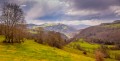
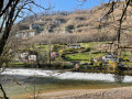
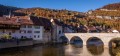
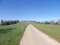
Through wooded pastures, forests, isolated farms and hamlets, with stunning views of the surrounding mountains and the Doubs valley. The route starts at a place called Les Malettes, at the junction of the roads to Les Rangiers and Saint-Ursanne.

Details

99958487
Creation:
Last update:
Last review:
  • Walking
    Activity: Walking
  • ↔
    Distance: 5.49 mi
  • ◔
    Average duration: 3h 15 
  • ▲
    Difficulty: Moderate

  • ⚐
    Back to start: Yes
  • ↗
    Ascent: + 827 ft
  • ↘
    Descent: - 810 ft

  • ▲
    Highest point: 3,081 ft
  • ▼
    Lowest point: 2,448 ft

Description of the walk

Start from the hamlet known as ‘Les Malettes’; the car park is on the right after the building.

S/E) Return to the road junction and take the forest track on the right signposted ‘Col de la Croix’; follow this track as it climbs to the ‘Montgremay’ farm.

(1) Before reaching the farm, take the path on the right which climbs up to the ridge, and continue to the left, crossing the hang-gliding launch site; at the bottom right, there is a view of the village of “Cornol” to the north-north-west. Continue along the path, crossing two fences using the ladders provided for this purpose.

(2), The path leads into the forest; continue along this ridge path until you cross a pasture. The path continues along the ridge through the forest, then descends towards the “Col de la Croix” track.

(3), Once you reach the track, take it to the left.

(4), Pass through the small hamlet of “Outremont” ( yurts on the left) and continue along the track. At the Y-junction, go straight on, past the “Les Grangettes” farm. Continue along this track.

(5), When you reach the road to “St Ursanne” (take care), head up the road on the left-hand side.

(S/E), You will reach the car park.

Waypoints

  1. S/E : mi 0 - alt. 2,595 ft - Les Malettes, Route des Rangiers
  2. 1 : mi 0.68 - alt. 2,946 ft - Montgremay Farm
  3. 2 : mi 1.25 - alt. 3,009 ft - Forest Trail
  4. 3 : mi 2.77 - alt. 2,572 ft - Chemin du Col de la Croix
  5. 4 : mi 3.2 - alt. 2,474 ft - The hamlet of Outremont
  6. 5 : mi 5.37 - alt. 2,612 ft - Route de St Ursanne
  7. S/E : mi 5.49 - alt. 2,595 ft - Les Malettes

Notes

Make sure you close the gates behind you and dress appropriately for the weather.

Worth a visit

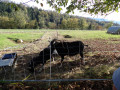
Stunning views of the surrounding hills and villages: the Ajoie to the right, the Clos du Doubs to the left, and the Alps on a clear day. There are numerous herds of cows in the pastures, curious about your presence. Please do not disturb them.

Other walks in the area

For more walks, use our search engine .

The GPS track and description are the property of this route's author. Please do not copy them without permission.