Country:

 City:
City:



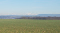
The route starts from the Stade de la Prairie, at the foot of the Fougères neighbourhood, along the D36.
(S/E) With your back to the football stadium, leave the car park by turning left to join the greenway, which you follow to the right. Turn right under the tunnel and then immediately left. Follow the path as it veers slightly to the right uphill, following a stream. You’ll reach a road which you cross: you’re now at Étang Neuf.
(1) Continue straight ahead along the path that winds through the woodland and takes you to the École des Quatre Vents (make sure you climb all the way to the top of the woodland before turning left).
(2) Walk past the school on your left and cross over to take the path opposite you, running alongside the houses. Ignore a path branching off to the right and stay on the one that veers slightly to the left: if the weather is on your side, you’ll have a magnificent view of the mountains, Mont Blanc, the Bugey and so on...
Follow this path to the Pavillon des Quatre Vents, a mysterious building whose origins and significance remain unknown.
(3) Cross the road and take the path, which soon becomes a descent. You’ll reach the D36, which you should cross carefully.
(4) Walk up the road opposite, then turn right to find a path (to the right of the house). At the edge of the meadow, turn left then right to enter the copse. Follow this path, which first turns right then left before descending and turning into a flight of wide steps.
(5) Join another path coming from the right, turn left and you’ll reach a road which you should cross. Continue along the road, even though it’s a no-entry road.
(6) Turn right onto the path between two hedges and allotments. Go through a tunnel and take the path that climbs to the left, running alongside a few blocks of flats. Keep left between more allotments and then a few detached houses.
(7) Turn right onto the path which leads up onto the footbridge and takes you over the road leading down to La Verpillière. Pass asecond footbridgeon your right and you’ll reach the Rudy Van Abeele Stadium.
(8) Walk along the right-hand side of the stadium and go through the tunnel under Boulevard de Villefontaine: you are now in Parc du Velllein.
(9) Head back up the greenway, immediately on the right after the tunnel. Follow it after crossing Rue du Driève until you reach a circular car park on your left.
(10) Turn left after this car park. Fancy a longer walk? (see practical information). Otherwise, walk past the tennis courts and then the baseball ground. When you reach a school, turn left and then right at the metal gate to go through the tunnel under the Route de Saint-Quentin Fallavier. Turn right at the tunnel exit and then left onto the path through the woodland.
(11) At the embankment of a former pond, walk down it and go round the Vallon du Layet following the path (if you want to take a shortcut, on the embankment, take the path that goes straight up to the right) until you reach a wide track.
Take this path to the left, walk up to the EDF pole, then you’ll reach a small road linking Bonnefamille to Villefontaine.
(13) Turn left, then take the path on the right, which is blocked by a chain. At the end of this path, climb the steep flight of steps directly in front of you. You’ll arrive in the La Noyera housing estate. Continue along the path opposite, veering very slightly to the right. You’re now on a lovely wide path; follow it to the right and it will take you down to the Étang de Vaugelas.
(14) Walk between the Jacques Anquetil sports hall and the Lionel Terray Stadium, skirt past the Saunia Delaunay secondary school and take the path leading down to the right just after it. Finally, go through the tunnel under the road.
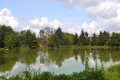
(15) Turn right to go round the Étang de Vaugelas, cross the road, the car park and then the road again. Take the greenway directly in front of you.
(16) Turn onto the path on the left, which will take you round the Étang de Saint-Bonnet.
(16) You can return directly to the Stade de la Prairie car park by staying on the greenway (S/E).

 Visorando Member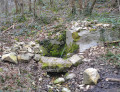

 Easy
Easy