Country:

 City:
City:


Starting point: L’Isle-d’Abeau station. Free car park.
(S/E) Go under the railway line to exit the station at the rear.
(1) Turn right onto the cycle path alongside the railway line.
(2) At a place called Le Temple de Vaulx, take the road uphill to the left, then the path running alongside the stables. Continue to the roundabout at the end of Boulevard des Trois Vallons.
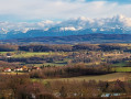
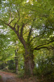
(3) Turn right to enter the Bois de Montgeard. When you reach the sign showing the map of the estate, take the path on the right. Follow the main path until it joins a country lane, then follow this to the left, heading uphill to the viewpoint overlooking Isle-d’Abeau and the surrounding area.
(4) At the top of the climb, head back into the woods to join another country lane, which you should follow to the left until you reach the edge of the Golf des Trois Vallons.
(5) Turn left onto the road leading to Saint-Alban-de-Roche and enter the village until you come out onto Rue de la Roche.
(6) Carry straight on along this street, then turn left just before you reach the town hall and the church to take the White Cross Road. Turn right at the three-way junction and continue to the next crossroads.
(7) Turn right, staying on the same street, and carry on until you reach the railway line.
(8) Turn left onto the country lane and follow the railway line to the station.
(1) Head right to go back under the tracks and reach the station (S/E).

 Visorando Member
 Moderate