


Refine your search for walks in Vieille-Brioude
Vieille-Brioude walks


 Vieille-Brioude Vineyard Museum
 Visorando Member
 0.19 mi
 +16 ft
 -16 ft
 0h 05
0h 05
 Easy
Easy
 Departure from Vieille-Brioude (Haute-Loire)
A short walk around the church of Vieille-Brioude, in an open-air eco-museum dedicated to vines and wine, in the form of a succession of small priests' gardens.
The heights of Vieille-Brioude from Costes-Cirgues to Dintillat via Le Monteil
5.88 mi
+748 ft
-843 ft
3h 20
 Moderate
Departure from Vieille-Brioude (Haute-Loire)
Moderate
Departure from Vieille-Brioude (Haute-Loire)
The route follows a variety of paths and landscapes, offering superb panoramic views of the Auvergne mountains, including the Puy de Dôme and the Allier valley. The trails lead to pastures, woods and streams.
Walk in Brioude
0.82 mi
+39 ft
-39 ft
0h 25
Easy
Departure from Brioude (Haute-Loire)
A discovery walk in Brioude, a small town in Auvergne boasting one of the most beautiful Romanesque churches in the region, the Basilica of Saint-Julien.
From the banks of the Senouire to the Allier
 11.81 mi
+1,270 ft
-1,270 ft
6h 30
11.81 mi
+1,270 ft
-1,270 ft
6h 30
 Difficult
Departure from Lavaudieu (Haute-Loire)
Difficult
Departure from Lavaudieu (Haute-Loire)
Lavaudieu, listed as one of the "Most Beautiful Villages in France", will be the starting point for your hike.
During the first part of the hike, you can admire beautiful views of the Cézallier, the Massif du Sancy and the Puy de Dôme. During the second part, you will follow the Allier gorges on a balcony trail. During the last part, you can discover a magnificent chapel and pastoral meadows.
From the banks of the Senouire in Lavaudieu to the red stones of the village of Buze
6.26 mi
+433 ft
-413 ft
3h 15
Easy
Departure from Lavaudieu (Haute-Loire)
Lavaudieu is one of the most beautiful villages in France.
This walk invites you to leave the village and stroll through the surrounding hills, passing through villages such as Buze, whose houses are built of red arkose.
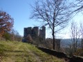
Along the Senouire: from Lavaudieu to Château de Domeyrat.
 8.33 mi
+686 ft
-659 ft
4h 25
Moderate
Departure from Lavaudieu (Haute-Loire)
8.33 mi
+686 ft
-659 ft
4h 25
Moderate
Departure from Lavaudieu (Haute-Loire)
Along the Vallée de Dieu (Valley of God), the former name given to the Senouire valley, this walk combines the pleasure of walking with the discovery of the Haute Loire's heritage. It takes us from the village of Lavaudieu, one of the most beautiful villages in France, to the impressive towers of the medieval castle of Domeyrat.
Left bank of the Allier and Limagne from Brioude to Cohade
6.70 mi
+39 ft
-36 ft
3h 05
Moderate
Departure from Brioude (Haute-Loire)
During this leisurely stroll, you’ll discover the banks of the Allier, the Limagne de Brioude plain and the village of Cohade.
Frugières-le-Pin - Vals-le-Chastel circular via Aubagnat
6.07 mi
+961 ft
-981 ft
3h 40
Moderate
Departure from Frugières-le-Pin (Haute-Loire)
In good weather, this route offers superb panoramic views of the Auvergne mountains at Fiossat. From the coudert (communal land) at Le Pin, you will have a magnificent view of the Château de Domeyrat. A visit to Vals-le-Chastel is a must: castle, church and seigneurial chapel. At Frugières station, you can visit the Resistance Museum and, on the way back, don't miss the church in Frugières.
Circular route around the hill overlooking Saint-Ilpize and the Allier via Chazieux
3.80 mi
+643 ft
-640 ft
2h 20
Easy
Departure from Saint-Ilpize (Haute-Loire)
This circular path offers a continuous and exceptional panorama of the Allier valley. The path is made up of rounded stones, where you can sometimes see the tracks of the iron wheels of carts. Although today the landscape is a heath where bushes, broom and prickly pears grow, before the phylloxera attack it was an important vineyard. As you pass through the village of Chazieux and the old town of Saint-Ilpize, you will notice numerous wine cellars. Today, the vineyard is being revived. Vines are planted in the village of Auzat on the left bank and the old grape varieties are preserved in the vine conservatory located before the village of Chazieux.
Circular route on the right bank of the Allier river starting from Allevier.
3.96 mi
+331 ft
-351 ft
2h 05
Easy
Departure from Azérat (Haute-Loire) (Haute-Loire)
Starting from Allevier, the route climbs through fields and villages, then enters the woods. Throughout the route, you will have a splendid view of the Sancy, Cézallier, Cantal and Margeride mountains.
Senouire Valley from Domeyrat
4.15 mi
+177 ft
-177 ft
2h 05
Easy
Departure from Domeyrat (Haute-Loire)
This route allows you to discover the Senouire valley between Domeyrat and Esbelin, a small "limagne" (flat area) framed by wooded slopes. The Senouire accompanies you with its murmurs all along the route, where you can sometimes hear it without seeing it. The majestic 12th-century feudal castle with its imposing ruins dominating the village is sure to impress, and the old Romanesque bridge completes the medieval feel of the village.
Panoramic view of Chaliergues (Paulhaguet basin)
4.57 mi
+269 ft
-272 ft
2h 20
Easy
Departure from Salzuit (Haute-Loire)
This route passes through the villages on the eastern side of the Paulhaguet basin called Le Chaliergue. It corresponds to the lower volcanic plateau of Paulhaguet, at around 600 m, drained by the Senouire. The name was once written Callianicum and refers to stones, a stony area; it is also known as the Paulhaguet plateau. The panorama opens up from Jaroussier and Scombalou.
Circular Étang de Lavaux in Saint-Préjet-Armandon
5.18 mi
+614 ft
-607 ft
2h 55
Easy
Departure from Domeyrat (Haute-Loire)
Starting from the Lavaux Pond (the pond is a former clay quarry), the route crosses pastures and fields and then reaches the woods on the heights of Saint-Préjet-Armandon.This route passes through villages with houses built from basalt stones from a distant volcanic period. Take the time to wander through the villages and notice the old workshops of blacksmiths and carpenters, and the communal ovens. Listen carefully and you may hear the sound of a hammer on an anvil or a carpenter's saw... These villages, once bustling with activity, are now quiet.
Pruneyrolles circular starting from Blassac
 6.92 mi
+1,345 ft
-1,322 ft
4h 20
Moderate
Departure from Blassac (Haute-Loire)
6.92 mi
+1,345 ft
-1,322 ft
4h 20
Moderate
Departure from Blassac (Haute-Loire)
A moderately difficult walk suitable for families, taking you through woods, hills and forests of beech, oak and fir trees.
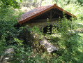
The forgotten mineral waters of Clémensat
 6.77 mi
+866 ft
-853 ft
3h 50
Moderate
Departure from Azérat (Haute-Loire) (Haute-Loire)
6.77 mi
+866 ft
-853 ft
3h 50
Moderate
Departure from Azérat (Haute-Loire) (Haute-Loire)
A walk through woodland, vineyards, farmland and orchards in the plains and mountains of Livradois.
Forests, meadows and fields in Champagnac-le-Vieux
5.88 mi
+1,220 ft
-1,217 ft
3h 45
Moderate
Departure from Champagnac-le-Vieux (Haute-Loire)
Take a stroll through the southern part of the commune near the village of Le Boucharel, where woodland, fields and meadows alternate.
Relive the past through rustic ruins, old farming equipment and modern-day agriculture set in unspoilt countryside.
In summer, this route is shaded.