Country:
 City:
City:


Park in the François Attibert car park (Hervé Bazin Cultural Centre; Slate Museum).
Blue-marked route, FFRP standard. Circular route that can be walked in either direction. Adjustable distance – see explanations in the ‘during the walk’ section.
(S/E) From the car park, head east and walk past the media library on your right. Cross the Square de l’Union and come out onto Rue Raymond Lefèvre. Follow this street to the right, then turn left into the Cité des 7 Parcelles, onto Rue Émile Zola. Cross the road and enter the Parc du Vissoir.
Cross the park to the right, passing close to the Salle Aragon on your right and the small pond hidden in the copse; before reaching the low schist stone wall, take the wide path on the right. Exit via the south exit of the park. Cross Rue Joseph Bara and head straight ahead. As soon as you’ve crossed the street, at the Fork in the road, turn right. You’ll reach the old Petit Anjou railway line.
(1) Follow it towards the street opposite. Cross Rue Ferdinand Vest at the pedestrian crossings and take Rue Daniel Rouger opposite. When you reach Boulevard Jean Pena, walk up it to the left for a few metres and cross it to reach the pumping station opposite; leave the car wash on your left and walk across the grass to turn right after the pumping station. Return to Rue Daniel Rouger, heading left. Pass close to the Églantine stadium on your right and head towards the allotments at the end of the road. After the allotments, continue to the corner with the horse paddock and before the concrete bollards.
(2) Turn onto the path on the right that runs alongside the horse paddock. Reach the old Loire embankment (Rue Camille Perdriaux – D952) and walk along its foot to the left. When you reach the travellers’ campsite, walk back up to the level of the embankment. Continue along the D952 on your right-hand side and take the path opposite which runs alongside the Petite Vicomté solar power station.
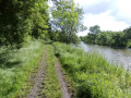
(3) Immediately after the solar power station, turn left. Pass close to the power station’s information point on your left and head back down towards the banks of the Authion via the path on the right. Follow the Authion north-eastwards (on your right). Walk alongside the Authion for about 1 km until you reach the Ru du Lapin.
(4) Cross the Ru du Lapin and continue along the banks of the Authion for a further 1 km. When you reach the Port de la Chevallerie (the Authion ferry, which operates from April to October and takes you to La Daguenière),
(5) Head north (left) along the Chemin de la Chevallerie; shortly afterwards, you’ll reach the Levée Napoléon (III), at the highest point of the Chemin de la Chevallerie.
(6) Turn left onto the Levée Napoléon (III) and follow it for about 300 metres, until you reach the next junction.
(7) Take the path that bends sharply to the right, the Allée de l’Authion (the former Petit Anjou railway line). Follow this path. Pass Grand Ronceray. Join the Route d’Andard (Rue Pasteur D4) and follow it to the left, heading west. After the cemetery, on your right, cross Rue Pierre Sémard and take the side lane immediately on the right, crossing the car park. Head left along Rue Joseph Le Sciellour. Go through the small park opposite and, at the Fork in the road, take the path on the left. Join Rue Pasteur (D4) via ‘rue’ Ferrer, walking alongside Saint-Pierre Church on your left.
(8) Walk westwards (to the right) along Rue Pasteur (D4), passing the former gendarmerie on the right-hand side of the street (No. 50 – La Marianne: see the La Marianne uprising). You’ll reach Place Olivier Thuau, opposite the town hall forecourt, on your right.
Turn left onto Rue des Toises. Walk between the shops and join Rue du 19 Mars 1962, following it to the left. After the bends, take the path on the right which climbs up and leads to the Biotteau Stadium. Cross the car park towards the glass recycling bins. Behind these, take the path leading down towards the Levée Napoléon (III). Follow this embankment south-west (to the right) for a few metres.
(9) After the junction, follow the path that gradually descends to the left (remnant) of a fitness trail (“Walk whilst breathing deeply”) and run alongside the embankment below it. Follow the embankment in parallel for 300 metres, then head back up towards it and take it to the left. Go round the Villeneuve-Napoléon Quarry site by following the fence.
Immediately after the fence, near the solar power station (on your left), turn right and continue along the “Loire à Vélo” route, skirting the quarry. Reach the highest point of Le Buisson (“Terril-Napoléon Viewpoint”) by continuing along the “Loire à Vélo” route for just over a kilometre. Temporarily leave this tourist route to the left before the old railway line below
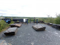
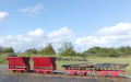
(10) Climb up to the viewing point and admire the panorama: a 360° view of the disused slate quarry, the Val d’Authion, the Loire Valley and the Angers conurbation. Head back down to the “Loire à Vélo” cycle route via the same path you took on the way up. Turn left twice and follow the railway line on your left-hand side. This is the former Ardoisières railway line, which was used to transport slate and workers from the quarries to the cutting works (where the slate was processed into roofing slates).
(11) Pass close to the Arena Loire multi-purpose hall (on your right). Cross Rue Ferdinand Vest (D4) via the Malembert Bridge and head down towards Rue Ambroise-Croizat, following the “Loire à vélo” route. Pass between the blocks of schist, go round the chicane and follow the “Loire à vélo” sign, which heads up Rue Ambroise-Croizat to the right. After about 200 m, leave the “Loire à vélo” route and turn left into Rue François Inizan. Follow this street, passing the bakery on your right.
(12) Cross Boulevard Dautel at the pedestrian crossings opposite the bakery and head for Parc du Vissoir opposite. Pass between the wooden barriers and, immediately after them, turn right between the trees. Make your way to the pond behind the mound, passing close to the shelter (a structure for anglers). Walk along the edge of the pond to the right along the dirt track. Continue along the edge of the pond, taking the path on the left. Cross the small wooden bridge. Once you’ve passed the spawning ground (on your right), turn right before the schist stone wall and walk along this low wall towards the park’s exit.
Take the exit opposite and head towards Rue Raymond Lefevre via Rue Émile Zola opposite (the ‘Cité des 7 Parcelles’ is on your right). Turn right onto Rue Raymond Lefevre for a few metres and, when you reach the pedestrian crossing, cross the road and take the narrow path between the houses. Cross the Square de l’Union and you’ll come out at the François Attibert car park (S/E).



 Visorando Member

 Easy
Easy 
 Tourist office