Country:
 City:
City:


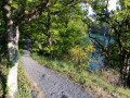
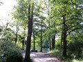
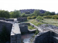
Half of the route runs through former industrial wastelands and urban areas (parks, squares, gardens, shared pathways, etc.).
Park at the François Attibert car park (Hervé Bazin Cultural Centre; Slate Museum).
Route marked in red, in accordance with FFRP standards. The circular route can be walked in either direction. The distance can be adjusted; see the explanations in the ‘During the walk’ section.
(S/E) From the car park, head west, pass the Slate Museum reception on your right and, immediately after the house adjoining the museum, take the path on the right. Pass through the gates and cross the Petit Pré site heading north-west. Leave the old Petit Pré pond on your left, walk past the foot of the majestic chestnut tree on your right, and exit the site by passing through the gates. Immediately turn left onto the path leading to Rue Maurice Poperen. Cross the street and follow Rue du Petit Pré for a few metres. After the third house, turn right onto the path that runs between numbers 6 and 8 and leads to Square de La Noue. Follow the street of the same name opposite and exit between the posts on the left to reach Rue Pierre Pilard.
Turn right onto this street and stay on the pavement on the right to continue along Rue Edouard Vaillant.
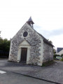
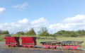
(1) At the junction of these streets, opposite, is the little Chapelle Saint-Lézin. Walk up Rue Edouard Vaillant towards the east and go round the Saint-Lézin roundabout on the right, crossing Rue Poperen, Rue Vaillant and the D117 to enter the Parc des Ardoises via the Saint-Lézin entrance. Walk past the standing schist blocks and take the path that climbs uphill. Decorative railway carriages can be seen on your left. At the top of the hill, take the path that veers slightly north-west and head back down towards the “Loire à vélo” cycle route.
(2) Immediately at the junction, turn left heading due west. Pass the “iron chimney” (a former slate support structure – see: artwork “Le parfum de l’ardoise”) on your right. Continue straight ahead along the straight path. Follow the old compressed-air pipe, which has been replaced by fallen tree trunks on your left. At the first barrier to prevent cars, turn right, cross the “Loire à vélo” route and take the path that runs between the two old quarries. Head towards the schist snail (art installation: stones arranged to represent a snail fossil). Leave this artwork on your right and take the path opposite. Descend along the small, winding track towards the Ru du Lapin. Cross the Lapin via a small bridge and follow the stream upstream on the left.
(3) Follow the stream as it winds its way up at the foot of the slate hills. Cross the wetlands via small wooden and schist footbridges. At the old watercourse of La Gonardière, leave the Lapin temporarily. Walk alongside the old watercourse on your right along the path, which then climbs the hill to the left before descending towards the ruined village of Les Favereaux.
(4) Stay at the foot of the village, following the schist stone wall on your left. After the metal barriers, turn right and cross the Lapin for the umpteenth time. At the junction, take the “Loire à vélo” route to the right and follow the Lapin for a few metres.
After the tunnel, before the allotments, leave the “Loire à vélo” route and turn left onto the small path that leads uphill. Follow the wire fence on your left and head towards the copse of black locust trees (false acacias). After the stone lying on the ground, leave the path running alongside the fence and enter the small copse on your right. Cross through the woods and exit on the right between the schist stone walls onto Rue Pierre et Marie Curie. Turn right and cross the car park diagonally to reach the allotments. Pass between the concrete blocks and take the path running parallel to Rue Pierre et Marie Curie which crosses the allotments. There are picnic tables on your left and a shed on your right. Continue across the lawn opposite, with the backs of the houses on your left and the allotment hedges on your right, to join the “Loire à vélo” (“LàV”) cycle route.
Pass between the flat schist stones and rejoin “LàV”, heading left. Go up the hill to reach the hamlet of La Roë. Immediately head back down towards Rue Pierre et Marie Curie, which runs through this hamlet (Trélazé district). Take this road to the right, heading uphill. (Follow “LàV”).
Head up the street; when you reach Saint-Barthélémy, turn right onto Rue du 8 Mai 1945 (“LàV”). When you reach headframe No. 26 (a metal structure used to lift workers and goods to and from the underground during slate mining operations), cross the street via the pedestrian bridge. Immediately turn left for a few metres and enter the La Paperie Slate Park on your right.
(5) At the park entrance, leave the old Sans-pareil pit on your right and leave “LàV” – which heads off opposite – to take the path leading down towards the Ru du Lapin on the left. Before crossing the Lapin, take the path on the right which runs alongside it for about fifty metres. Turn left, cross the stream and climb the few steps to follow the path through the lush vegetation to reach the old riverbed of the Grand-Bouc. Before reaching this old riverbed, take the path which climbs to the right and overlooks the old quarry on your left.
At the highest point, continue along the path straight ahead and follow the fence on your left-hand side before descending the steps on the right. Cross the Lapin again and follow it to the left as it winds between the hills. Head back up to its source and leave it by taking the steps that lead back to “LàV”. Follow “LàV” to the left and head back down to Rue de la Paperie. Leave the Paperie site and the slate-mining areas behind to now pass through the built-up areas.
(6) Take Rue de la Paperie southwards. At the roundabout, cross Rue des Perreyeux and head eastwards (left) along it. Pass the clinics on your right, go round the small roundabout on the right, leave the garden centre on your left, and after the McDonald’s, go round the large roundabout on the right to reach Rue Louis Armstrong behind the noise barriers. Follow these walls on your right and turn right twice to reach Rue Louis Armstrong. Follow this street to the end and, at the T-junction, take the right-hand turn which leads to Rue Jean-Sébastien Bach.
Walk down this street until you reach Rue Sydney Bechet. Turn left onto it. Cross Rue de la Tour and follow it for a few metres to the right. Turn left into Rue des Ardoisiers and, before the bend, enter the small park on the right, ‘Parc des Ardoisiers’. Cross it diagonally towards the south-east, heading for Château Rosseau.
(7) On leaving the park, before reaching the château, turn right and follow Rue des Spirées to the right. At the junction with Rue de la Tour, head down towards Square de la Marianne (roundabout). Go round it on the left. Cross Rue Elisée Reclus and Avenue de la République. Walk up the avenue for a few metres and turn onto the greenway on the right – the former Angers–Poitiers railway line, now a shared-use route.
(8) Head due south-southeast along this route until you reach Avenue Mendès France. Before crossing the avenue, turn left twice and follow the path leading to the Picasso neighbourhood.
Take a circular loop via Place Pablo Picasso along the green corridor. To do this, after the children’s playground, head back up the green corridor by turning left just before it, go round it on the right-hand side, and pass through Place Pablo Picasso.
(9) Before the statue, turn right twice to head back towards the children’s playground, keeping the green corridor on your right-hand side.
Back at the children’s playground, follow the path that brought you into this neighbourhood for a few metres, then quickly turn left between the buildings. Cross Avenue Mendès France, take the passage opposite leading to the “Parc Bellevue” leisure area, and just before reaching it, head up towards the old railway line on the right. Follow it as it continues due south-south-east. You’ll pass close to the Lycée Pro Ludovic Ménard on your left.
(10) Cross Rue Jean Jaurès and continue along the greenway heading south-south-east. Pass the former Allumettes factory on your left, which has been converted into social housing and a retail area. Go round this revitalised area on your left. At the end of the greenway, before the small “Chemin de la Brosse” roundabout, turn left. Take the passageway on the left behind the electricity substation. This will take you onto Rue Charles Sauria; follow it to the left to go round the small retail area (motorbike dealerships). Leave this retail area via Rue Charles Sauria, heading due south.
At the Jean Boutton roundabout, go round it on the left and head up the avenue of the same name for 200 metres. Turn into Rue du Château d’Eau and, opposite Place des Tellières, take Rue du Lavoir to the right. Cross Rue Julien Riotteau at the pedestrian crossing and walk between the houses along the small path that runs past the base of the large sequoia.
(11) Walk past the base of the sequoia and head for Parc Pasquier behind the houses. Cross the park, turning right and then left after the children’s playground. Follow this path to the left and, at the end, take the path on the right which leads onto Rue des Ponts-de-Cé.
Walk up it towards the east (left) for a few metres, cross at the pedestrian crossing and continue along the path opposite, which turns westwards, crosses Rue André Le Nôtre and leads to Parc André Leroy. Cross the street of the same name and head for the green corridor opposite. Leave the pond on your right and take the path on the left between the houses.
Head towards Rue Buffon. Walk up it to the left for about a hundred metres and, after number 16, take the small path between the houses which crosses the neighbourhood’s streets. Once you have crossed Rue Théodore Monod, continue along this small path. At the end, turn left, cross Rue André Le Nôtre, follow it to the right for about fifty metres and, before number 21, take a path on the left to leave the neighbourhood and head up towards Impasse Jean-Jaurès.
Leave this cul-de-sac towards Rue Jean-Jaurès opposite (north) and follow it eastwards (to the right) for a few metres; cross it via the pedestrian crossings and continue for about fifty metres to the right. Take the street on the left before number 30 and, between the buildings, head into the Malaquais residential neighbourhood. Go round this neighbourhood on the left. To do this, after the car park, turn left; immediately when you reach the rubbish bins and before the garages, take the passage on the right to reach Impasse de la Pyramide.
Turn right onto this and head towards Place Gabriel Péri. At the top of the square, turn right onto Rue Roger Salengro. Cross Rue Raymond Lefèvre and follow Rue du 4 Septembre 1870 for about 100 metres. When you reach the blocks of flats on your right, enter the car park on your left. Walk through it and head due east along the old Petit Anjou railway line on your right.
(12) Follow this shared path for over 200 metres, then leave it to take the hairpin bend to the left and immediately to the right at the schist stone well. You’ll come out onto Rue Joseph Bara. Cross it to reach Parc du Vissoir.
Walk through the park on the left, with the Salle Aragon on your left and the children’s playground on your right. After the playground, leave the park via the path on the left and walk through the Cité des 7 Parcelles.
Head towards Rue Raymond Lefèvre and follow it to the right for a few metres; when you reach the pedestrianised area, cross the street and take the small path between the houses. Cross Square de l’Union and you’ll come out at the François Attibert car park (S/E).


 Hello,
 —a proper rubbish dump. What’s more, a tree has fallen across the path. Clearly, this didn’t happen yesterday.
 Visorando Member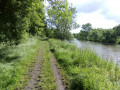

 Easy
Easy 
 Tourist office