A tour of Angers

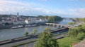
Angers is a city in western France, situated beside the Maine River, on the outskirts of the Loire Valley. The medieval seat of the Plantagenet dynasty, it boasts an old town featuring half-timbered houses, such as the superb Maison d’Adam (built around 1500). Saint-Maurice Cathedral, on the central Place Sainte-Croix, boasts two 75-metre-high towers and magnificent pink stained-glass windows. In the more recent urban areas, a café culture is flourishing.

Details

25526361
Creation:
Last update:
Last review:
  • Walking
    Activity: Walking
  • ↔
    Distance: 3.00 mi
  • ◔
    Average duration: 1h 25 
  • ▲
    Difficulty: Easy

  • ⚐
    Back to start: Yes
  • ↗
    Ascent: + 82 ft
  • ↘
    Descent: - 82 ft

  • ▲
    Highest point: 154 ft
  • ▼
    Lowest point: 46 ft
  • ⚐ Country: France
  • ⚐ City: Angers (49000|49100)
  • ⚑
    Start/End: N 47.468438° / W 0.559271°
  • ❏
    IGN map(s): Ref. 1522ET
  • Hour-by-hour weather

Photos

Description of the walk

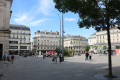
The starting point is at Place de l’Académie (car park, bus stop).

(S/E) Cross Boulevard du Général de Gaulle then the car park at Place Kennedy, keeping the castle on your left, and continue to the end of the square.

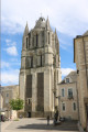
(1) Turn right into Rue Saint-Evroult. Follow this street to the end, at the foot of Saint-Maurice Cathedral.

(2) Turn right and cross Place Freppel, keeping the cathedral on your left. At the chevet, turn right into Rue Toussaint and leave Place Sainte-Croix on your left. Take the first left, Rue du Musée. Walk past the Museum of Fine Arts and cross Place Saint-Éloi. Walk past the base of the Saint-Aubin Tower and arrive in Rue des Lices. First turn left then right to enter Place Michel Debré. At the entrance to the Prefecture, turn left, cross Rue Saint-Aubin and follow Rue Saint-Martin to the collegiate church of the same name.

(3) Turn left into Rue Corneille, then immediately right into Rue Franklin Roosevelt. Walk past the post office, cross Rue Louis de Romain and take Rue Saint-Denis diagonally to the left. Then cross Place du Ralliement to join Rue de la Roë. Continue straight ahead along this street, following the tram line, until you reach Place Molière. Turn left and cross Rue Plantagenêt. Immediately turn right to cross the Mail de la Poissonnerie and reach the Esplanade Cœur de Maine.

(4) Cross the Pont des Arts et Métiers to cross the Maine. On the other side, turn left twice to take the passage under the bridge and follow Quai Monge northwards. After about 200 m, climb a flight of steps and cross a large car park. On the other side, cross Boulevard Arago and follow Rue Godard Faultrier. Cross Rue Auguste Michel and continue straight ahead to quickly reach Rue Gay Lussac (opposite the Reposoir du Tertre Saint-Laurent).

(5) Turn right then left to pass in front of the Greniers Saint-Jean. Continue along Rue Henri Legludic. After about a hundred metres, turn right onto a path that crosses the eastern part of Place de la Paix. At the end, turn left. At the corner of the western part of Place de la Paix, turn left. At the next corner, turn left again. Then turn right into Rue de l’Hoummeau. Take the first left, Rue de la Bouteille. Turn right at Place du Tertre and, turning right again, take Rue Maleau (Hôtel de Tinténiac on the left). At the end, turn left onto Rue de la Harpe (at the corner, the 17th-century Logis de la Roche Corbin). Continue to the junction with Rue Lionnaise.

(6) Follow it to the right until you reach the Communauté du Carmel on the left-hand side (at no. 39). Return to the junction.

(6) Continue straight downhill along Rue Lionnaise (half-timbered houses). You will come out onto Place de la Laiterie (fountain dedicated to Garnier, doctor to the poor). Turn left into Rue Beaurepaire and walk past the Church of the Trinity on your left. Cross Boulevard du Ronceray and the tram tracks and go straight on to reach Pont de Verdun.

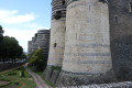
(7) Cross the bridge to cross the Maine again. On the other side, turn right onto the quay along the Maine. After about thirty metres, turn left to cross two lanes of traffic. Continue straight ahead up Montée Saint-Maurice towards the cathedral, which is clearly visible. Halfway up the slope, turn right onto Rue Donadieu de Puycharic, a cobbled street with steps. Ignore all the side streets on the left and you’ll reach the Promenade du Bout du Monde at the foot of the round towers of Angers Castle. Turn right to quickly reach the viewpoint overlooking the Maine.

(8) Turn back and walk along the castle walls on your right. Pass in front of the drawbridge.

(1) Turn right and cross Place du Président Kennedy again. Cross Boulevard du Général de Gaulle and head towards Place de l'Académie (S/E).

Waypoints

  1. S/E : mi 0 - alt. 125 ft - Place de l'Académie
  2. 1 : mi 0.12 - alt. 148 ft - Junction of the circular loop - Château d'Angers
  3. 2 : mi 0.26 - alt. 148 ft - Cathédrale Saint-Maurice (Angers)
  4. 3 : mi 0.58 - alt. 154 ft - Collégiale Saint-Martin (Angers)
  5. 4 : mi 1.07 - alt. 62 ft - Pont des Arts et Métiers (Angers)
  6. 5 : mi 1.49 - alt. 92 ft - Place du Tertre Saint-Laurent
  7. 6 : mi 1.95 - alt. 108 ft - Junction of Rue de la Harpe and Rue Lionnaise. Towards the - Maine (rivière) - Affluent de la Loire
  8. 7 : mi 2.39 - alt. 69 ft - Pont de Verdun (Angers)
  9. 8 : mi 2.76 - alt. 141 ft - Belvedere on the Promenade du Bout du Monde
  10. S/E : mi 3 - alt. 125 ft - Place de l'Académie

Notes

This urban walk requires suitable footwear.

This walk is not signposted. It is advisable to follow the directions in the description, which provide street names and details of points of interest along the route, as well as the map.

Walk completed by the author on 11 May 2022

Worth a visit

Angers
Saint Maurice Cathedral
Construction began in the early 11th century, was interrupted by a fire in 1032, and resumed in the second half of the 11th century.

The Museum of Fine Arts
The museum, which reopened in 2004, presents a collection of fine art from the 14th century to the present day (paintings, sculptures, decorative arts).

The Maine-et-Loire Prefecture

Saint Aubin Tower

Place du Ralliement

Arts and Crafts Bridge
A new link between the two banks of the Maine, the Pont des Arts-et-Métiers has been unveiled. Designed by architect Thomas Lavigne, this metal bridge, 135 metres long and 15 metres wide, resting on two piers, is now open to pedestrians and cyclists.

The Jean-Lurçat Museum and Museum of Contemporary Tapestry
The collections of the Jean-Lurçat and Contemporary Tapestry Museum are displayed in two buildings. The Hôpital Saint-Jean, a remarkable 12th-century architectural complex, houses Jean Lurçat’s ‘Chant du Monde’ tapestry. A neighbouring building showcases collections ranging from the 1930s to contemporary approaches to textile design.

The Reposoir du Tertre Saint Laurent
"The parish cemetery of Saint-Laurent, or La Trinité, included a 12th-century octagonal building whose original function is unknown: a funeral chapel, a lantern of the dead, or a reliquary? The upper chapel fulfilled this latter function in the 13th century, housing the Blessed Sacrament when the procession of the same name was established, which ended in the cemetery on Corpus Christi.

Saint Jean Granary
The Saint-Jean hospital complex, built in the 12th century, is now a unique event venue with sumptuous décor.

The Hôtel de Tinténiac

The Carmel
The Carmelite convent in Angers was founded in 1626 on the site it still occupies today. Its 17th-century buildings are listed

The Church of the Trinity
The history of the Church of the Trinity begins with the founding of the Abbey of Notre-Dame-de-la-Charité in 1028. ...

Promenade du Bout du Monde
At the end of the promenade in front of the castle entrance, the viewing platform offers a fine view of the Maine and the old Doutre district, whose name derives from its location ‘beyond the Maine’. ...

King René’s Castle
The earliest traces of human occupation on the rocky promontory overlooking the Maine date back to 4000 BCE, as a Neolithic burial site was discovered there. The fortress itself was built from 1230 onwards by the regent Blanche of Castile and her young son Saint Louis. The ramparts, nearly half a kilometre long and punctuated by 17 towers of schist and limestone, clearly demonstrate its defensive purpose. ...

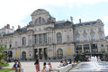
Town Hall
Louis XI granted Angers a municipal charter in 1475, marking the origins of municipal government and its town halls.

Jardin du Mail
This garden originated in the 17th century from the Jeu de Mail. In the 17th century, the garden ceased to be a playing field and became a space planted with elm trees. ....

Notre-Dame des Victoires
The present church succeeded the Church of Saint-Michel du Tertre, one of the oldest parishes in Angers, dating back to the time of Charlemagne at the end of the 8th century.

Other walks in the area

For more walks, use our search engine .

The GPS track and description are the property of this route's author. Please do not copy them without permission.