Country:

 City:
City:


(S/E) Park at the roadside below the Chalet Liotard, in the marked spaces.
(1) The route starts in front of the information board, at the signpost for "Bergerie de l'Avocat 1413 m". Head down towards the Bergerie de l'Avocat. At the Fork in the road, do not head towards the sheepfold but go down to the left towards the first display stand topped with a giant wooden comb. Continue along the “Sentier du Géant de Bois” (Wooden Giant Trail), marked in blue, with additional “Raquette” (snowshoe) markings and educational display stands, which soon enters a beautiful beech forest.
(2) At the signpost for Les Faysses, head towards “Mont Serein” on the right and “Grand Valat”. You’ll arrive in front of the impressive Géant de Bois (a sculpture over 4 metres tall created by Jacques Marcy and Stéphane Bourret). Carry on, taking the time to read the information boards.
(3) At the signpost for "Grand Valat", turn right towards "Chalet des Sports". The path soon offers a view of the summit of Mont Ventoux.
(4) At the signpost for "Chalet des Sports", leave the blue markings and turn left towards "Serrière", following the route marked with small orange signs featuring a magnifying glass. This is the Sentier du Géant des Sciences. At the next junction, turn left. In front of six life-size figures representing a “large family of scientists”, turn left (PR® markings). Make the most of the gaps between the trees to enjoy a view to the left over a beautiful valley and the Saint-Léger-du-Ventoux National Forest. At the next junction, continue to the left. After a hairpin bend, the yellow-marked path joins the Giant of Science Trail just in front of Jean-Henri Fabre’s “Work Table”, facing the summit of Mont Ventoux. Continue along the orange-marked trail to the left. Ignore two paths branching off to the right.
(5) At the signpost for "Serrières", follow the signs to the right for "Le Contrat" and "Mont Ventoux". Don’t forget to browse through “Jean-Henri Fabre’s herbarium” displayed on a lectern. At the next junction, take the path on the left marked with three signs: a snowshoe, an orange magnifying glass and a green arrow. Further on, ignore a path branching off to stay on the wide path that turns right. Continue along this main path. You will reach a meadow.
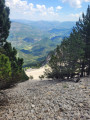
(6) In this meadow, keep left to follow the direction indicated for the Raquette route. Leave the “Sentier du Géant des Sciences” to follow the green-marked “Géant de la Forêt” route. You’ll reach a vast viewpoint overlooking the Toulourenc valley. Continue downhill, taking a right-hand bend.
(7) At the signpost for “Le Contrat”, leave the wide path and head down to the left to the Abri du Contrat and its spring. Then continue towards “Contrat sud”. The single-track path briefly crosses some rocks before joining a path. This path, formerly the red route, is now a “Memorial and Photographic Trail”. Signs, mounted on wooden structures, recount the history of the Mont Serein and Chalet Reynard resorts.
(8) At the signpost for “Le Contrat sud”, head left towards “Brantes”. A sign indicates the presence of remarkable trees, or “relic trees”, in the primeval forest, which are over 300 years old. Spotting them along the route will require a bit of attention.
(9) At the signpost for "Combe de la Mine", follow the sign for "Serres Gros" straight ahead. You will reach the sign illustrating the 1936 ski competition. Other signs provide information about the Mont Ventoux Integral Biological Reserve.
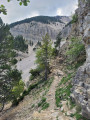
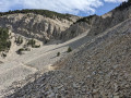
(10) At the “Danger” sign indicating a high-altitude area and warning of the risks of falls and avalanches, take the yellow-marked trail for a round trip. This single-track path will quickly cross a scree slope and lead to an impressive rocky area: the Grave Faouletière. The view opens out onto the Toulourenc valley from the vast scree slope. Once you reach a small rocky outcrop, turn back. Beyond the outcrop, the scree slopes overlooked by the cliff give way to the sound of falling rocks. Jean-Henri Fabre spoke of the “waterfalls of Mont Ventoux and their cascades of scree”. This round trip allows you to get a sense of this impressive natural phenomenon without taking any risks.
(10) Return to the wide path and head uphill.
(11) At the signpost for “Les Mélèzes”, continue straight ahead towards “Caravaneige”. Cross the path of a 1963 avalanche, details of which are displayed on a lectern. The path, lined with larch trees, emerges from the woods and continues along the side of the ski slopes, offering a breathtaking panorama of the Baronnies Provençales.
(12) Climb up to the “Danger téléski” sign, continue straight ahead, passing several ski lifts, and cross the ski slopes whilst staying at the same level. Above, the summit of Mont Ventoux, clearly visible, seems very close. Then descend along a wide, stony track to the start of a toboggan run.
(13) Walk over rubber slabs between safety barriers made of old tyres at the start of the toboggan run and continue the descent towards Chalet Liotard. At the roundabout, turn right to return to the car park (S/E).

 Visorando Member
 Difficult
 Very difficult