A short circular loop in the Gros Cerveau, above Sanary

Here is a short route that allowed us to explore two little-used paths with a view to incorporating them into one or two other hikes, but which stands on its own as a pleasant and easy walk.

Details

31863890
Creation:
Last update:
Last review:
  • Walking
    Activity: Walking
  • ↔
    Distance: 2.63 mi
  • ◔
    Average duration: 1h 55 
  • ▲
    Difficulty: Moderate

  • ⚐
    Back to start: Yes
  • ↗
    Ascent: + 768 ft
  • ↘
    Descent: - 774 ft

  • ▲
    Highest point: 1,004 ft
  • ▼
    Lowest point: 325 ft

Photos

Description of the walk

Coming from Bandol Plage, head towards Saint-Cyr – La Ciotat, then turn right under the motorway towards the Jardin des Oliviers, Chemin de Sainte-Trinide, and continue along this road after passing the entrance to the Jardin des Oliviers. It becomes the Chemin de la Piole Paul Venel. Pass a sign describing the walking trails and park on the right just after it, opposite the wide entrance to a property.

The starting car park is actually the same as for the walk to La Roche Curade.

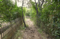
(S/E) In front of the sign indicating the hiking trails, find the start of the path which heads straight north, running alongside a large villa, between two rows of wattle fences.

(1) As you emerge from the ganivelle corridor, leave the path heading due east (which passes in front of a lime kiln) on your right and head straight on, climbing the rocky path, as for the variant route to La Roche Curade. Very soon, this path veers westwards.

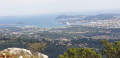
(2) Ignore a path on your right heading due north (the return route), and continue westwards, soon reaching a balcony-like path offering fine views of Sanary and Bandol. After about 600 m, this path descends steeply to the bottom of a narrow valley and climbs a few metres before joining another path coming from the left, whilst turning at a right angle towards the north. Head north, following the valley floor.

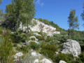
(3) At the junction with a path that climbs steeply westwards, continue northwards along the valley floor. After about 700 m, you’ll emerge onto the Gros Cerveau ridge road, having passed through an area of rocks and heath.
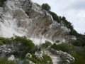
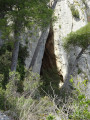
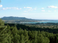
You are now just below the eastern slope of the highest ridge of the Gros Cerveau, opposite the entrance to the Grotte du Garou, with a superb panorama over the Beausset basin, beyond the Val d’Aren to the north, and a beautiful view of the coast to the south.

(4) Head east along the botanical trail, marked by a few information boards about the flora, which were unfortunately in poor condition when we visited.
When the botanical trail joins the tarmac road, follow it westwards for a short distance until you reach the entrance to a track with a gate. Take this track heading due south.

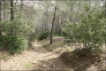
(5) Ignore the path continuing southwards (which leads, amongst other places, to La Roche Curade) and turn right onto the lovely track that runs horizontally through a beautiful pine forest.
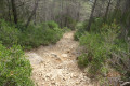
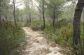
After a left-hand bend, this track passes close to a cistern and continues straight on, narrowing as it goes. It becomes a stony path that descends along a ridge and rejoins the junction you passed earlier at the start of the walk.

(2) Then follow this path back in the opposite direction to return to the car park (S/E).

Waypoints

  1. S/E : mi 0 - alt. 341 ft - Small car park for one or two cars
  2. 1 : mi 0.11 - alt. 348 ft - First junction
  3. 2 : mi 0.28 - alt. 404 ft - Junction of the circular loop
  4. 3 : mi 0.75 - alt. 397 ft - The trail starts at the bottom of the valley
  5. 4 : mi 1.21 - alt. 853 ft - Near the Garou Cave
  6. 5 : mi 1.73 - alt. 945 ft - Forest track
  7. S/E : mi 2.63 - alt. 341 ft - Small car park for one or two cars

Notes

Walk completed in March 2023.

No particular difficulty, but you’ll need suitable footwear and walking poles: many sections are stony or rocky, with a risk of slipping or falling in wet conditions.

The route is relatively short but consists mainly of footpaths and does not follow any tarmac roads or many forest tracks.

Each of the sections, between (1) and (4) and between (5) and (2), can be combined with other trails to create one or two further routes.

Worth a visit

Reviews and comments

4.4 / 5
Based on 3 reviews

Reliability of the description
4.7 / 5
Ease of following the route
4.7 / 5
Route interest
4 / 5
stjo
stjo

@JeanVar Yes, the botanical trail is suffering from a lack of maintenance by Sanary council. They really need to roll up their sleeves and do something to restore it.

Machine-translated

JeanVar
JeanVar

Overall rating : 3.7 / 5

Date of your route : Sep 15, 2024
Reliability of the description : ★★★★☆ Good
Ease of following the route : ★★★★☆ Good
Route interest : ★★★☆☆ Average
Very busy route : No

Before setting out on this walk, you need to be fully aware of the significant elevation gain (230 metres), with some steep sections (both uphill and downhill).
It took us over 2 hours 30 minutes.
The botanical trail is of no interest. However, the view over the Beausset basin is lovely.

Machine-translated

SAUBESTY
SAUBESTY

Overall rating : 4.7 / 5

Date of your route : Oct 23, 2023
Reliability of the description : ★★★★★ Very good
Ease of following the route : ★★★★★ Very good
Route interest : ★★★★☆ Good
Very busy route : No

A walk suitable for older walkers who need to avoid strenuous sections but want to stay active.
A short climb before the summit, but no major difficulties.
A very good description by JEA, below...

Machine-translated

JEA
JEA

Overall rating : 5 / 5

Date of your route : Apr 25, 2023
Reliability of the description : ★★★★★ Very good
Ease of following the route : ★★★★★ Very good
Route interest : ★★★★★ Very good
Very busy route : No

Completed on 24 April, this is a lovely, well-described circular walk that begins with a panoramic view over Bandol and Sanary and culminates at a beautiful double viewpoint after winding through a small, steep-sided valley. The valley floor remains visible, but for a long stretch it is obscured by the vegetation on either side, which, depending on the species, either brushes against us or scratches us from head to toe, or gets caught on our rucksacks.
Opt for a pair of walking boots rather than good trainers, as the paths are rutted and unpaved, and stones roll underfoot.
We would have liked some information about the nature of the rocks we walked on or admired. A sign at the end of the botanical trail goes some way towards satisfying this curiosity.

Machine-translated

Other walks in the area

For more walks, use our search engine .

The GPS track and description are the property of this route's author. Please do not copy them without permission.