La Roche Curade above Sanary-sur-Mer

A short walk in the Gros Cerveau massif above Sanary-sur-Mer to discover two geological features, including the Roche Curade, and some remnants of Provence’s former agricultural and industrial activity.

Details

2672064
Creation:
Last update:
Last review:
  • Walking
    Activity: Walking
  • ↔
    Distance: 2.49 mi
  • ◔
    Average duration: 1h 45 
  • ▲
    Difficulty: Moderate

  • ⚐
    Back to start: Yes
  • ↗
    Ascent: + 669 ft
  • ↘
    Descent: - 669 ft

  • ▲
    Highest point: 1,010 ft
  • ▼
    Lowest point: 325 ft

Photos

Description of the walk

Access: from Sanary-sur-Mer, head towards the zoo. As you pass under the motorway, take the road on the right which runs past the olive grove and heads towards Sainte-Trinide and La Piole. Leave the road leading to Sainte-Trinide on your right and continue straight on for 500 m. Stop at the signpost detailing the hiking trails. At the side of the road, against the low wall opposite the sign, there is space to park two or three small cars.

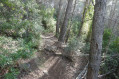
(S/E) The path starts opposite, to the left of a property which it runs alongside and around. After about 150 m, you’ll pass a path on your left that climbs through the scrub; then, after passing through a well-cleared area, you’ll see the remains of a lime kiln to the left of the path. Continue climbing for 250 m until you reach a crossroads with four paths.

(1) Take the path marked in red and blue on the left, which you follow for about 350 m; after passing through a rocky area, you’ll find the path leading up to La Roche Curade on the right, marked by a cairn shaped like a small wall.

(2) Although this path (just like the Roche Curade site itself) was developed as part of a rehabilitation project, when I visited it was not yet signposted and there was no sign indicating the site.
The climb is steep, first through heath, then amongst scattered pine trees; you pass a few rocky outcrops, and it isn’t long before you catch sight of La Roche Curade, which you reach after a 250-metre climb from the fork.
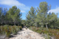
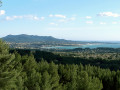
After taking plenty of time to admire these truly stunning surroundings, as well as the panoramic view over Sanary and Bandol Bay, you continue along the path which winds round the rock to the right as it climbs, and which continues as a well-maintained track through a grove of beautiful Aleppo pines.
You’ll come to a forest track heading south

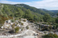
(3) Cross it and follow it along the valley floor; after about fifty metres, you’ll come to an area where limestone boulders have collapsed, forming a vague funnel shape, in the centre of which you’ll see deep cavities.
Head back up the track, then follow it down for 500 metres to a semi-buried cistern.

(4) Take the path on the right, marked in red and blue, which leads downhill. As this path has rocky and clayey sections, it can be slippery in wet weather; take care to avoid falls. You’ll come to the crossroads you passed on the way there.

Leave the track on your left, which continues down towards the Lançon neighbourhood, and go to the right of the cistern to take a smaller, rocky track that descends steadily.

Note: for those in a hurry (and who aren’t afraid of twisting their ankles), it is possible from point 4 to head directly back to point 1 by taking a path that descends to the right into the rocky bed carved out by runoff water.

(5) Here you’ll find the start of a path branching off to the right.
If you were to continue for a few dozen metres, you would reach a beautiful limestone slab overlooking the forest track you did not take at point 4, from where you have a lovely view of the surroundings of Le Lançon.
Take this path and head west.

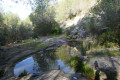
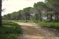
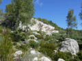
The path soon passes close to a limestone basin, which is very pretty if you’re lucky enough to find water there. It then winds its way through a lovely pine forest dotted with striking rocky outcrops, often offering a beautiful view of Sanary.
This brings you to the junction of five paths that you have already passed earlier.

(1) Follow the same route back as on the way there, until you reach the car park where you started (S/E).


Waypoints

  1. S/E : mi 0 - alt. 341 ft - Car park near a low wall
  2. 1 : mi 0.38 - alt. 561 ft - Junction of the circular loop trails
  3. 2 : mi 0.6 - alt. 666 ft - Start of the path towards La Roche Curade
  4. 3 : mi 1.1 - alt. 994 ft - Site of the sinkholes
  5. 4 : mi 1.43 - alt. 846 ft - Semi-buried cistern
  6. 5 : mi 1.77 - alt. 682 ft - Change of path
  7. S/E : mi 2.49 - alt. 341 ft - Back to the car park

Notes

This walk had initially been classified as easy. I have chosen to reclassify it as moderate, as there are quite a few stony or even rocky sections and crossings that need to be tackled with care, especially in wet weather (and in the shaded woodland, dampness lingers well into the day), and require suitable footwear and, preferably, a pair of walking poles.

Worth a visit

Geological points of interest:

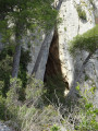
La Roche Curade (250 m past the point (2)): This rock formation, which resembles a breaking wave, does not, contrary to appearances, seem to me to be the result of folding: if one examines the rock closely, one can see that the sedimentological structures indicate that the layers are uniformly inclined towards the north and not folded. In my view, this is a feature of karst erosion, no doubt a former underground karstic cave – a sinkhole or a passage – exposed by erosion and partially destroyed, of which only one lateral half remains. I base this on its sub-horizontal cylindrical shape and the remains of stalactite-like concretions still hanging near its ceiling.

Rock boulders beyond the point (3): This is a sinkhole (a karst depression formed by the collapse of limestone blocks) resulting from the dissolution of the underlying limestone layers by surface runoff. About fifteen metres further down, another sinkhole can be seen, smaller and less pronounced.

Traces of human activity:

Lime kilns: in addition to the kiln clearly visible to the left of the path after the first 400 metres (photo), another well-known lime kiln in the area can be seen at the edge of the forest track about 200 metres south-east of this point: next to this very well-restored kiln, an illustrated panel provides full details on how lime kilns operate.

Threshing floor: If you follow the private track to the east of the car park for about a hundred metres, you can see an old, remarkably well-preserved wheat threshing floor next to a house (photo).

Reviews and comments

4.1 / 5
Based on 4 reviews

Reliability of the description
4 / 5
Ease of following the route
3.8 / 5
Route interest
4.5 / 5
frerot
frerot

Overall rating : 4.3 / 5

Date of your route : Jun 16, 2025
Reliability of the description : ★★★★☆ Good
Ease of following the route : ★★★★☆ Good
Route interest : ★★★★★ Very good
Very busy route : No

For me, everything was pretty clear because it's a hike I knew, partly thanks to your information.

Machine-translated

Boeland
Boeland
• Edited:

Overall rating : 3.3 / 5

Date of your route : Jan 06, 2025
Reliability of the description : ★★★★☆ Good
Ease of following the route : ★★★☆☆ Average
Route interest : ★★★☆☆ Average
Very busy route : No

A beautiful, unobstructed view of Sanary/Bandol Bay, a magnificent wave-shaped rock, but no parking available at the start of the walk.

Machine-translated

Aquariel
Aquariel

Overall rating : 5 / 5

Date of your route : May 29, 2024
Reliability of the description : ★★★★★ Very good
Ease of following the route : ★★★★★ Very good
Route interest : ★★★★★ Very good
Very busy route : No

A lovely little walk with a really beautiful spot of interest; the geological explanations are a real bonus for appreciating it! We climbed up the cairn, which was shaped like a small wall and was a bit scattered

Machine-translated

stjo
stjo

Thank you @Navarro Jérôme for your feedback. As I can see you rated the reliability of the description and the ease of following the route as ‘Average’, could you please let me know where you encountered difficulties? This would help me to improve my description.
Thanks in advance.

Machine-translated

Navarro Jérôme
Navarro Jérôme

Overall rating : 3.7 / 5

Date of your route : May 15, 2023
Reliability of the description : ★★★☆☆ Average
Ease of following the route : ★★★☆☆ Average
Route interest : ★★★★★ Very good
Very busy route : No

A really lovely route – I’d definitely recommend it!

Machine-translated

Other walks in the area

For more walks, use our search engine .

The GPS track and description are the property of this route's author. Please do not copy them without permission.